Image
Paths, Around Honeyman State Park, Lane County, Oregon, As A Campsite Place

Path To Dunes
(1 of 10) (8095 views)

./Honeymans_Campground_20160906_160652_C16_9204.jpg

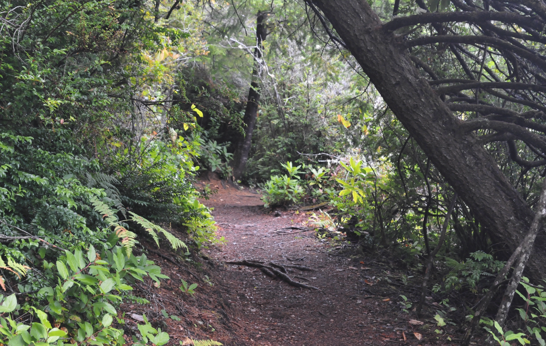
The path that led to the sand dunes was composed of flattened dirt and surrounded by mature trees.


Paths external link   •  Around Honeyman State Park external link   •  Lane County, Oregon external link   •  As A Campsite Place external link   •  (Date Photographed: 16:06:52 Tuesday 6 September 2016)   •  (Date Published: Tuesday 11 April 2017)   •  © 2017 Bryan Costales Creative Commons Attribution-NonCommercial License #C16_9204
Add a comment or report a mistake

A Tunnel
(2 of 10) (5080 views)

./Honeymans_Campground_20160906_160736_C16_9205.jpg

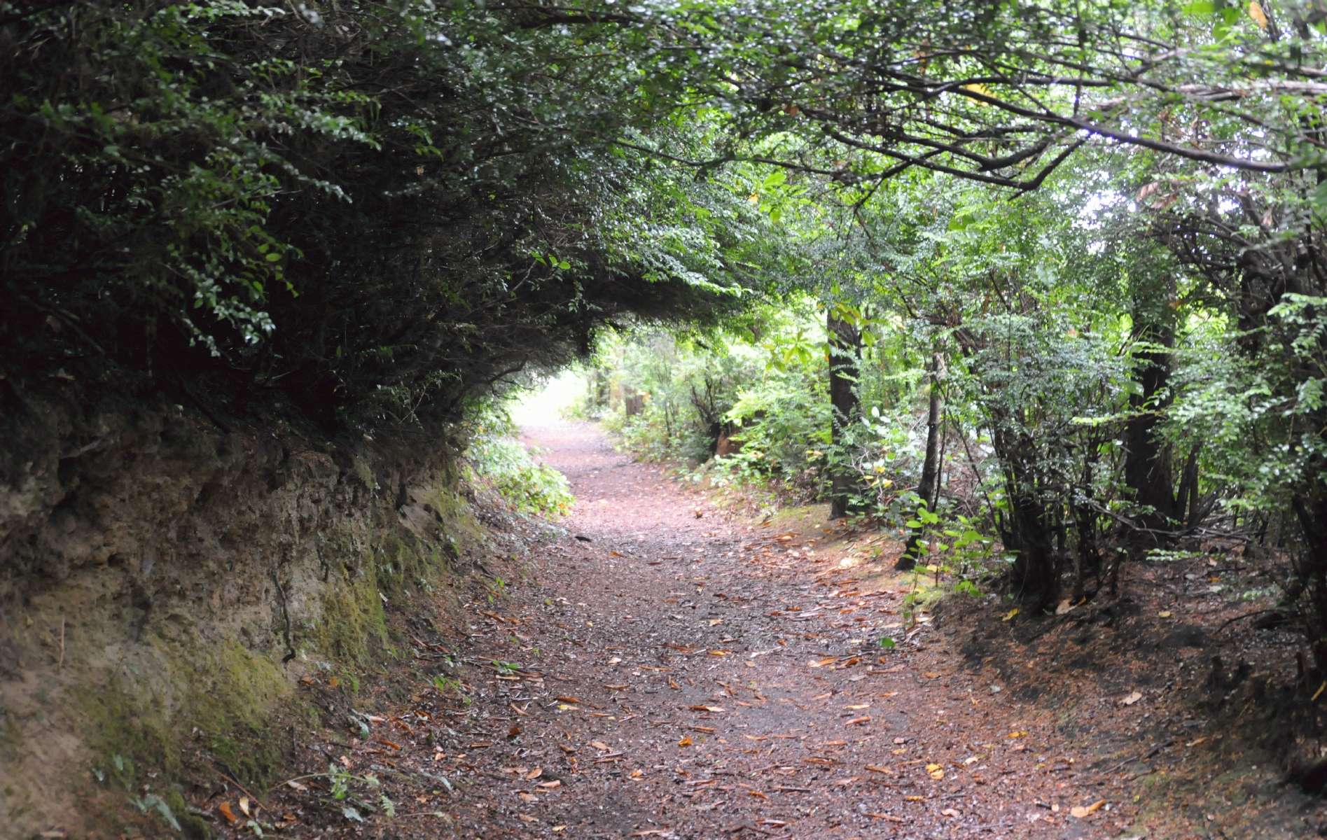
Trees over grew the path thusly creating a tunnel in the path.


Paths external link   •  Around Honeyman State Park external link   •  Lane County, Oregon external link   •  As A Campsite Place external link   •  (Date Photographed: 16:07:36 Tuesday 6 September 2016)   •  (Date Published: Tuesday 11 April 2017)   •  © 2017 Bryan Costales Creative Commons Attribution-NonCommercial License #C16_9205
Add a comment or report a mistake

Signs Regulated The Path
(3 of 10) (5075 views)

./Honeymans_Campground_20160906_160849_C16_9208.jpg

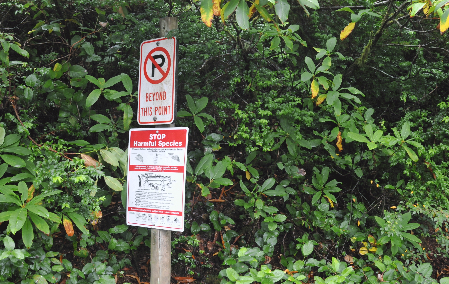
Signs prohibited parking "beyond this point." And another sign showed how to, "Stop Harmful Species."


Paths external link   •  Around Honeyman State Park external link   •  Lane County, Oregon external link   •  As A Campsite Place external link   •  (Date Photographed: 16:08:49 Tuesday 6 September 2016)   •  (Date Published: Tuesday 11 April 2017)   •  © 2017 Bryan Costales Creative Commons Attribution-NonCommercial License #C16_9208
Add a comment or report a mistake

Lichen Covered Branches
(4 of 10) (5041 views)

./Honeymans_Campground_20160906_161451_C16_9227.jpg

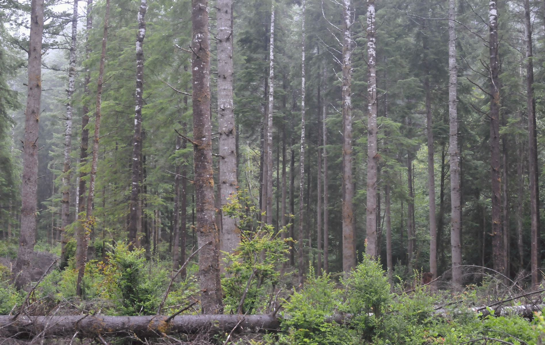
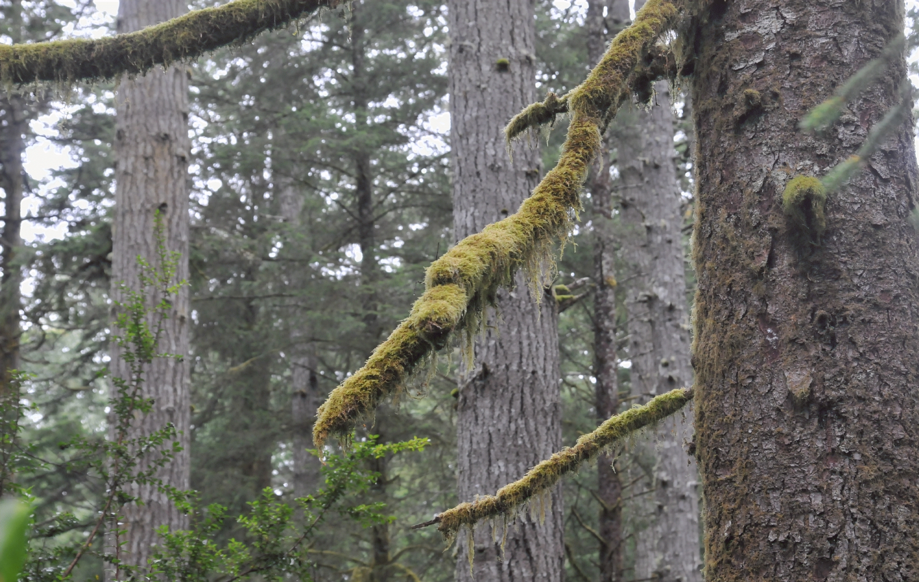
Because this campground was near the ocean, moist air encouraged the growth of lichen on branches.


Paths external link   •  Around Honeyman State Park external link   •  Lane County, Oregon external link   •  As A Campsite Place external link   •  (Date Photographed: 16:14:51 Tuesday 6 September 2016)   •  (Date Published: Tuesday 11 April 2017)   •  © 2017 Bryan Costales Creative Commons Attribution-NonCommercial License #C16_9227
Add a comment or report a mistake

Distance Guide
(5 of 10) (5089 views)

./Honeymans_Campground_20160906_161722_C16_9229.jpg

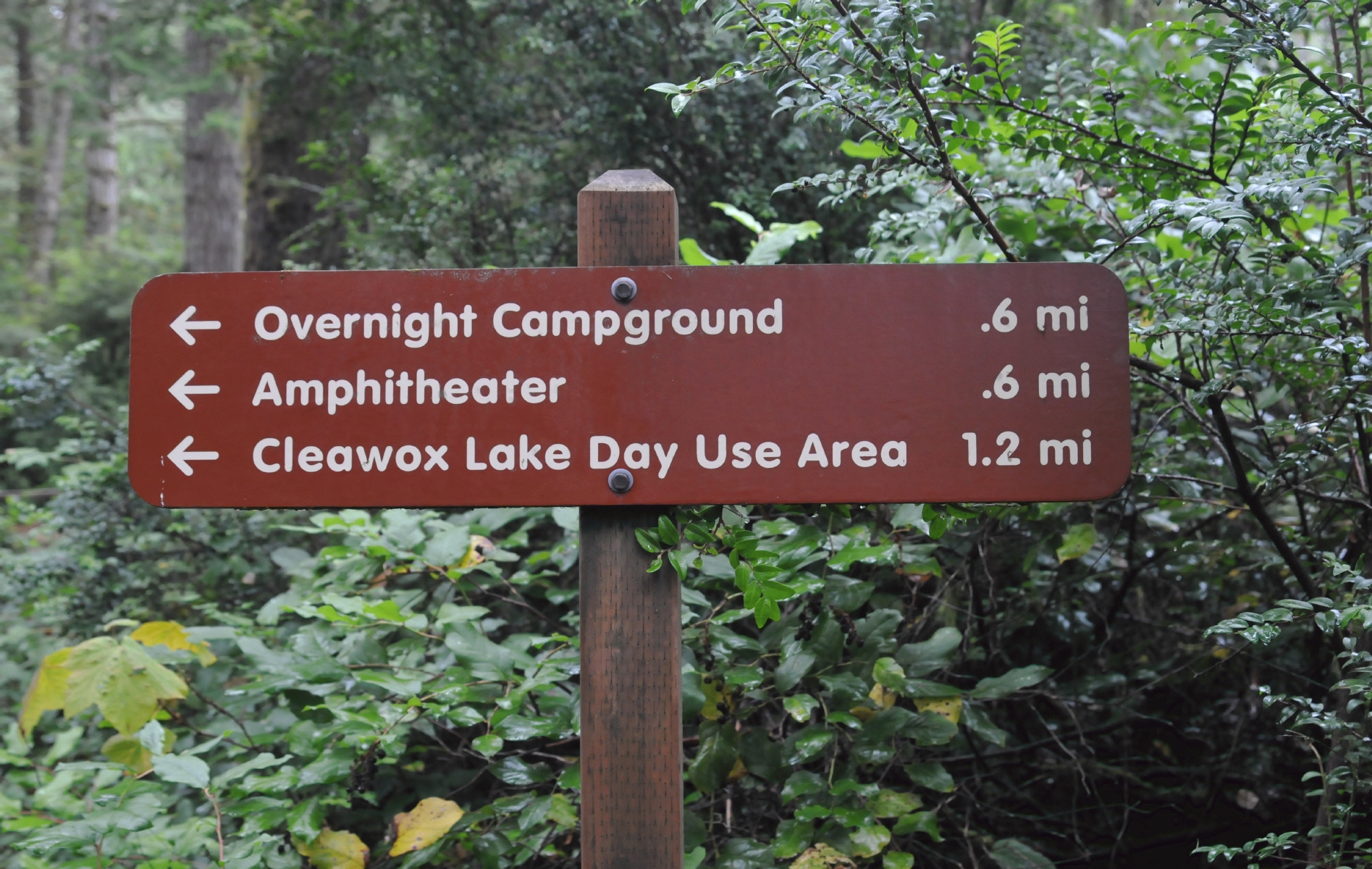
A sign at the intersection of one trail with another indicated the distances to various venues.


Paths external link   •  Around Honeyman State Park external link   •  Lane County, Oregon external link   •  As A Campsite Place external link   •  (Date Photographed: 16:17:22 Tuesday 6 September 2016)   •  (Date Published: Tuesday 11 April 2017)   •  © 2017 Bryan Costales Creative Commons Attribution-NonCommercial License #C16_9229
Add a comment or report a mistake

Bear Report
(6 of 10) (5098 views)

./Honeymans_Campground_20160906_162648_C16_9235.jpg

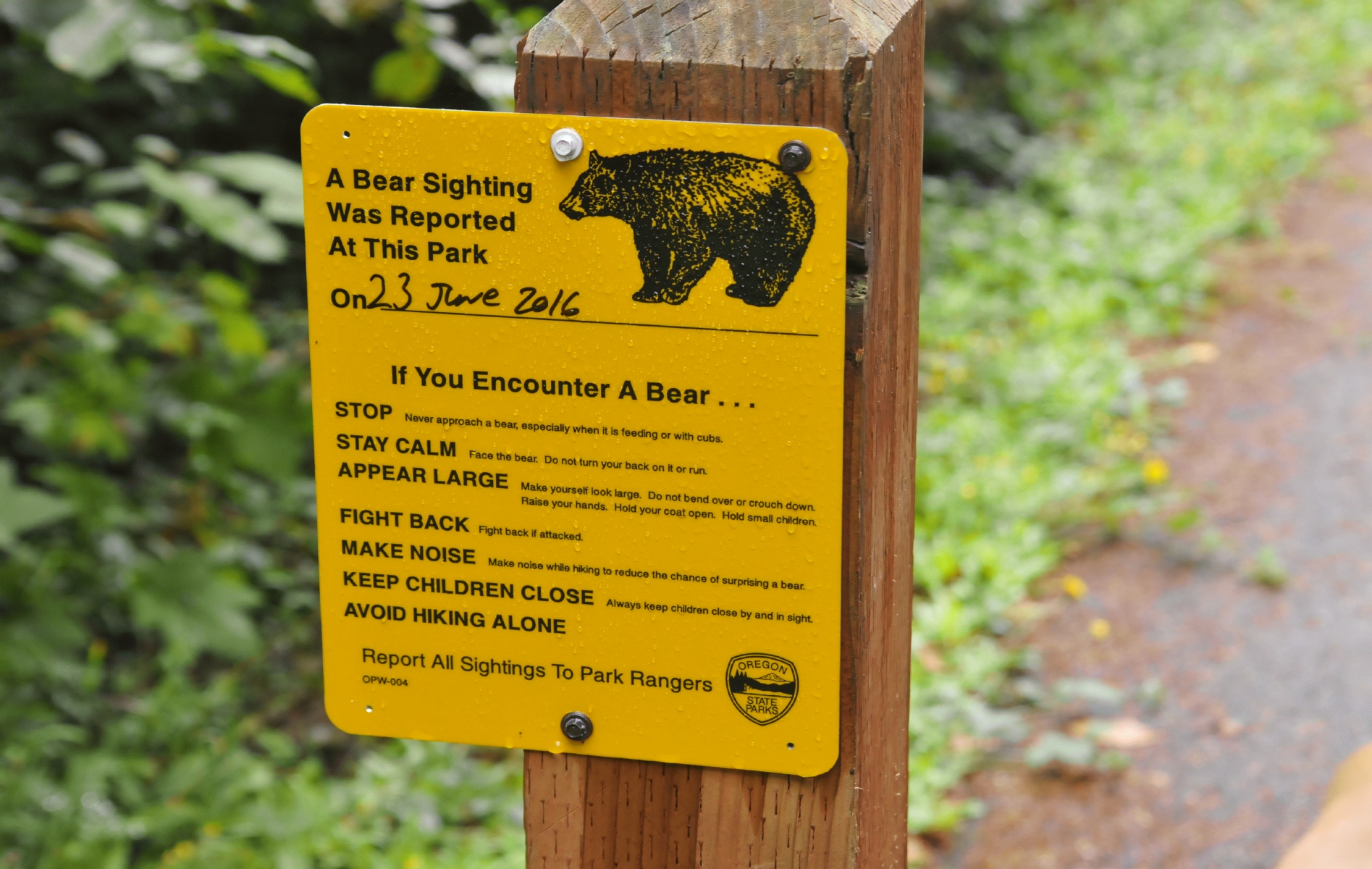
A sign posted at a trail head indicated that a bear had been see on June 23, 2016.


Paths external link   •  Around Honeyman State Park external link   •  Lane County, Oregon external link   •  As A Campsite Place external link   •  (Date Photographed: 16:26:48 Tuesday 6 September 2016)   •  (Date Published: Tuesday 11 April 2017)   •  © 2017 Bryan Costales Creative Commons Attribution-NonCommercial License #C16_9235
Add a comment or report a mistake

A Bench
(7 of 10) (5079 views)

./Honeymans_Campground_20160906_162926_C16_9236.jpg

Ahead and to the left, a bench waited beside the tail. A good place to rest or commune quietly with nature before continuing.


Paths external link   •  Around Honeyman State Park external link   •  Lane County, Oregon external link   •  As A Campsite Place external link   •  (Date Photographed: 16:29:26 Tuesday 6 September 2016)   •  (Date Published: Tuesday 11 April 2017)   •  © 2017 Bryan Costales Creative Commons Attribution-NonCommercial License #C16_9236
Add a comment or report a mistake

Leaning Tree
(8 of 10) (5100 views)

./Honeymans_Campground_20160906_164035_C16_9247.jpg

A tree leaned over the path, briefly giving the illusion that the path itself leaned.


Paths external link   •  Around Honeyman State Park external link   •  Lane County, Oregon external link   •  As A Campsite Place external link   •  (Date Photographed: 16:40:35 Tuesday 6 September 2016)   •  (Date Published: Tuesday 11 April 2017)   •  © 2017 Bryan Costales Creative Commons Attribution-NonCommercial License #C16_9247
Add a comment or report a mistake

Tree Fell
(9 of 10) (5095 views)

./Honeymans_Campground_20160906_172647_C16_9302.jpg

A tree had fallen sometime in the past and now silently lay next to the path.


Paths external link   •  Around Honeyman State Park external link   •  Lane County, Oregon external link   •  As A Campsite Place external link   •  (Date Photographed: 17:26:47 Tuesday 6 September 2016)   •  (Date Published: Tuesday 11 April 2017)   •  © 2017 Bryan Costales Creative Commons Attribution-NonCommercial License #C16_9302
Add a comment or report a mistake

Trashed Tree
(10 of 10) (5125 views)

./Honeymans_Campground_20160906_172722_C16_9305.jpg

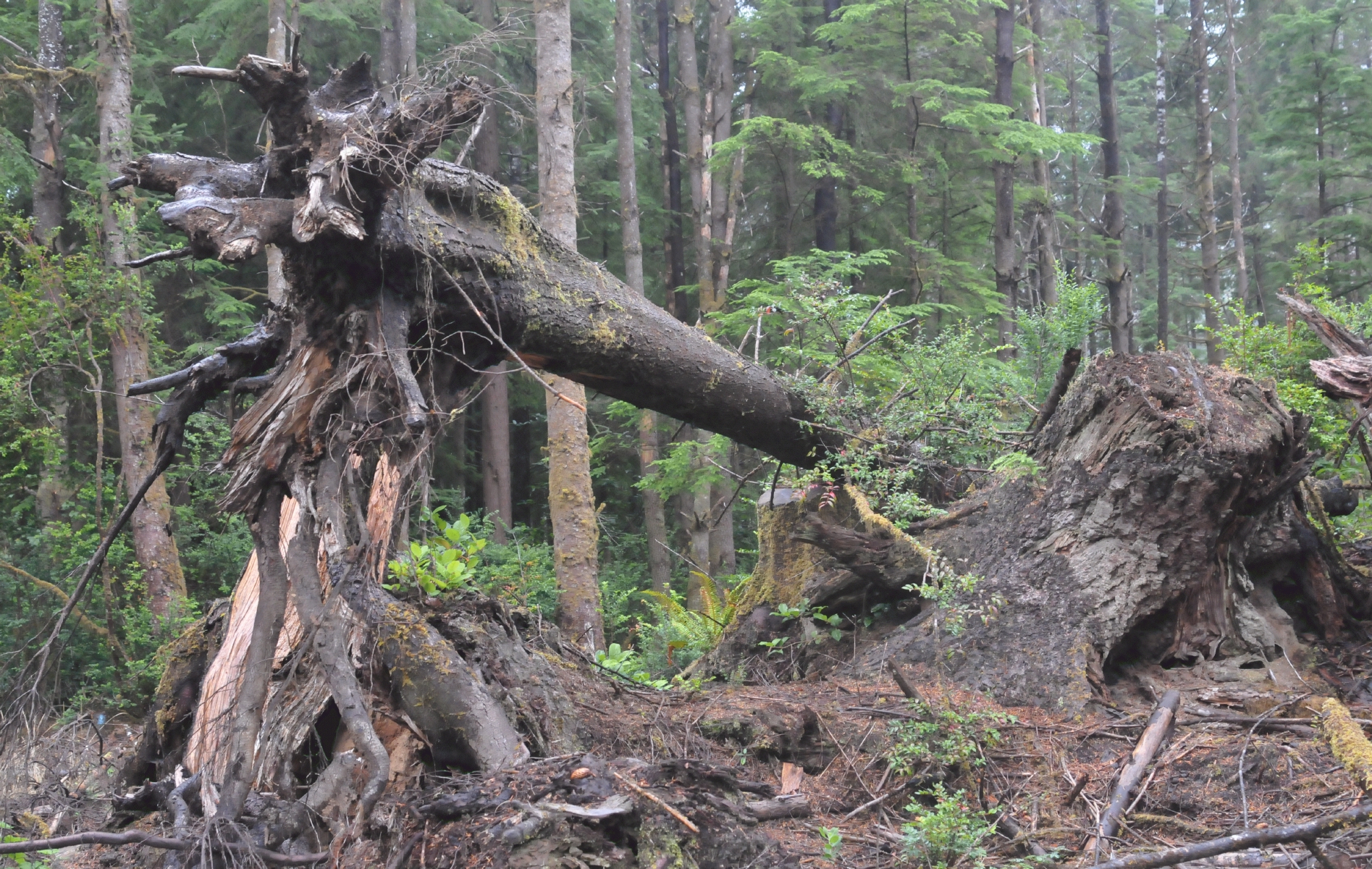
A tree had been trashed by some form of heavy equipment. The abstract leftover-look made for a dramatic photo.


Paths external link   •  Around Honeyman State Park external link   •  Lane County, Oregon external link   •  As A Campsite Place external link   •  (Date Photographed: 17:27:22 Tuesday 6 September 2016)   •  (Date Published: Tuesday 11 April 2017)   •  © 2017 Bryan Costales Creative Commons Attribution-NonCommercial License #C16_9305
Add a comment or report a mistake


Subscribe to our mailing list for a Sunday summary of the week's stories.
* indicates required
Email Format
home contact topic guide top 25 photos video writing blogs upload terms privacy