
|
|
|
|
|
Middle Harbor, Shoreline Park Oakland
|
|
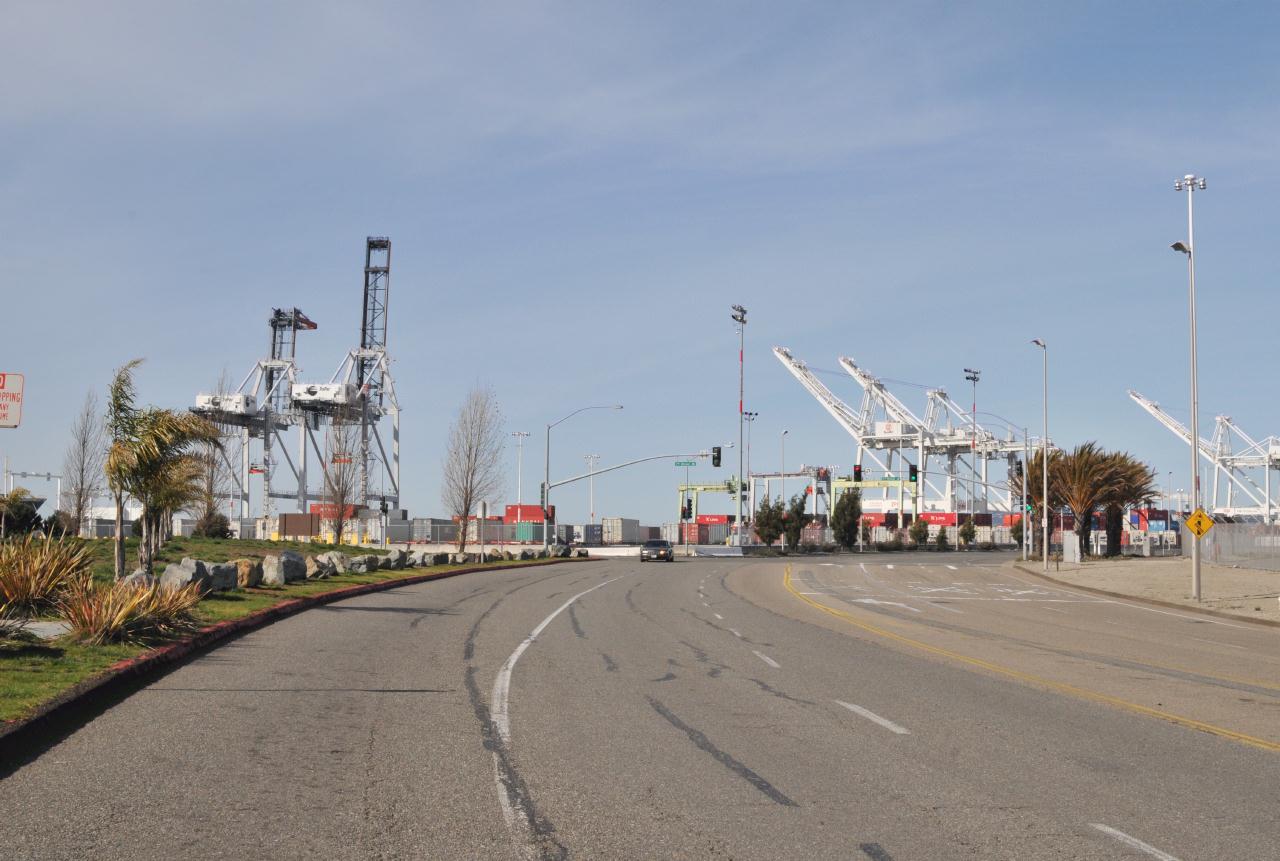 The park was surrounded by the Port of Oakland Marine Terminals. Access was along 7th Street (at the intersection) then a short way out Middle Harbor road to the entrance. The park was newly opened in 2004. Note the total lack of a sidewalk on the park side of the road.
Middle Harbor Shoreline Park • Operated by: East bay Regional Park District • 7th St. at Middle Harbor Road, Oakland, California • (Photo posted Friday 28 May 2010) • (Photo taken 15:06:18 Sunday 14 March 2010) • © 2010 Bryan Costales 
Add a comment or report a mistake
|
|
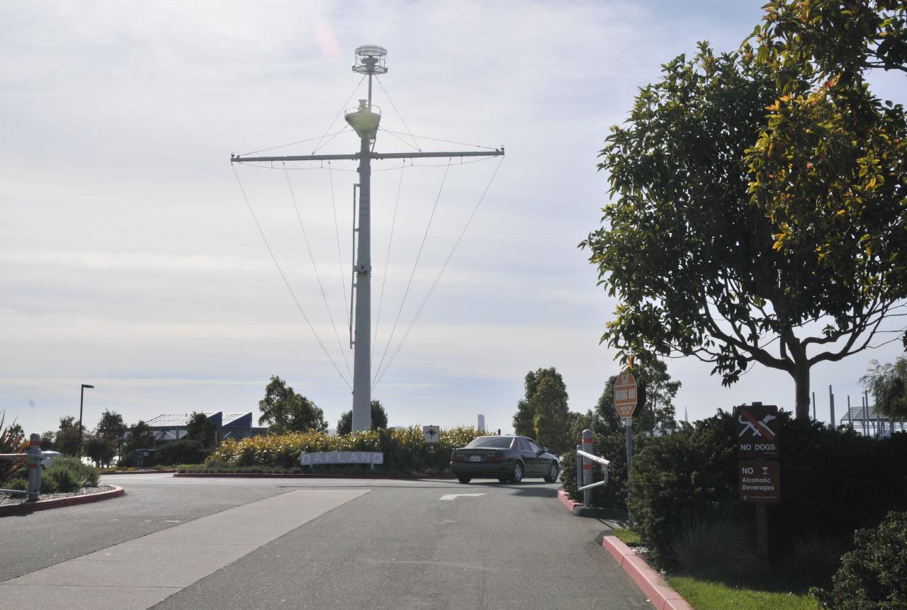 Entry to the park is a drive past a bit of nautical art and access to vast parking lots. The signs read: No Dogs
Middle Harbor Shoreline Park • Operated by: East bay Regional Park District • 7th St. at Middle Harbor Road, Oakland, California • (Photo posted Friday 28 May 2010) • (Photo taken 15:06:40 Sunday 14 March 2010) • © 2010 Bryan Costales
Add a comment or report a mistake
|
|
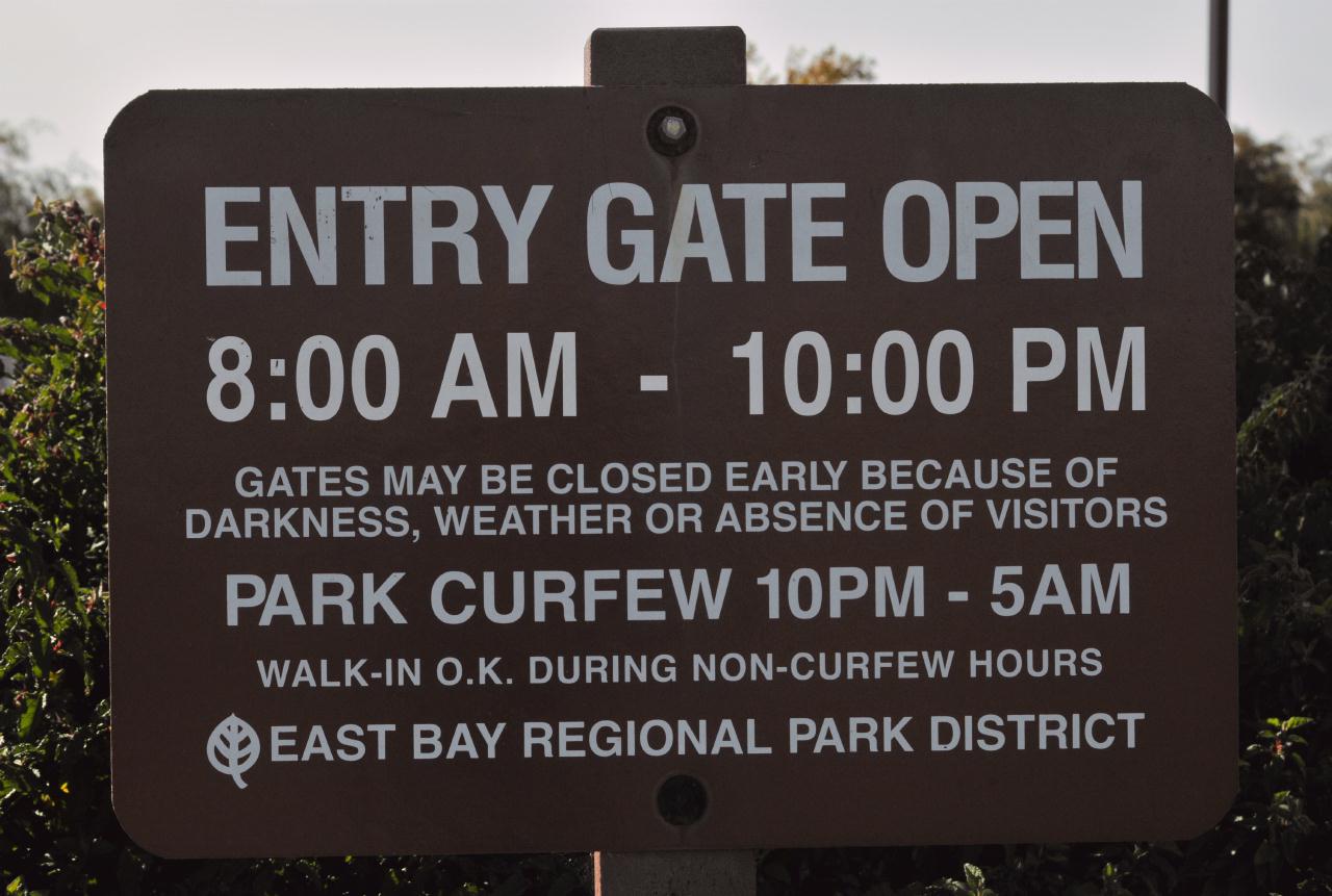
A sign inside the park states that the driveway entry gate
is closed from 10:00 p.m. to 5:00 a.m. Note that the
park graciously allows walk in access when the park is open.
Unfortunately the park is
almost a mile away for the nearest houses.
Entry Gate Open
Middle Harbor Shoreline Park • Operated by: East bay Regional Park District • 7th St. at Middle Harbor Road, Oakland, California • (Photo posted Friday 28 May 2010) • (Photo taken 15:06:46 Sunday 14 March 2010) • © 2010 Bryan Costales
Add a comment or report a mistake
|
|
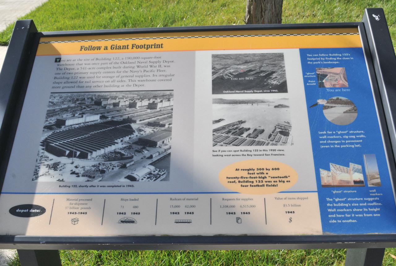 The park was built on land formerly occupied by the Oakland Naval Supply Depot. A printed guide near the entrance explained how building 122 (left photo) dominated the location before it became a park. A huge warehouse that was one of the primary storage and supply facilities for the Navy's Pacific Fleet.
Middle Harbor Shoreline Park • Operated by: East bay Regional Park District • 7th St. at Middle Harbor Road, Oakland, California • (Photo posted Friday 28 May 2010) • (Photo taken 15:08:20 Sunday 14 March 2010) • © 2010 Bryan Costales
Add a comment or report a mistake
|
|
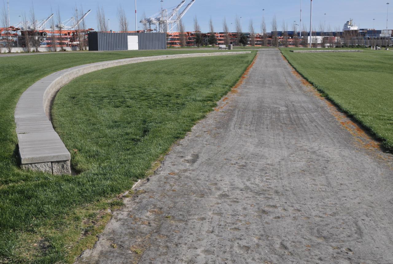
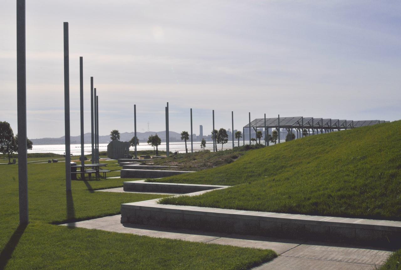 That large warehouse that dominated the site, was remembered by the zig-zag seating that outlined the former edge of building 122.
Middle Harbor Shoreline Park • Operated by: East bay Regional Park District • 7th St. at Middle Harbor Road, Oakland, California • (Photo posted Friday 28 May 2010) • (Photo taken 15:08:30 Sunday 14 March 2010) • © 2010 Bryan Costales
Add a comment or report a mistake
|
|
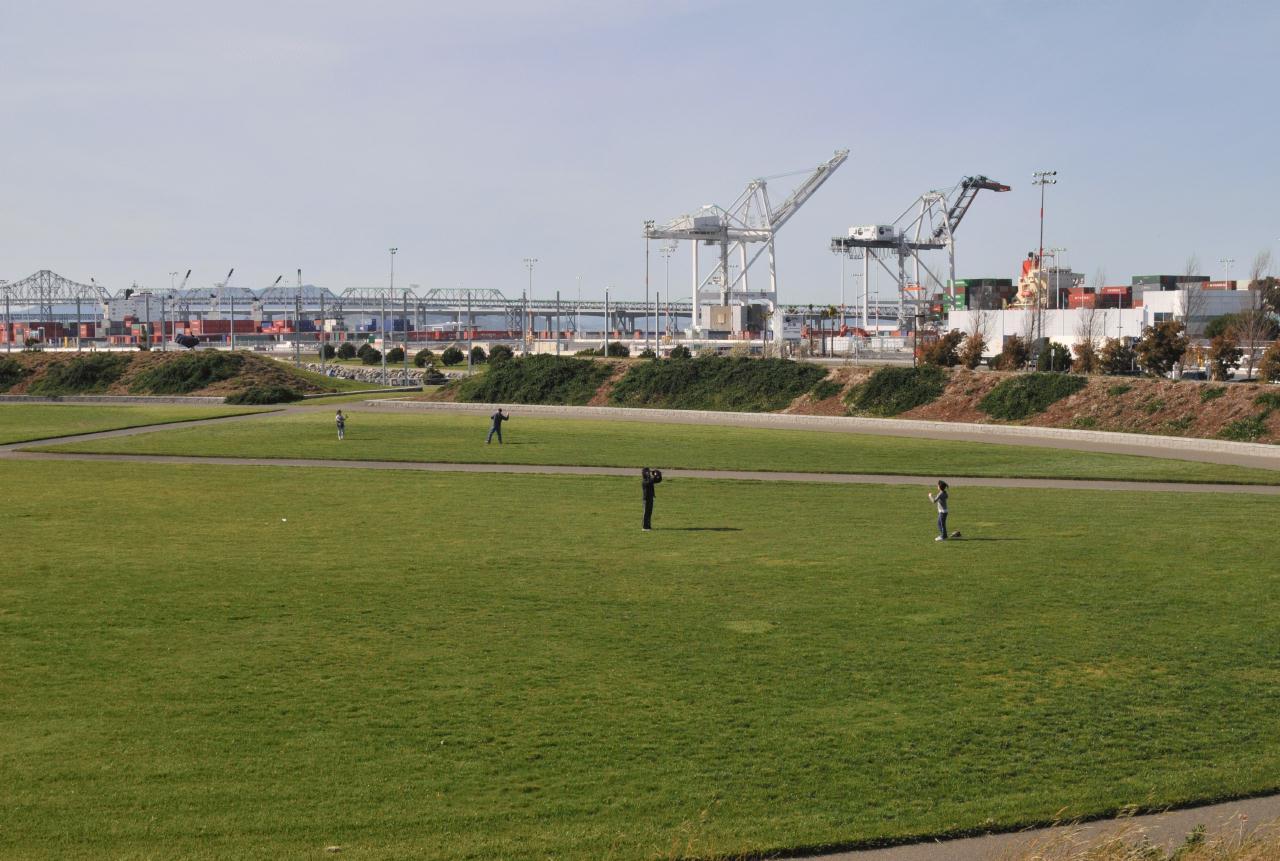 The interior of building 122 had become a grassy field upon with folks could play ball. Note that the Oakland side of the Bay Bridge could be seen just beyond the park.
Middle Harbor Shoreline Park • Operated by: East bay Regional Park District • 7th St. at Middle Harbor Road, Oakland, California • (Photo posted Friday 28 May 2010) • (Photo taken 15:08:50 Sunday 14 March 2010) • © 2010 Bryan Costales
Add a comment or report a mistake
|
|
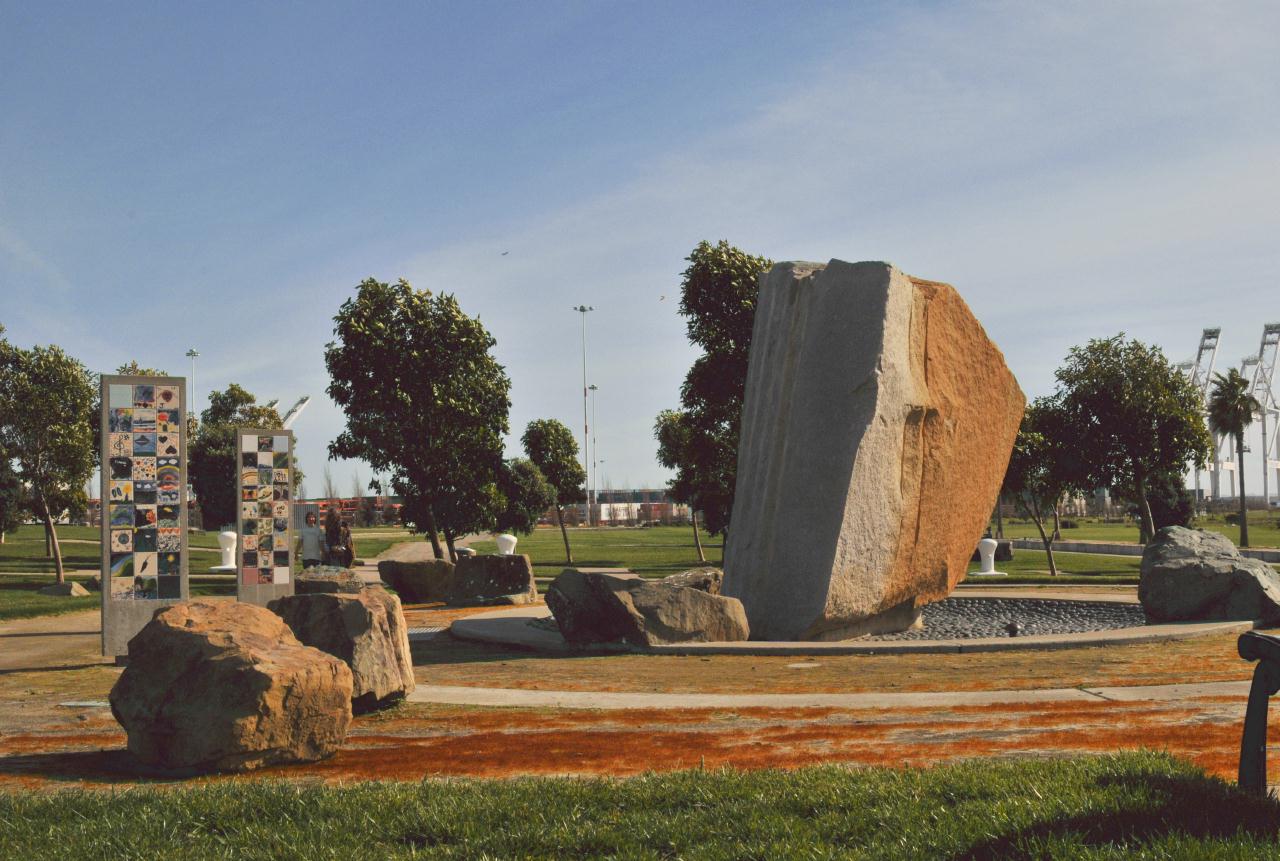 In the interior of the park was a non-running fountain decorated with stone art. Ceramic art squares produced by school children were at the left. This oasis was surrounded by few benches.
Middle Harbor Shoreline Park • Operated by: East bay Regional Park District • 7th St. at Middle Harbor Road, Oakland, California • (Photo posted Friday 28 May 2010) • (Photo taken 15:11:16 Sunday 14 March 2010) • © 2010 Bryan Costales
Add a comment or report a mistake
|
|
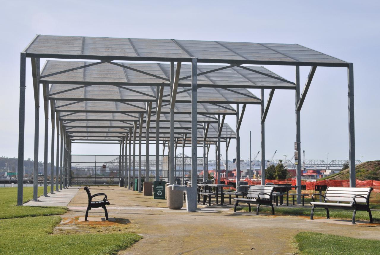 Barbecues were available for use along with picnic tables. They were arranged in a long row under a saw-tooth roof. The saw-tooth roof was in the same location and at the height as the original roof of building 122.
Middle Harbor Shoreline Park • Operated by: East bay Regional Park District • 7th St. at Middle Harbor Road, Oakland, California • (Photo posted Friday 28 May 2010) • (Photo taken 15:12:00 Sunday 14 March 2010) • © 2010 Bryan Costales
Add a comment or report a mistake
|
|
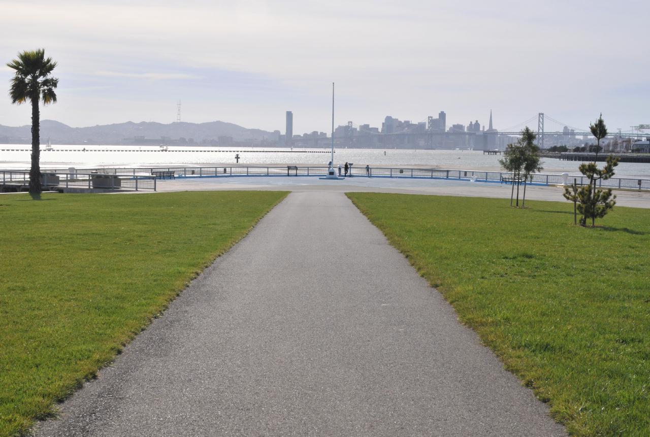 From the parking lots, a path ran down the center of the park leading to a vast viewing area. Across the bay from this park was San Francisco.
Middle Harbor Shoreline Park • Operated by: East bay Regional Park District • 7th St. at Middle Harbor Road, Oakland, California • (Photo posted Friday 28 May 2010) • (Photo taken 15:13:58 Sunday 14 March 2010) • © 2010 Bryan Costales
Add a comment or report a mistake
|
|
 Middle Harbor itself as it looked during low tide. Note the buoys appear to set aside a swimming area, but signs were also present that prohibited swimming.
Middle Harbor Shoreline Park • Operated by: East bay Regional Park District • 7th St. at Middle Harbor Road, Oakland, California • (Photo posted Friday 28 May 2010) • (Photo taken 15:14:36 Sunday 14 March 2010) • © 2010 Bryan Costales
Add a comment or report a mistake
|
|
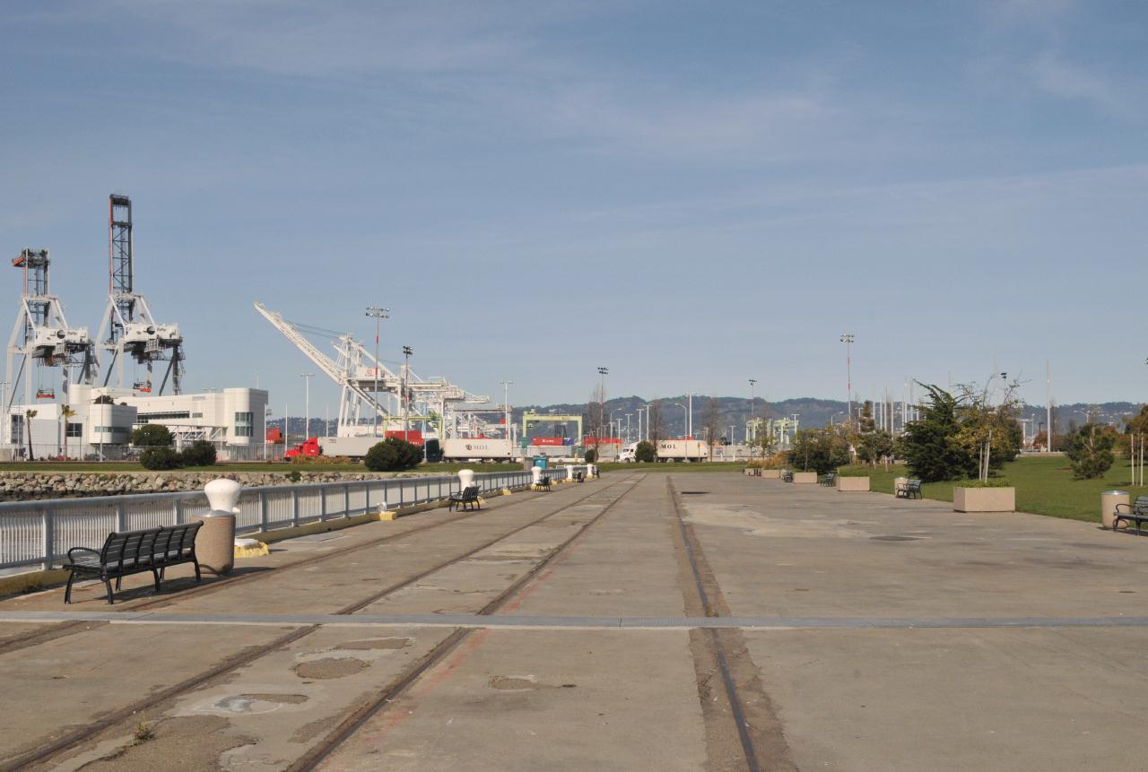
The former rail line that serviced building 122 and the other buildings
that used to occupy this area. This wide plaza was part of the Bay Trail and
led at its far end, left around to Port View park
Middle Harbor Shoreline Park • Operated by: East bay Regional Park District • 7th St. at Middle Harbor Road, Oakland, California • (Photo posted Friday 28 May 2010) • (Photo taken 15:15:24 Sunday 14 March 2010) • © 2010 Bryan Costales
Add a comment or report a mistake
|
|
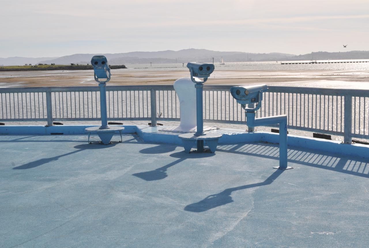 Three binocular telescopes were available in the viewing area. Two tall ones for use by people standing and one lower one on an offset arm for children and people in wheelchairs.
Middle Harbor Shoreline Park • Operated by: East bay Regional Park District • 7th St. at Middle Harbor Road, Oakland, California • (Photo posted Friday 28 May 2010) • (Photo taken 15:16:08 Sunday 14 March 2010) • © 2010 Bryan Costales
Add a comment or report a mistake
|
|
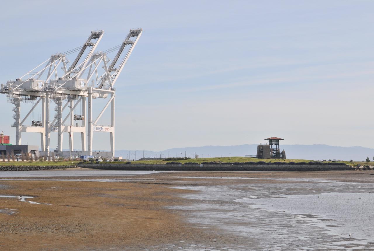 Near the southern end stood the Observation Tower. It was available to view the workings of the Port of Oakland, or to view the wildlife in the wetlands below it. The Observation Tower was about 1/4 mile (0.4 km) away from the viewing area where this picture was taken.
Middle Harbor Shoreline Park • Operated by: East bay Regional Park District • 7th St. at Middle Harbor Road, Oakland, California • (Photo posted Friday 28 May 2010) • (Photo taken 15:16:58 Sunday 14 March 2010) • © 2010 Bryan Costales
Add a comment or report a mistake
|
|
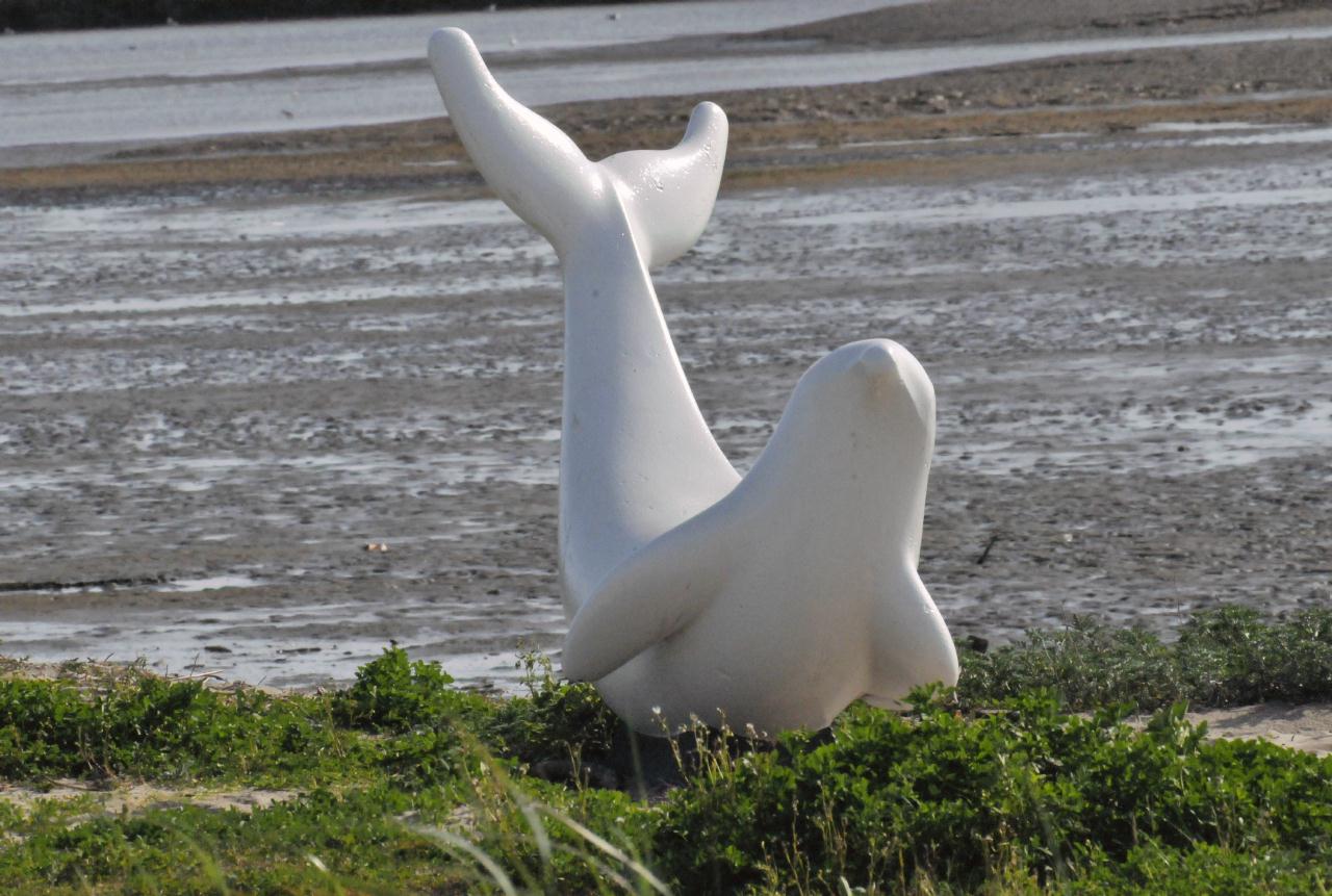 One the shore near the beach was a statue of a seal.
Middle Harbor Shoreline Park • Operated by: East bay Regional Park District • 7th St. at Middle Harbor Road, Oakland, California • (Photo posted Friday 28 May 2010) • (Photo taken 15:26:58 Sunday 14 March 2010) • © 2010 Terry Costales
Add a comment or report a mistake
|
|
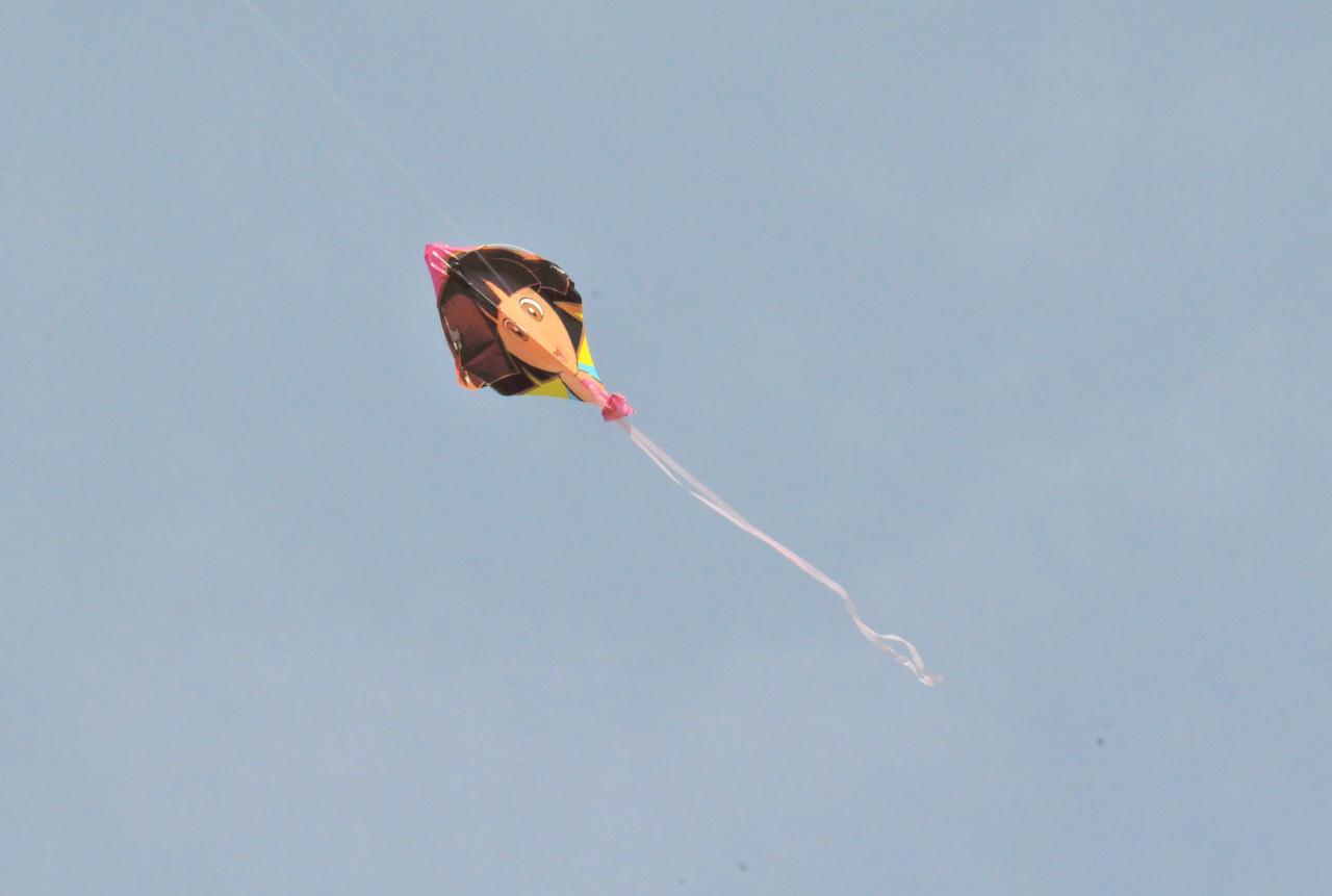 This park was a good place to fly kites because of the reliable on-shore breeze from the Pacific Ocean.
Middle Harbor Shoreline Park • Operated by: East bay Regional Park District • 7th St. at Middle Harbor Road, Oakland, California • (Photo posted Friday 28 May 2010) • (Photo taken 15:28:12 Sunday 14 March 2010) • © 2010 Terry Costales
Add a comment or report a mistake
|
|
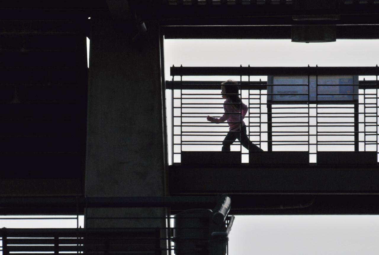 A girl, as part of exercise, ran across the Observation Tower. The tower was accessible using stairs, but lacked an elevator so barred access to the elderly and disabled.
Middle Harbor Shoreline Park • Operated by: East bay Regional Park District • 7th St. at Middle Harbor Road, Oakland, California • (Photo posted Friday 28 May 2010) • (Photo taken 15:41:08 Sunday 14 March 2010) • © 2010 Terry Costales
Add a comment or report a mistake
|
|
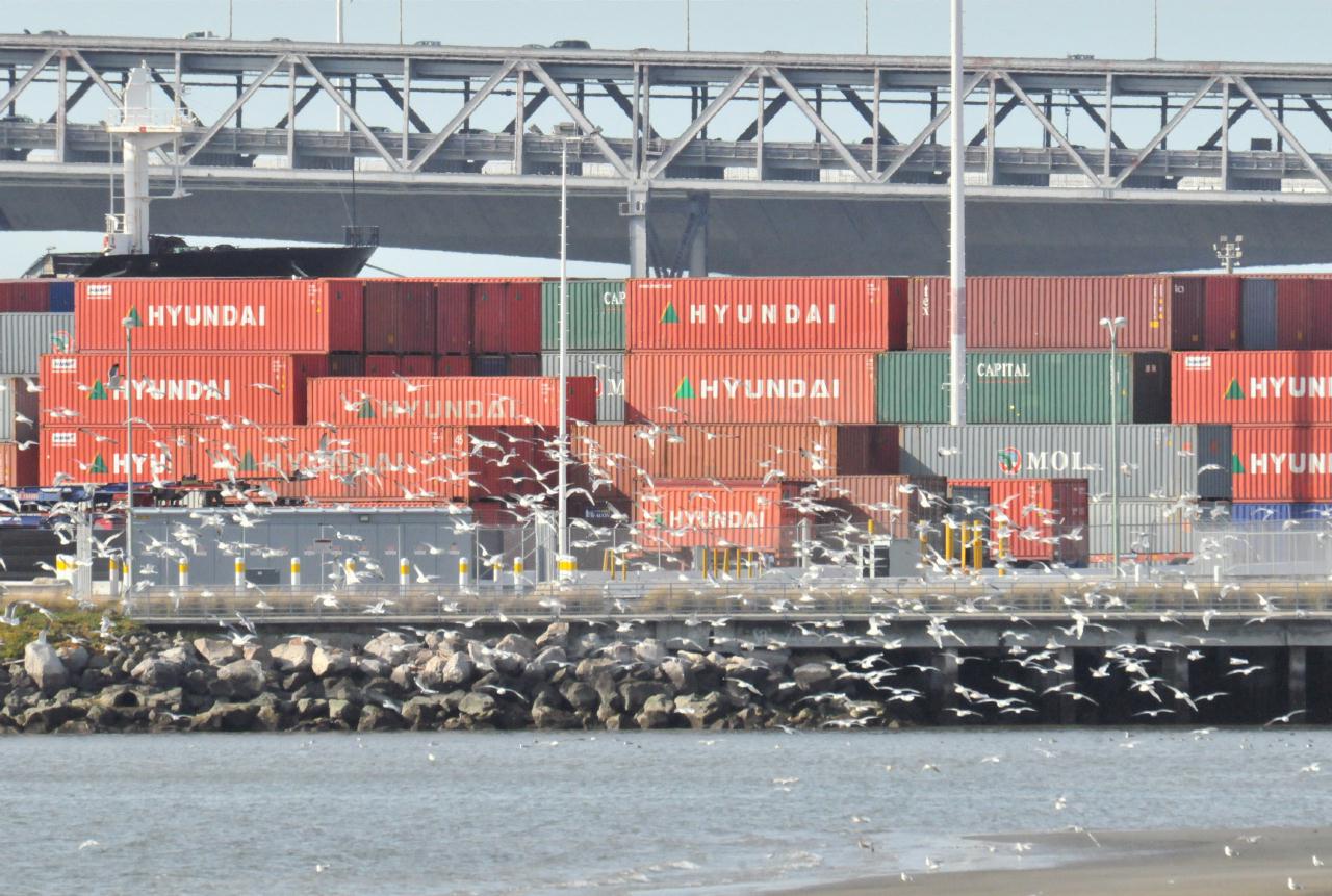 A telephoto view from the park of the Bay Bridge in the far distance, shipping containers in the near distance, and masses of birds in the foreground.
Middle Harbor Shoreline Park • Operated by: East bay Regional Park District • 7th St. at Middle Harbor Road, Oakland, California • (Photo posted Friday 28 May 2010) • (Photo taken 15:43:50 Sunday 14 March 2010) • © 2010 Terry Costales
Add a comment or report a mistake
|
|
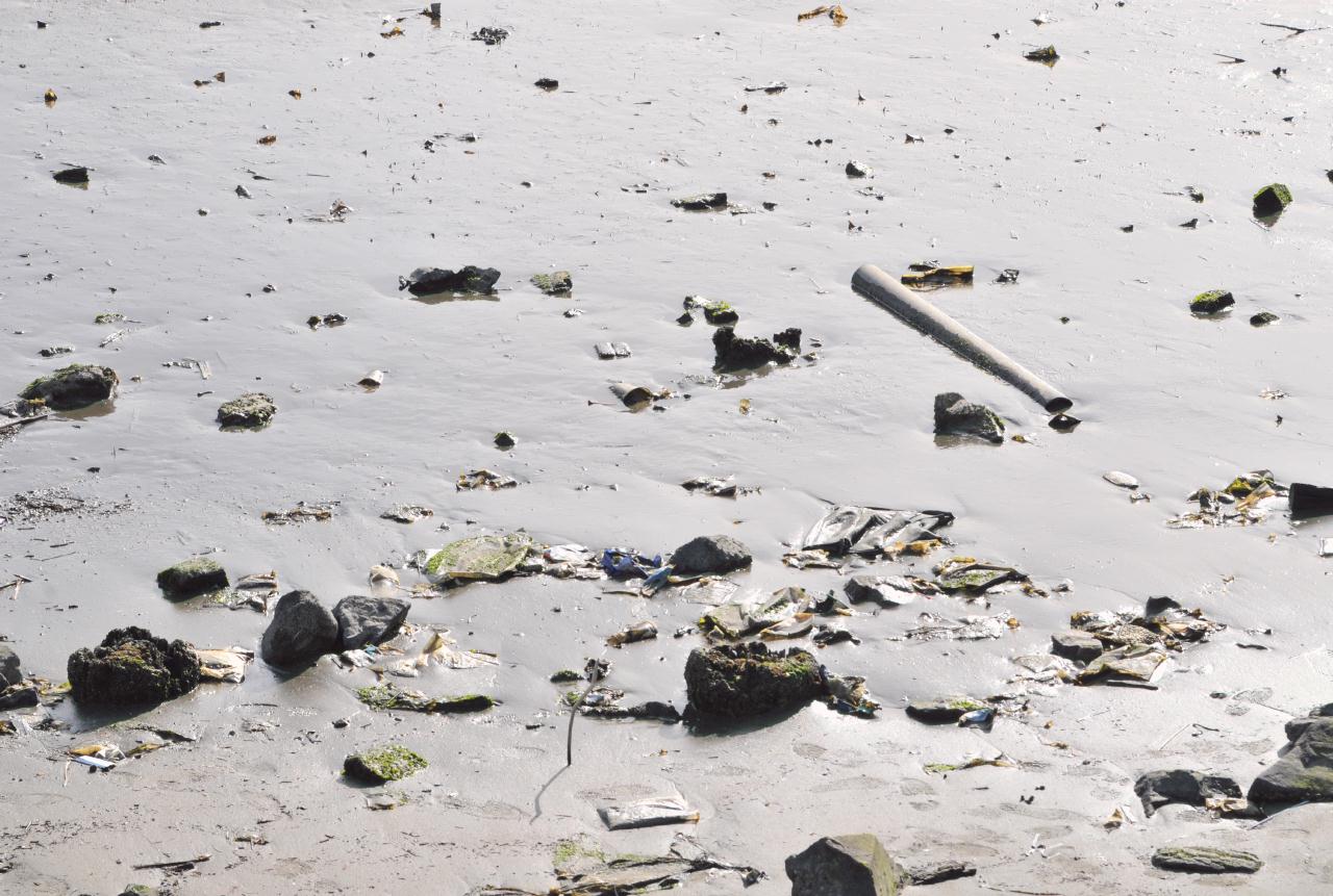 One reason to stay out of the mud in Middle Harbor was the trash there.
Middle Harbor Shoreline Park • Operated by: East bay Regional Park District • 7th St. at Middle Harbor Road, Oakland, California • (Photo posted Friday 28 May 2010) • (Photo taken 15:44:12 Sunday 14 March 2010) • © 2010 Bryan Costales
Add a comment or report a mistake
|
|
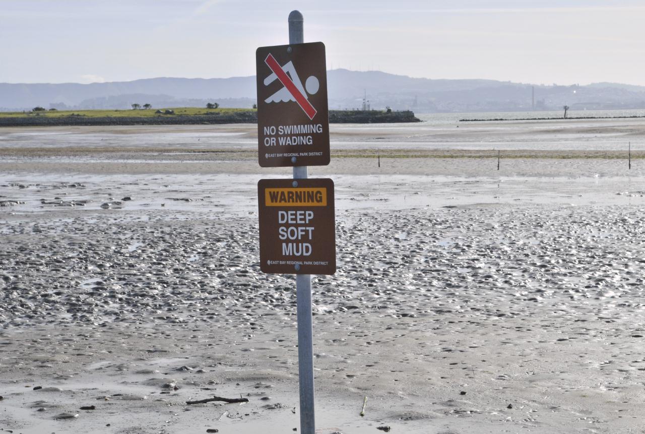 Two signs outlined the rules for use of the beach. The signs read: No swimming or wading
Middle Harbor Shoreline Park • Operated by: East bay Regional Park District • 7th St. at Middle Harbor Road, Oakland, California • (Photo posted Friday 28 May 2010) • (Photo taken 15:49:38 Sunday 14 March 2010) • © 2010 Bryan Costales
Add a comment or report a mistake
|
|
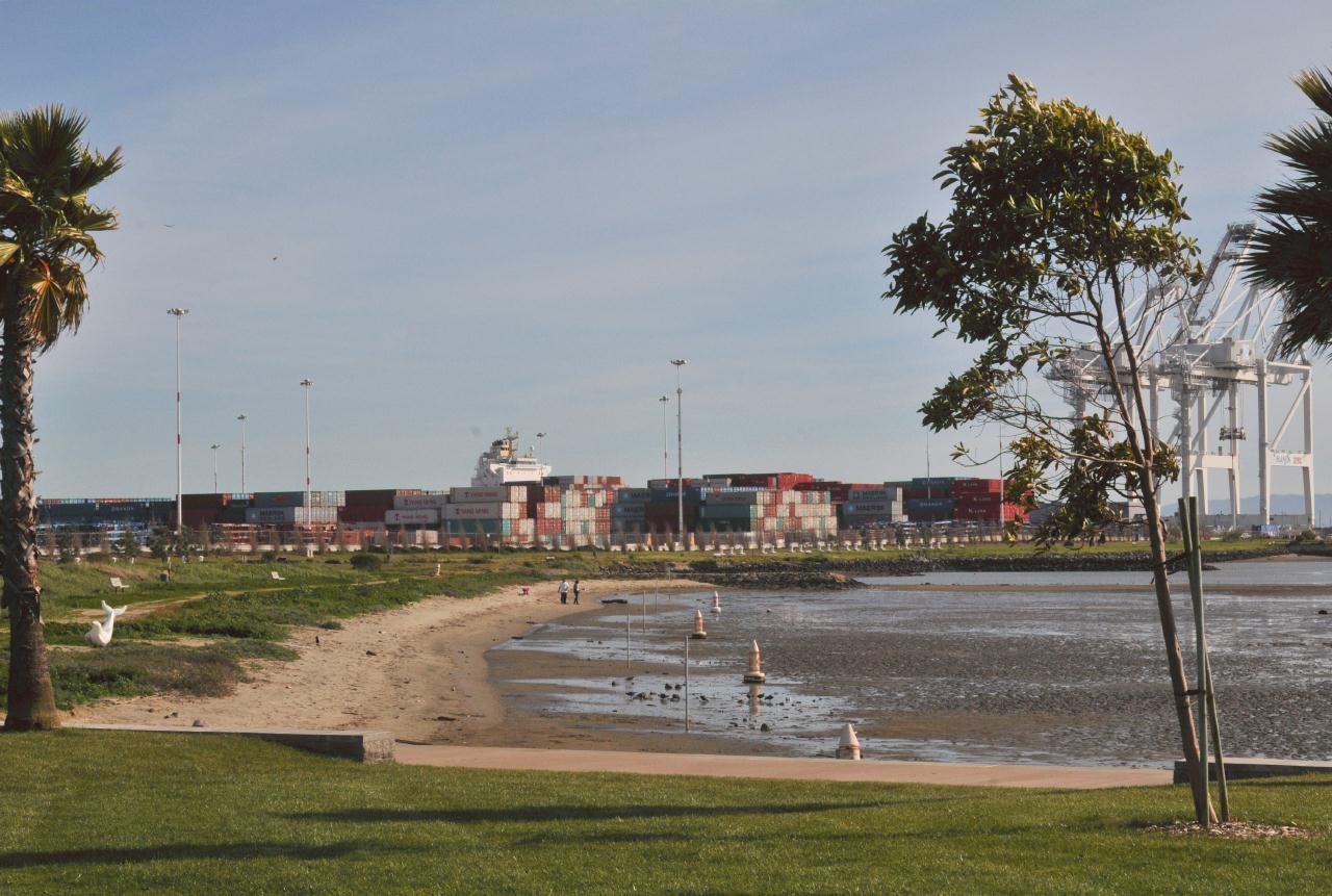
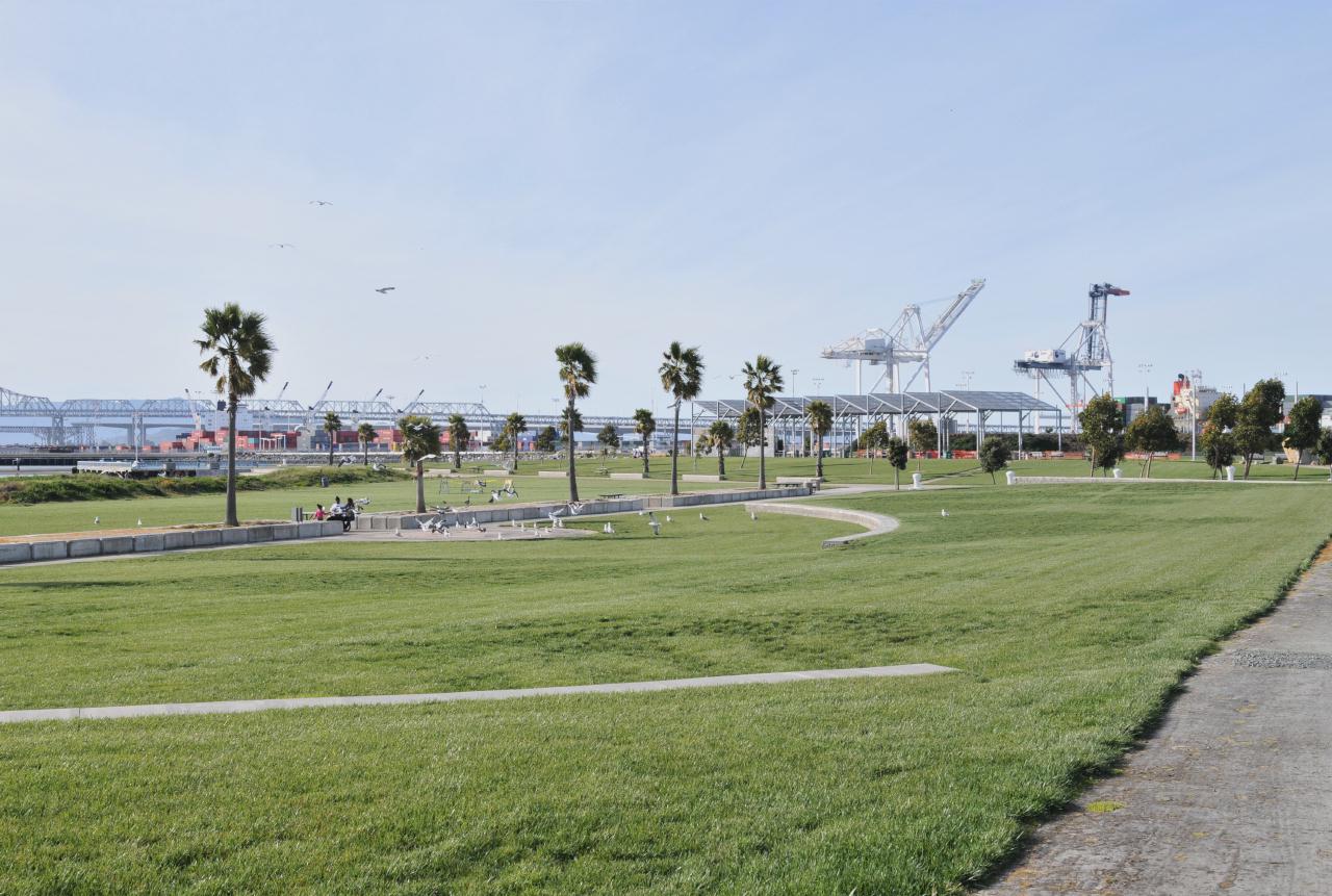
 A line of palm trees parallel the beach. Seating and picnic tables were scattered between the trees.
Middle Harbor Shoreline Park • Operated by: East bay Regional Park District • 7th St. at Middle Harbor Road, Oakland, California • (Photo posted Friday 28 May 2010) • (Photo taken 15:50:14 Sunday 14 March 2010) • © 2010 Bryan Costales
Add a comment or report a mistake
|
|
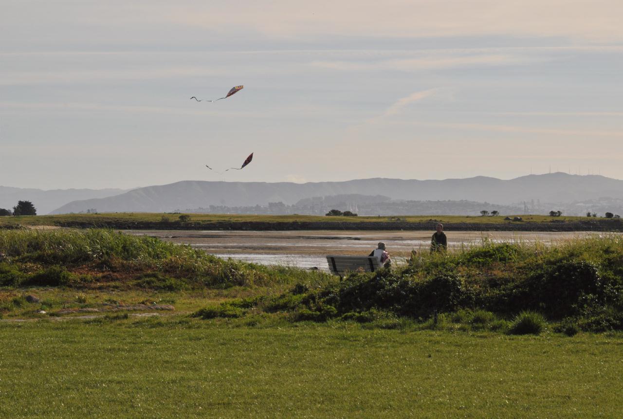 A bench between two berms had a clear view that afternoon of Middle Harbor, the Coast Range across the bay, and of kites flown.
Middle Harbor Shoreline Park • Operated by: East bay Regional Park District • 7th St. at Middle Harbor Road, Oakland, California • (Photo posted Friday 28 May 2010) • (Photo taken 15:50:34 Sunday 14 March 2010) • © 2010 Bryan Costales
Add a comment or report a mistake
|
|
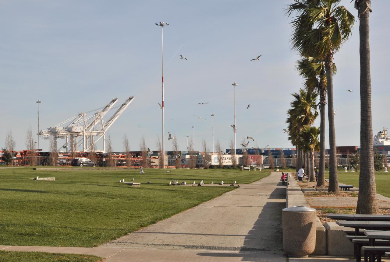 The back side of the line of palms. A walkway with the occasional picnic table. Note the sea gulls and cranes.
Middle Harbor Shoreline Park • Operated by: East bay Regional Park District • 7th St. at Middle Harbor Road, Oakland, California • (Photo posted Friday 28 May 2010) • (Photo taken 15:51:20 Sunday 14 March 2010) • © 2010 Bryan Costales
Add a comment or report a mistake
|
|
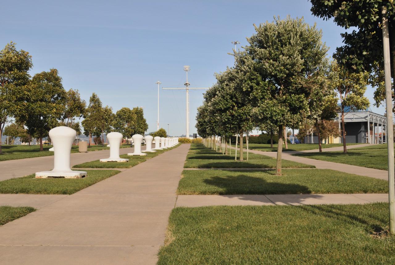 Bollards were lined up down the center of the main path into and out of the park. They were purely decorative because no big ship could possibly tie up here.
Middle Harbor Shoreline Park • Operated by: East bay Regional Park District • 7th St. at Middle Harbor Road, Oakland, California • (Photo posted Friday 28 May 2010) • (Photo taken 15:51:18 Sunday 14 March 2010) • © 2010 Bryan Costales
Add a comment or report a mistake
|
|
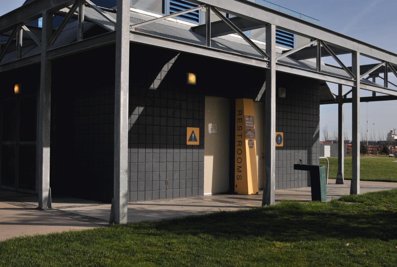 The restrooms appeared clean and new, but were closed on weekends. Beware that the closest "open" restrooms were a half mile away in Port View Park (but they were closed that weekend too). Shouldn't restrooms be open when people are most likely to visit?
Middle Harbor Shoreline Park • Operated by: East bay Regional Park District • 7th St. at Middle Harbor Road, Oakland, California • (Photo posted Friday 28 May 2010) • (Photo taken 15:52:02 Sunday 14 March 2010) • © 2010 Bryan Costales
Add a comment or report a mistake
|
|
 A curved seating area lay just off the central pathway parallel to the beach and parallel to the line of palms.
Middle Harbor Shoreline Park • Operated by: East bay Regional Park District • 7th St. at Middle Harbor Road, Oakland, California • (Photo posted Friday 28 May 2010) • (Photo taken 15:55:24 Sunday 14 March 2010) • © 2010 Bryan Costales
Add a comment or report a mistake
|
|
 Overview of the park shot from its south east corner. The beach was to the left. The saw-tooth roof was at the far end. Unseen beyond the path at the left was building 122 (now a grassy ball park).
Middle Harbor Shoreline Park • Operated by: East bay Regional Park District • 7th St. at Middle Harbor Road, Oakland, California • (Photo posted Friday 28 May 2010) • (Photo taken 15:56:32 Sunday 14 March 2010) • © 2010 Bryan Costales
Add a comment or report a mistake
|
|
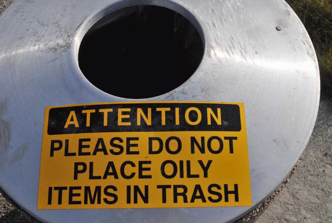 On a few of the garbage cans nearest the parking lot were signs that read: AttentionDid this imply that in Oakland one would expect people to work on their cars in parking lots?
Middle Harbor Shoreline Park • Operated by: East bay Regional Park District • 7th St. at Middle Harbor Road, Oakland, California • (Photo posted Friday 28 May 2010) • (Photo taken 15:58:36 Sunday 14 March 2010) • © 2010 Bryan Costales
Add a comment or report a mistake
|
|
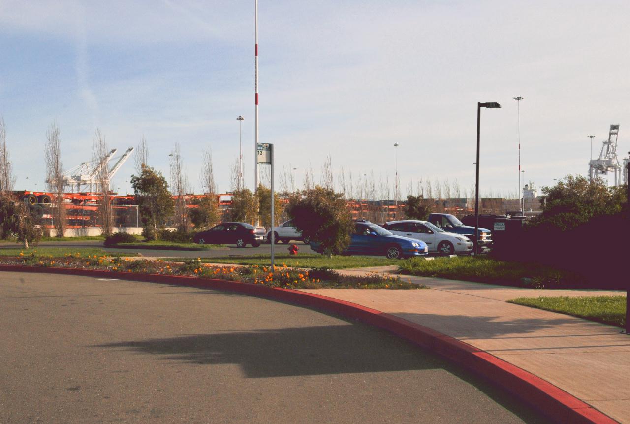 There was a bus stop for the AC Transit 13 bus line at the park. But AC Transit recently discontinued the 13 line. The stop is still there, but a bus will never arrive. That means the only way to access this park is by automobile and possibly by bicycle from West Oakland BART, about a 1.5 mile ride along an industrial section of 7th Street that runs under freeways and railroad tracks.
Middle Harbor Shoreline Park • Operated by: East bay Regional Park District • 7th St. at Middle Harbor Road, Oakland, California • (Photo posted Friday 28 May 2010) • (Photo taken 16:04:18 Sunday 14 March 2010) • © 2010 Bryan Costales
Add a comment or report a mistake
|
 |
| home • contact • topic guide • top 25 • photos • video • writing • blogs • upload • terms • privacy |