
|
|
|
|
|
San Lorenzo River, Santa Cruz
|
|
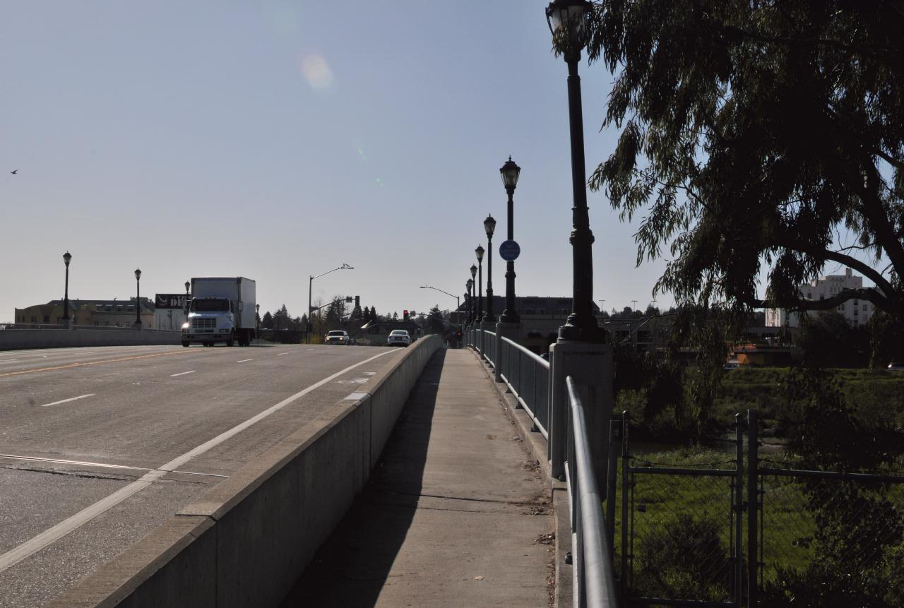
Soquel Avenue
San Lorenzo River, Santa Cruz, California • (Photo posted Tuesday 30 March 2010) • (Photo taken 15:59:56 Wednesday 10 March 2010) • © 2010 Bryan Costales 
Add a comment or report a mistake
|
|
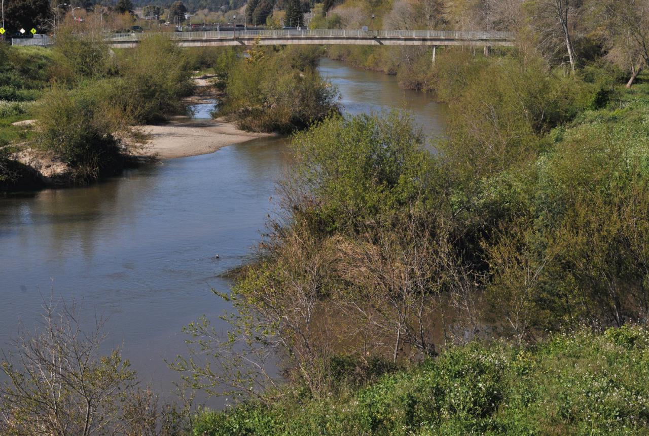 San Lorenzo River was full and appeared healthy. The total width of the overall basin was part of past attempts at flood control. Note that high tides and storm surges can push salt water and sand up river to just past the Soquel Avenue bridge from which this photograph was taken. San Lorenzo River, Santa Cruz, California • (Photo posted Tuesday 30 March 2010) • (Photo taken 16:01:40 Wednesday 10 March 2010) • © 2010 Bryan Costales
Add a comment or report a mistake
|
|
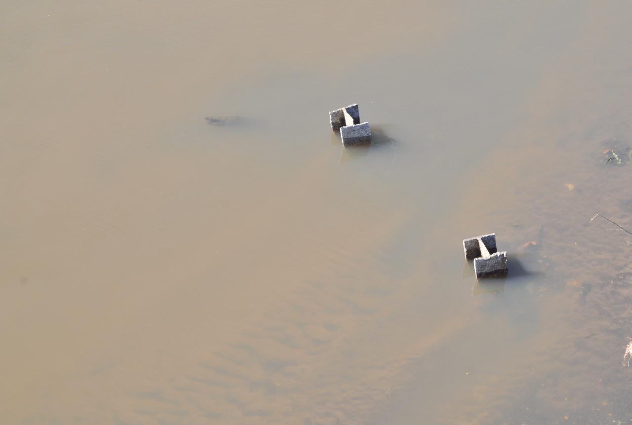 Two I-beams were embedded in the mud of San Lorenzo River. Notice how shallow the river actually was. San Lorenzo River, Santa Cruz, California • (Photo posted Tuesday 30 March 2010) • (Photo taken 16:02:40 Wednesday 10 March 2010) • © 2010 Bryan Costales
Add a comment or report a mistake
|
|
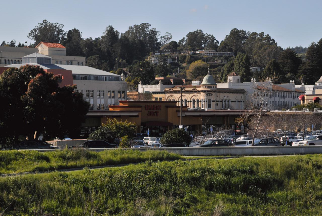
Downtown Santa Cruz was visible from the Soquel Avenue bridge over
the San Lorenzo River. Note the parking lots between the river and
the town. This kind of layout implied that the town had always
considered the river an eye-sore. Contrast that to European towns which
typically embrace
San Lorenzo River, Santa Cruz, California • (Photo posted Tuesday 30 March 2010) • (Photo taken 16:03:38 Wednesday 10 March 2010) • © 2010 Bryan Costales
Add a comment or report a mistake
|
|
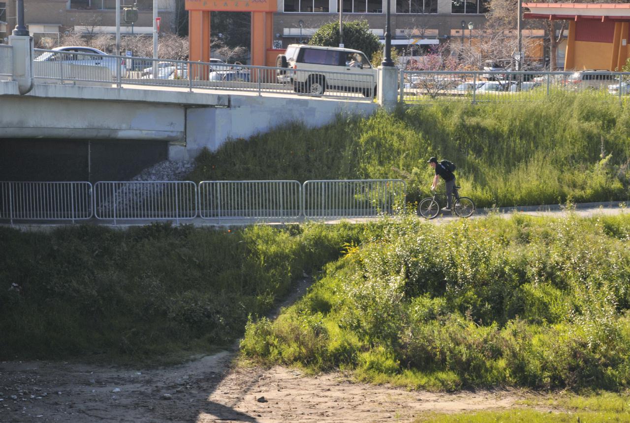
A bicycle path ran under the Soquel Avenue bridge on the downtown
side of the San Lorenzo River. This trail was part of a much larger
bikeway system
San Lorenzo River, Santa Cruz, California • (Photo posted Tuesday 30 March 2010) • (Photo taken 16:05:00 Wednesday 10 March 2010) • © 2010 Bryan Costales
Add a comment or report a mistake
|
|
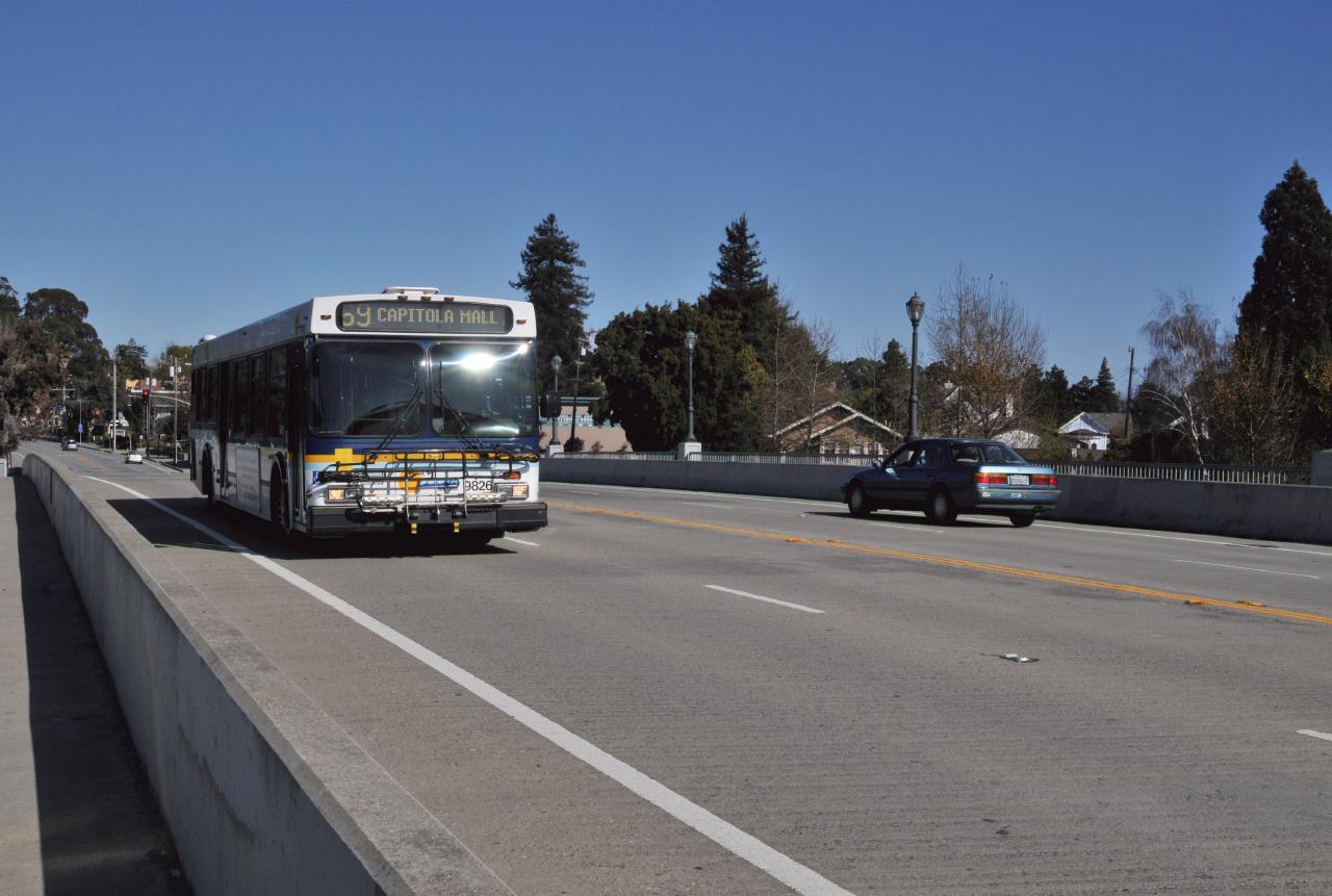
Santa Cruz was served by a typical bus system called
the Santa Cruz Metro
San Lorenzo River, Santa Cruz, California • (Photo posted Tuesday 30 March 2010) • (Photo taken 16:07:24 Wednesday 10 March 2010) • © 2010 Bryan Costales
Add a comment or report a mistake
|
|
 The Soquel Avenue bridge as viewed from the bicycle path on the downtown side of the bridge. San Lorenzo River, Santa Cruz, California • (Photo posted Tuesday 30 March 2010) • (Photo taken 16:08:12 Wednesday 10 March 2010) • © 2010 Bryan Costales
Add a comment or report a mistake
|
|
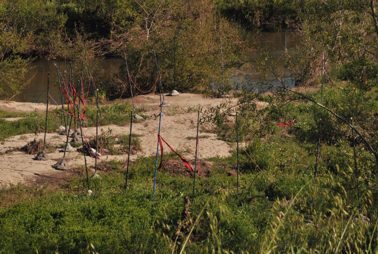 An odd looking fence surround part of a sand bar located in the middle of the San Lorenzo River basin half way between the Soquel Avenue bridge and the pedestrian bridge. San Lorenzo River, Santa Cruz, California • (Photo posted Tuesday 30 March 2010) • (Photo taken 16:10:50 Wednesday 10 March 2010) • © 2010 Bryan Costales
Add a comment or report a mistake
|
|
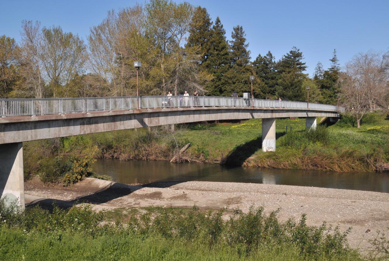 A pedestrian bridge crossed the San Lorenzo River half way between the Soquel Avenue bridge and the Water Street bridge. This was a narrow but practical bridge. San Lorenzo River, Santa Cruz, California • (Photo posted Tuesday 30 March 2010) • (Photo taken 16:12:38 Wednesday 10 March 2010) • © 2010 Bryan Costales
Add a comment or report a mistake
|
|
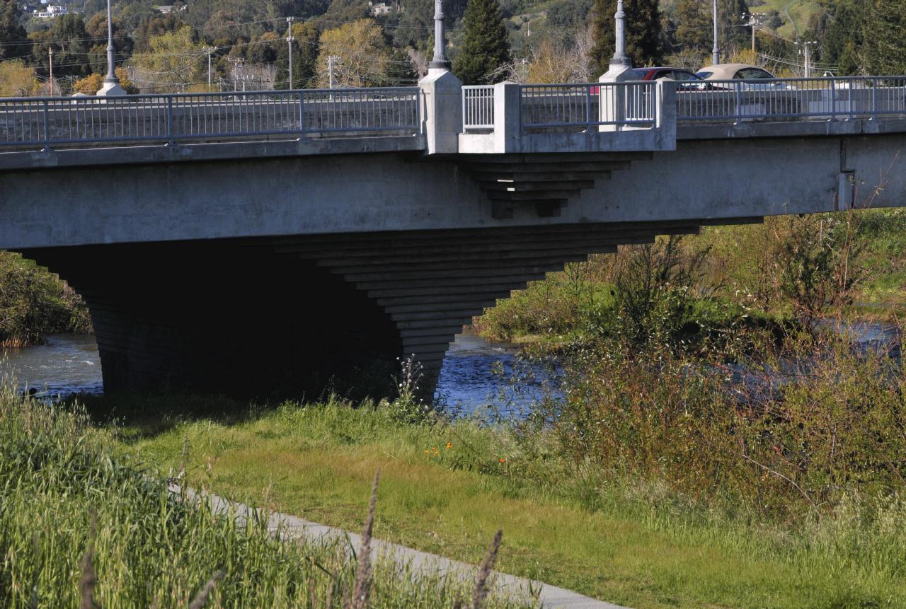 Interesting stair-step risers supported the bridge. Note the pedestrian viewing platforms along the edge of the bridge. San Lorenzo River, Santa Cruz, California • (Photo posted Tuesday 30 March 2010) • (Photo taken 16:17:54 Wednesday 10 March 2010) • © 2010 Bryan Costales
Add a comment or report a mistake
|
|
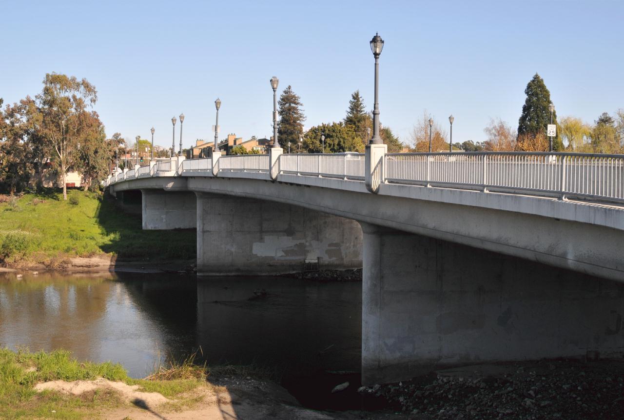
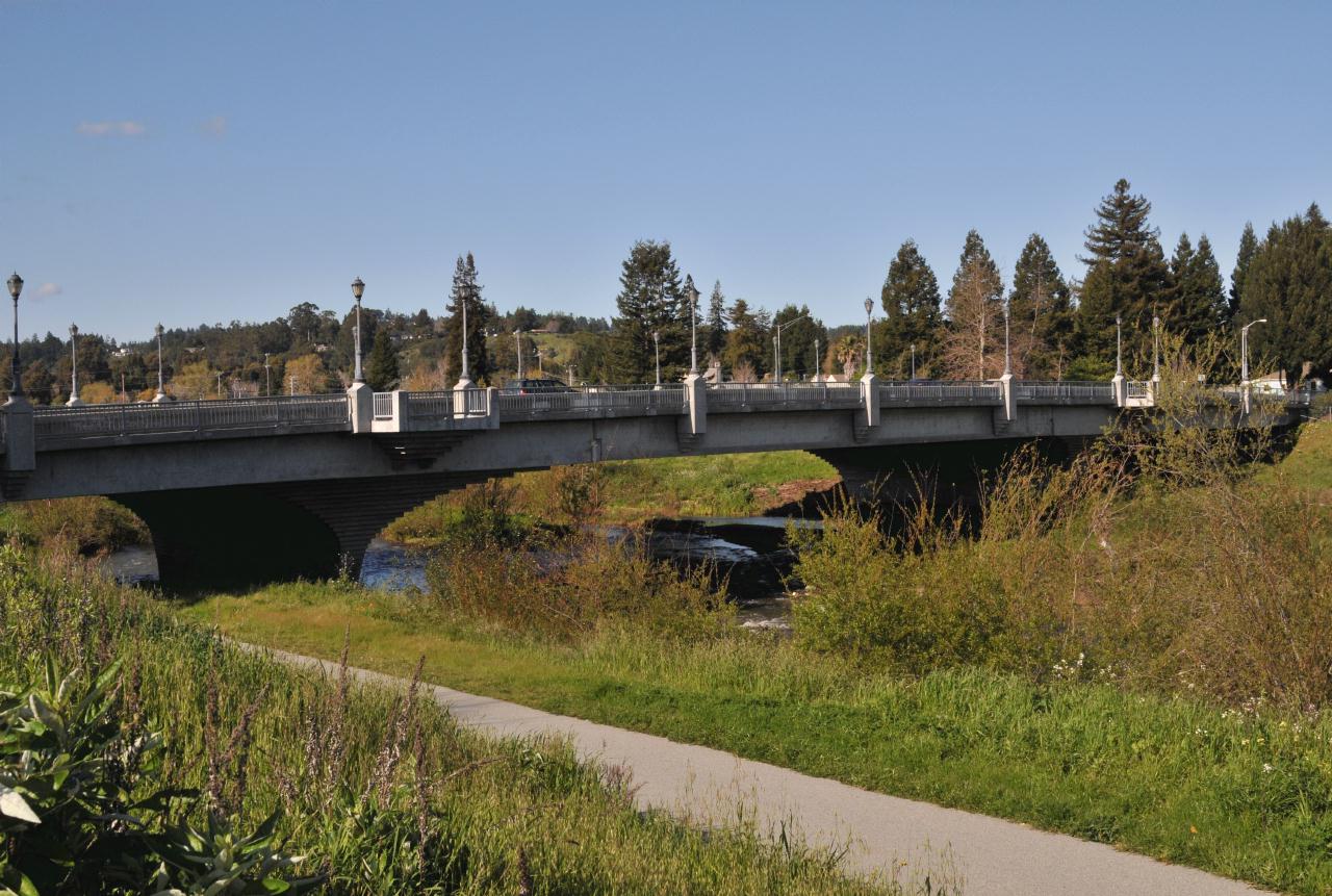 Another four lane road crossed the San Lorenzo River at Water Street. From a distance the bridge looked somewhat European. But closeup it was just another wide road over a river. San Lorenzo River, Santa Cruz, California • (Photo posted Tuesday 30 March 2010) • (Photo taken 16:17:56 Wednesday 10 March 2010) • © 2010 Bryan Costales
Add a comment or report a mistake
|
 |
| home • contact • topic guide • top 25 • photos • video • writing • blogs • upload • terms • privacy |