
|
|
|
|
|
Sibley Volcanic, Regional Preserve
|
|
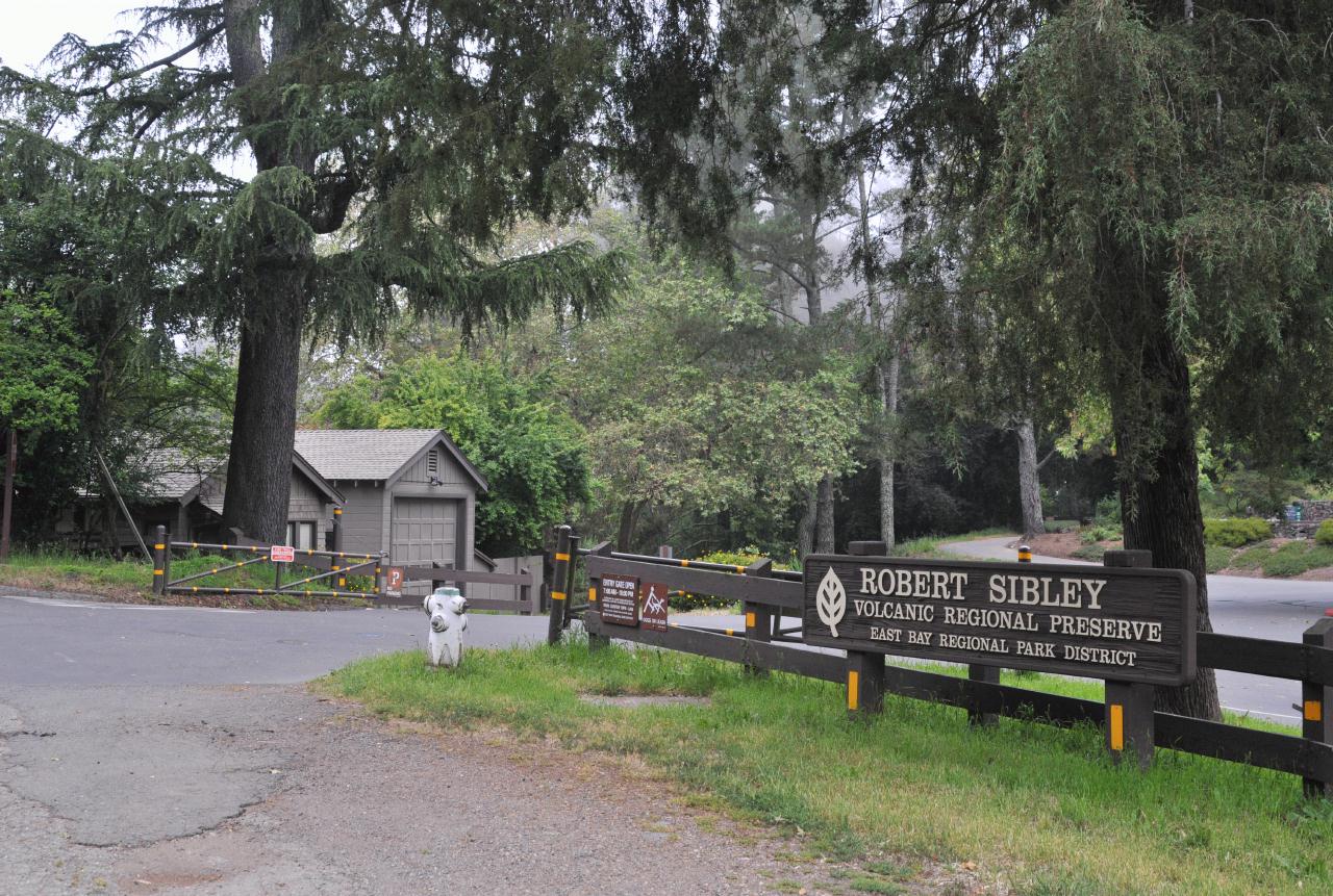 Although located more in the Berkeley hills then in Oakland, the park is best accessed from the Moraga side of the Caldecott Tunnel. Take the Fish Ranch Road exit, cross over the tunnel and head up hill to Grizzly Peak Boulevard. Turn left on Grizzly Peak and follow that to Skyline Boulevard. Left again and the entry is on the left as you round a sweeping right curve.
Robert Sibley Volcanic Regional Preserve • East Bay Regional Park District • Access via Oakland, but above Berkeley • (Photo posted 31 July 2010) • (Photo taken 12:17:30 Wednesday 9 June 2010) • © 2010 Bryan Costales 
Add a comment or report a mistake
|
|
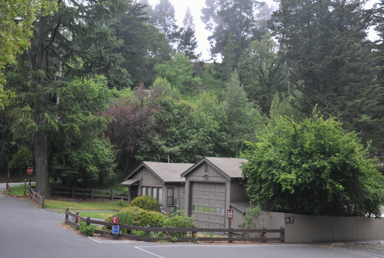
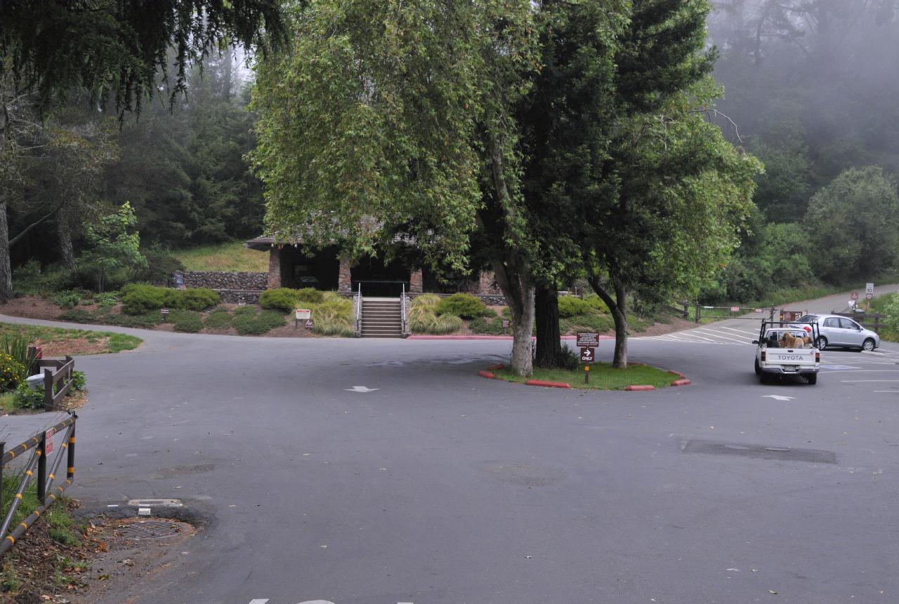 Just inside the entry was parking for at most two dozen cars. The turn-around was wide to accommodate school buses. The road leading off at the upper left led to a large secondary parking lot. Restrooms and general information were available in the building at the opposite end of this first parking lot.
Robert Sibley Volcanic Regional Preserve • East Bay Regional Park District • Access via Oakland, but above Berkeley • (Photo posted 31 July 2010) • (Photo taken 12:17:54 Wednesday 9 June 2010) • © 2010 Bryan Costales
Add a comment or report a mistake
|
|
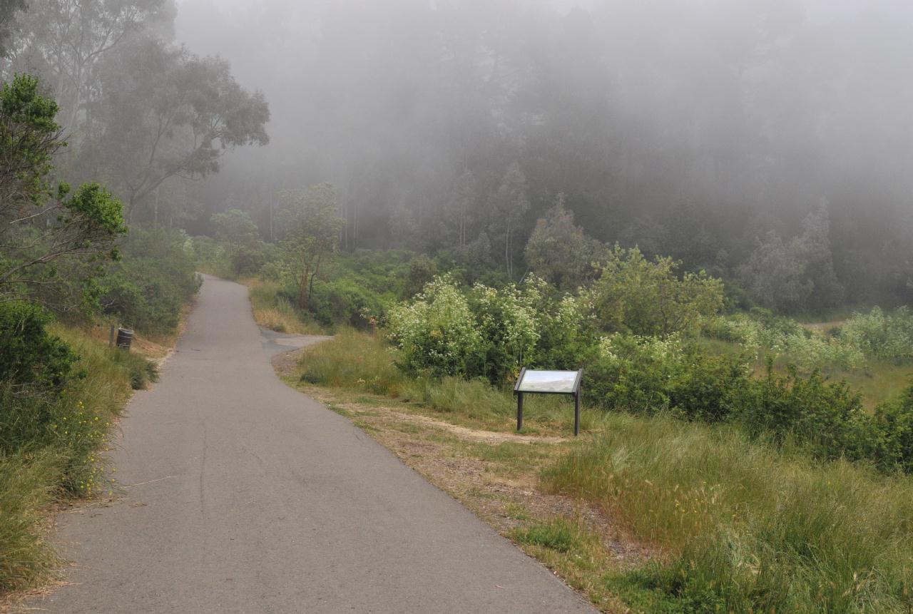
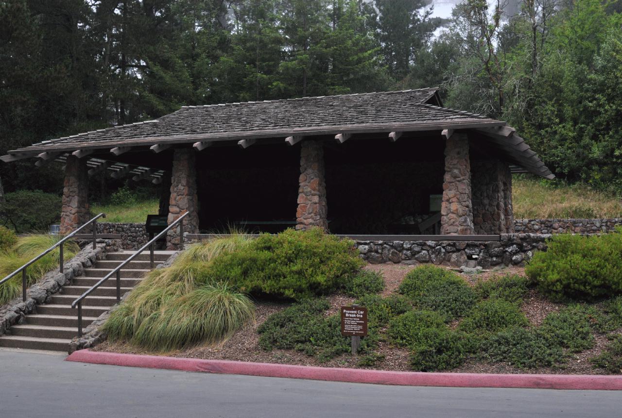 The restrooms were fairly new and well maintained. They were located on either ends of this building. In front, just behind the columns, were exhibits which described the natural and geologic wonders of this preserve. The sign read, "Prevent Car Break-Ins," and listed common sense rules to protect your valuables.
Robert Sibley Volcanic Regional Preserve • East Bay Regional Park District • Access via Oakland, but above Berkeley • (Photo posted 31 July 2010) • (Photo taken 12:19:28 Wednesday 9 June 2010) • © 2010 Bryan Costales
Add a comment or report a mistake
|
|
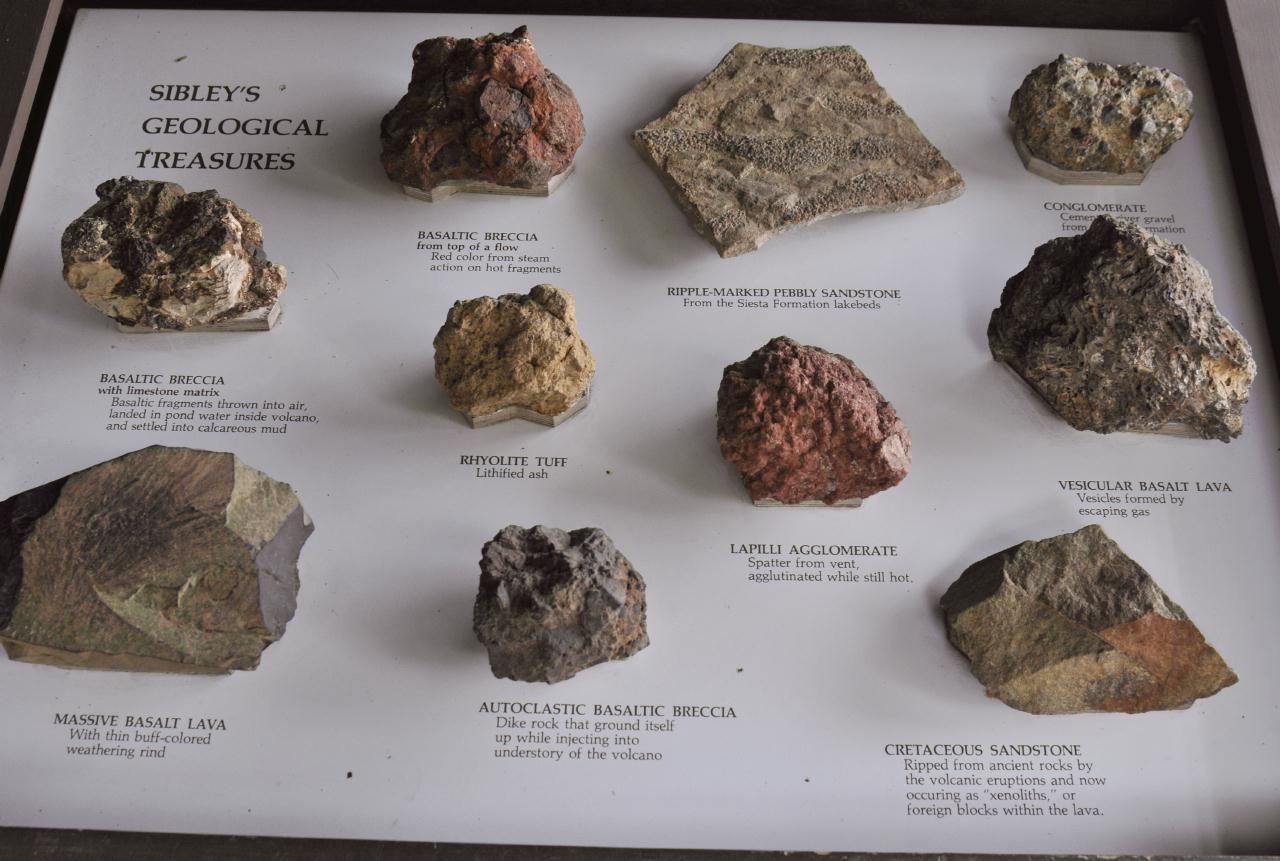 A display labeled, "Sibley's Geological Treasures," exhibited samples of the kinds of rocks and minerals found inside the preserve. Note that many were produced as the result of volcanic heat and grasses. For example, "Lapilli Agglomerate, Spatter from vent, agglutinated while still hot."
Robert Sibley Volcanic Regional Preserve • East Bay Regional Park District • Access via Oakland, but above Berkeley • (Photo posted 31 July 2010) • (Photo taken 12:19:58 Wednesday 9 June 2010) • © 2010 Bryan Costales
Add a comment or report a mistake
|
|
 The house for the ranger that was responsible for the maintenance and protection of this preserve. Note the emergency phone located at the base of the fence just in front of the ranger house. On Wednesday, there was no sign of a ranger.
Robert Sibley Volcanic Regional Preserve • East Bay Regional Park District • Access via Oakland, but above Berkeley • (Photo posted 31 July 2010) • (Photo taken 12:23:00 Wednesday 9 June 2010) • © 2010 Bryan Costales
Add a comment or report a mistake
|
|
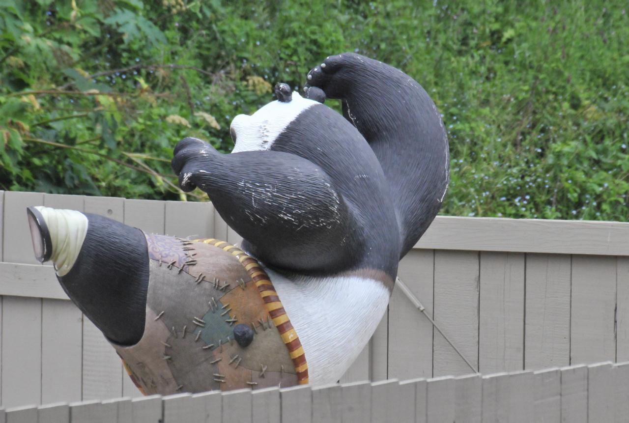 Behind the ranger house was a modest playground for young children. One of the delights was a large replica of Kung Fu Panda.
Robert Sibley Volcanic Regional Preserve • East Bay Regional Park District • Access via Oakland, but above Berkeley • (Photo posted 31 July 2010) • (Photo taken 12:24:46 Wednesday 9 June 2010) • © 2010 Terry Costales
Add a comment or report a mistake
|
|
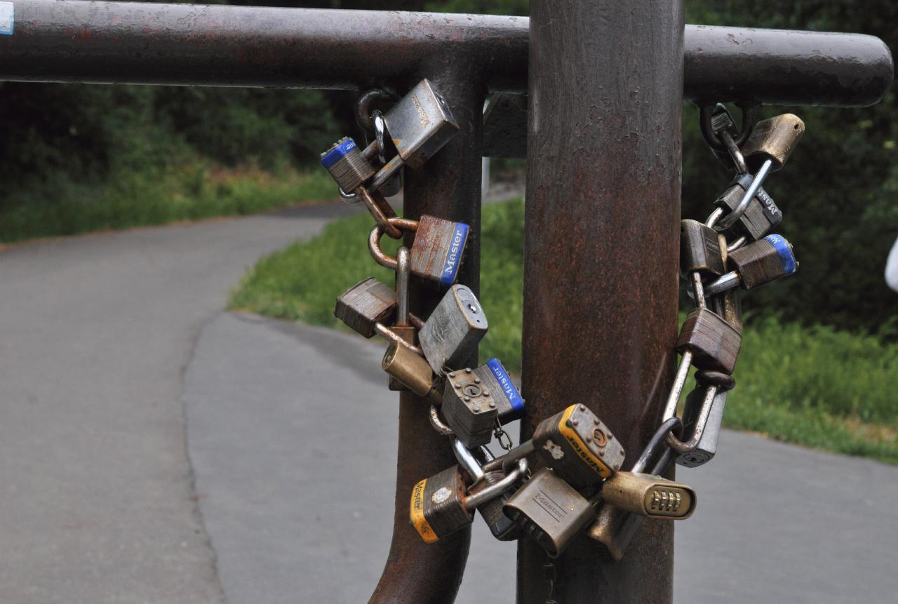 A common technique used on public lands is to close and secure a gate using a chain and a single lock. Over time, however, others will also need to access the land beyond the gate. Perhaps the local sheriff will need access, or a fire inspector, or a land surveyor, or workers for the water district, and so on. Each brings his or her own lock. The technique is to cut out a link in the chain, and to replace that link with a lock. Over time, the chain may vanish as it did here, and the entire chain will become formed of locks.
Robert Sibley Volcanic Regional Preserve • East Bay Regional Park District • Access via Oakland, but above Berkeley • (Photo posted 31 July 2010) • (Photo taken 12:24:47 Wednesday 9 June 2010) • © 2010 Bryan Costales
Add a comment or report a mistake
|
|
A paved road leads up from the parking lot to a water storage tank
at the top of the hill. Various hiking trails led off the road
on both sides. For example the Bay Area Ridge Trail
Robert Sibley Volcanic Regional Preserve • East Bay Regional Park District • Access via Oakland, but above Berkeley • (Photo posted 31 July 2010) • (Photo taken 12:25:30 Wednesday 9 June 2010) • © 2010 Bryan Costales
Add a comment or report a mistake
|
|
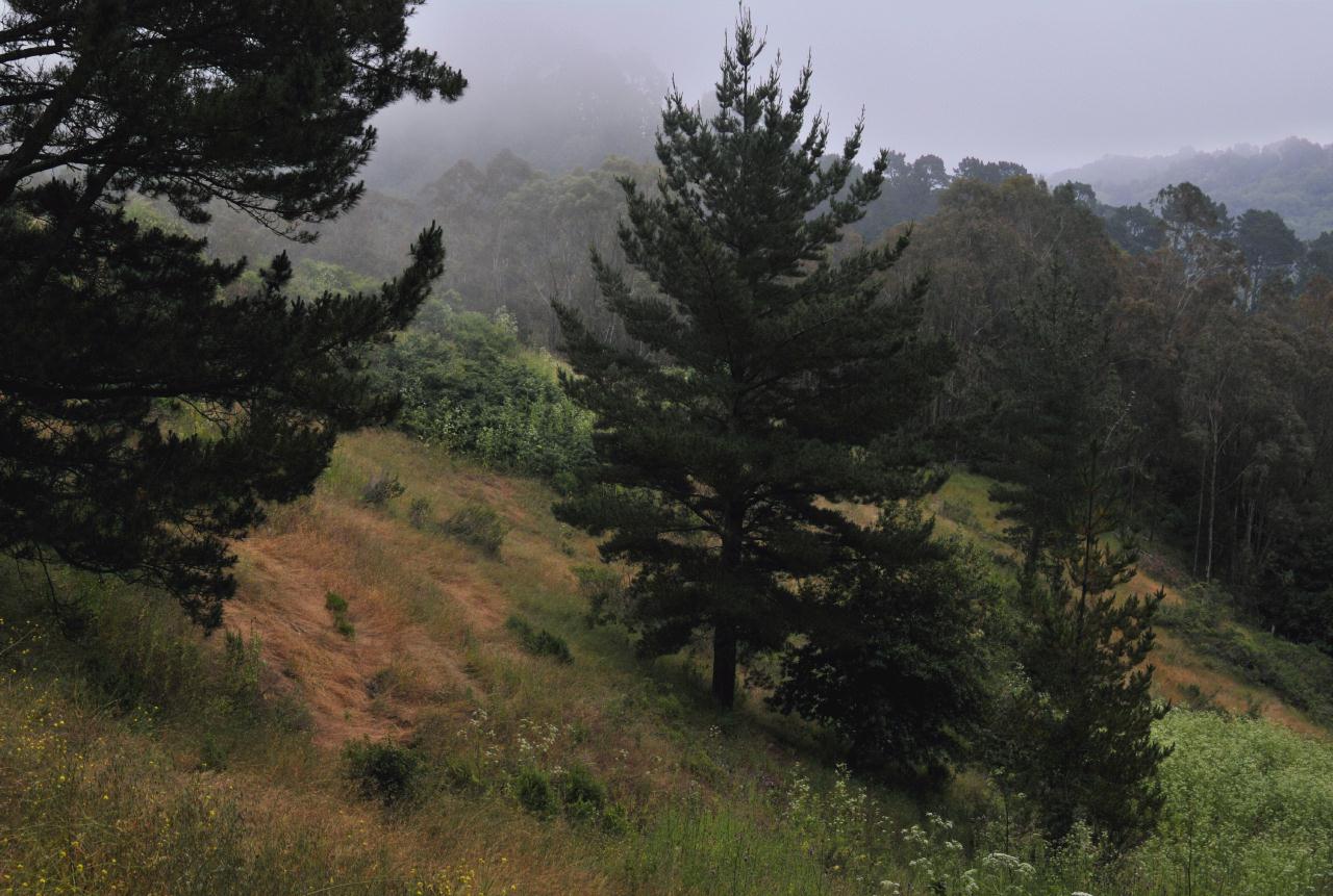 The core of the park between the parking lot and the water tower and roughly equally distant on either side was forest land. Later on this tour you will see where forest gives way to grasslands. The forest was composed mostly of pine, fir, eucalyptus and manzanita trees.
Robert Sibley Volcanic Regional Preserve • East Bay Regional Park District • Access via Oakland, but above Berkeley • (Photo posted 31 July 2010) • (Photo taken 12:27:16 Wednesday 9 June 2010) • © 2010 Bryan Costales
Add a comment or report a mistake
|
|

In the wilds alongside the road grew milk thistles
Robert Sibley Volcanic Regional Preserve • East Bay Regional Park District • Access via Oakland, but above Berkeley • (Photo posted 31 July 2010) • (Photo taken 12:28:00 Wednesday 9 June 2010) • © 2010 Bryan Costales
Add a comment or report a mistake
|
|
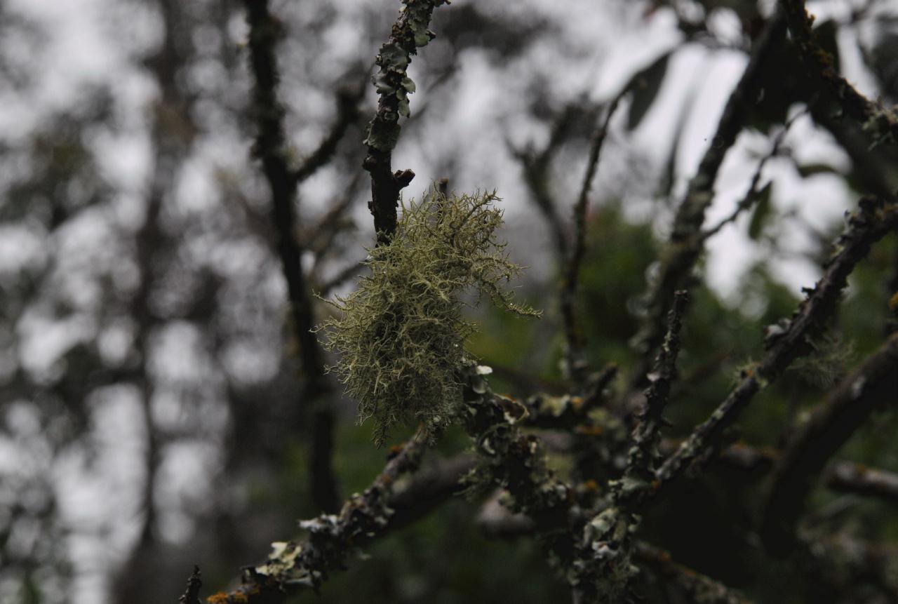 Because ocean fog collects in the Oakland/Berkeley hills, this forest was very damp until the fog burned off typically early to mid afternoon. Trees subjected to this fog developed patches of lichen. Unknown Sun, 22 Jan 2023 12:04:01 The image shows lichen, not moss.
Robert Sibley Volcanic Regional Preserve • East Bay Regional Park District • Access via Oakland, but above Berkeley • (Photo posted 31 July 2010) • (Photo taken 12:31:18 Wednesday 9 June 2010) • © 2010 Bryan Costales
Add a comment or report a mistake
|
|
 A sign alongside the road described the geologic history of this preserve. It showed a painted replica of the low hill in front of it as that hill looked millions of years ago as an erupting volcano.
Robert Sibley Volcanic Regional Preserve • East Bay Regional Park District • Access via Oakland, but above Berkeley • (Photo posted 31 July 2010) • (Photo taken 12:31:34 Wednesday 9 June 2010) • © 2010 Bryan Costales
Add a comment or report a mistake
|
|
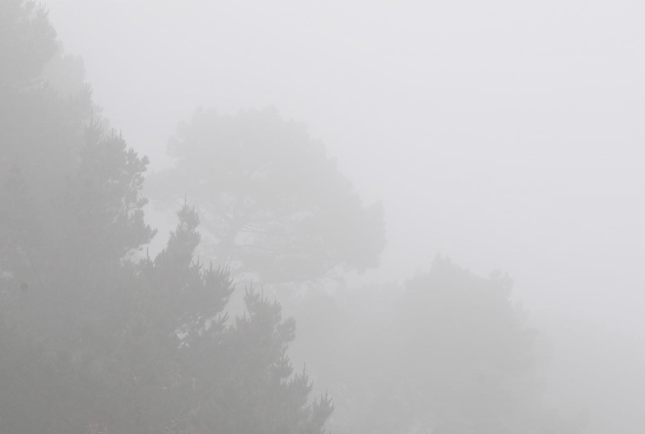 The top of this preserve was on one of the peaks that captured fog from the pacific ocean on its way blown eastward. This peak could remain foggy long after the fog burned off in San Francisco, twelve miles to the west and across the bay. As you can see, even on a bright sunny day, the fog could become very dense.
Robert Sibley Volcanic Regional Preserve • East Bay Regional Park District • Access via Oakland, but above Berkeley • (Photo posted 31 July 2010) • (Photo taken 12:34:28 Wednesday 9 June 2010) • © 2010 Bryan Costales
Add a comment or report a mistake
|
|
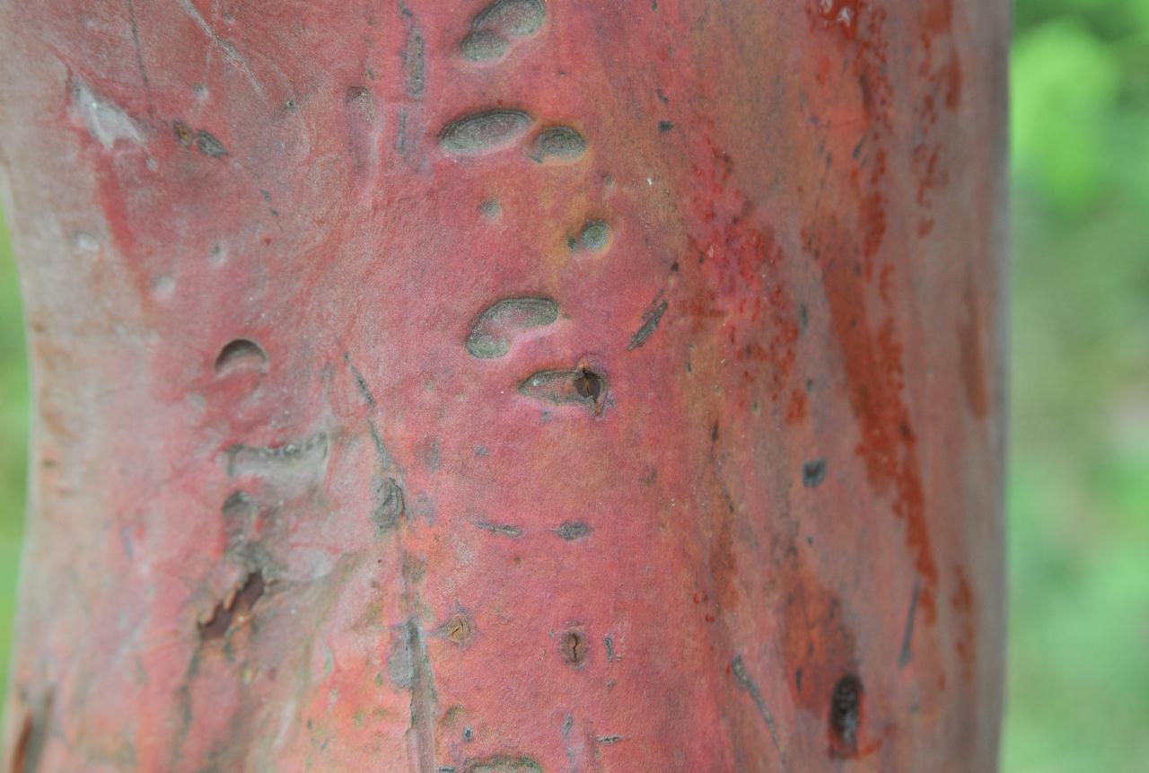 Manzanita grew alongside the paved road that led up to the water tower from the park entrance. A close-up of the manzanita's trunk showed its bright red color.
Robert Sibley Volcanic Regional Preserve • East Bay Regional Park District • Access via Oakland, but above Berkeley • (Photo posted 31 July 2010) • (Photo taken 12:34:42 Wednesday 9 June 2010) • © 2010 Bryan Costales
Add a comment or report a mistake
|
|
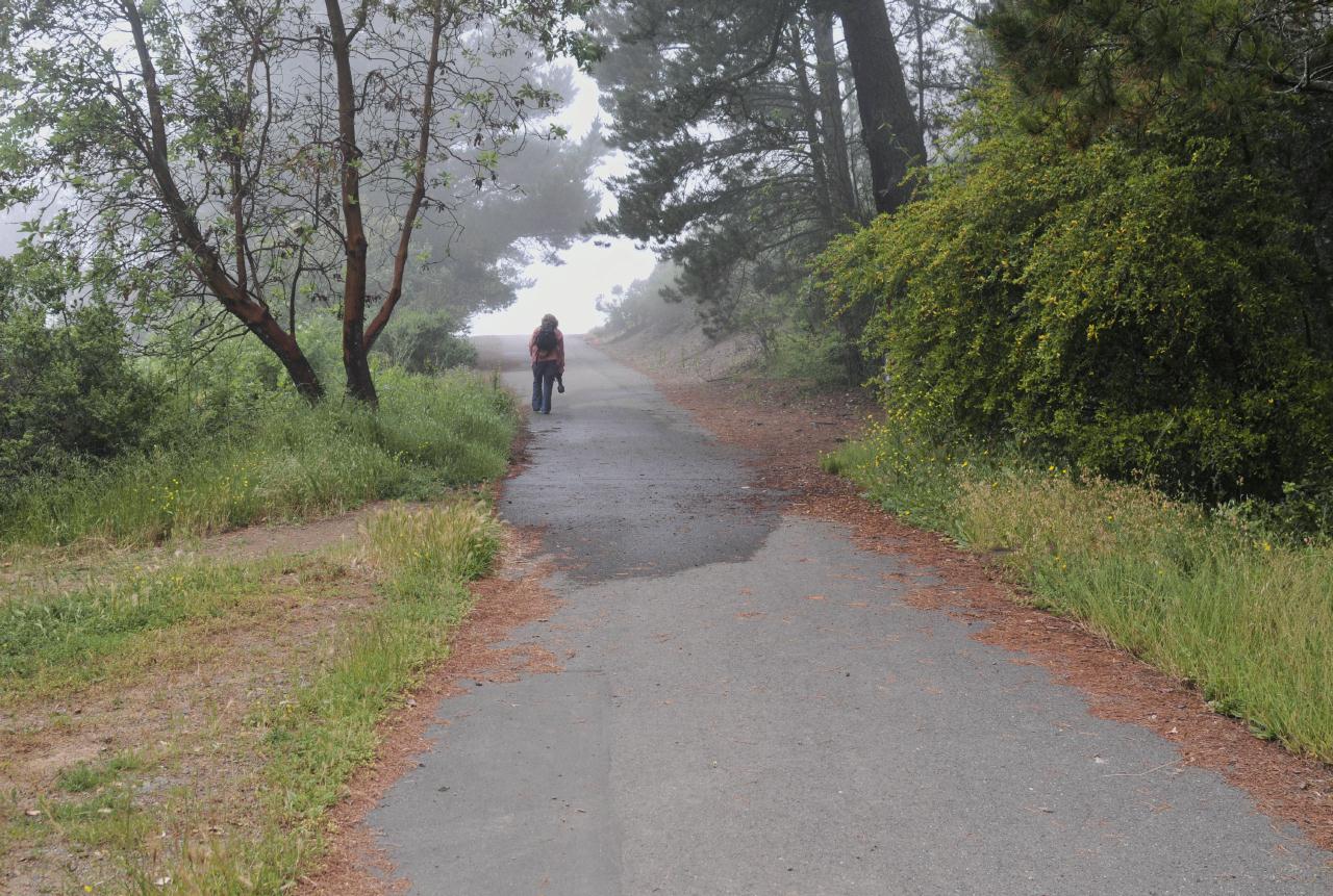 The road up to the water tank was uphill the whole way. Despite the hill, the walk was dramatically beautiful even in the fog.
Robert Sibley Volcanic Regional Preserve • East Bay Regional Park District • Access via Oakland, but above Berkeley • (Photo posted 31 July 2010) • (Photo taken 12:36:46 Wednesday 9 June 2010) • © 2010 Bryan Costales
Add a comment or report a mistake
|
|
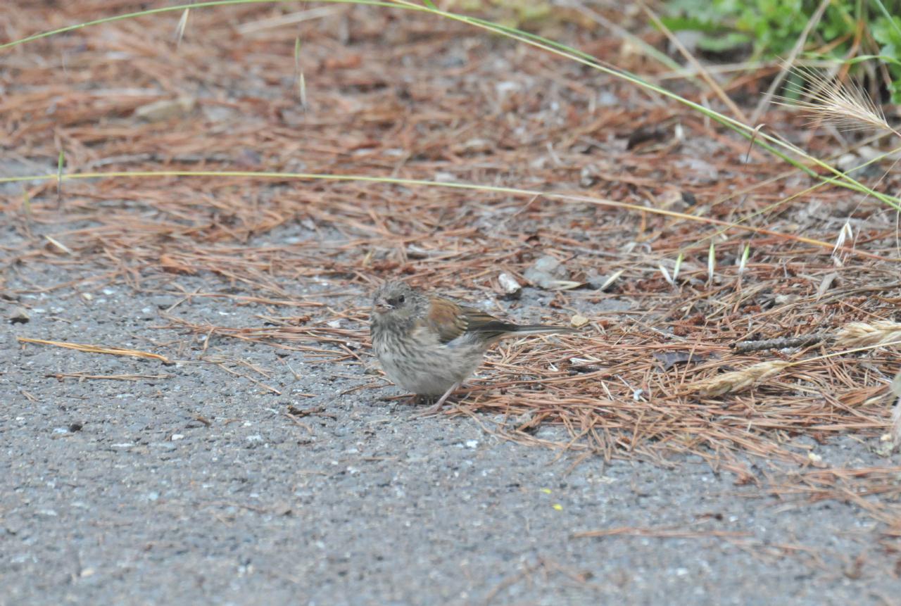 An Oregon Junco was a small bird that blended well with the fallen pine needles alongside the road. The bird had been looking for food as we approached and flew off shortly after this shot was taken.
Robert Sibley Volcanic Regional Preserve • East Bay Regional Park District • Access via Oakland, but above Berkeley • (Photo posted 31 July 2010) • (Photo taken 12:37:18 Wednesday 9 June 2010) • © 2010 Terry Costales
Add a comment or report a mistake
|
|
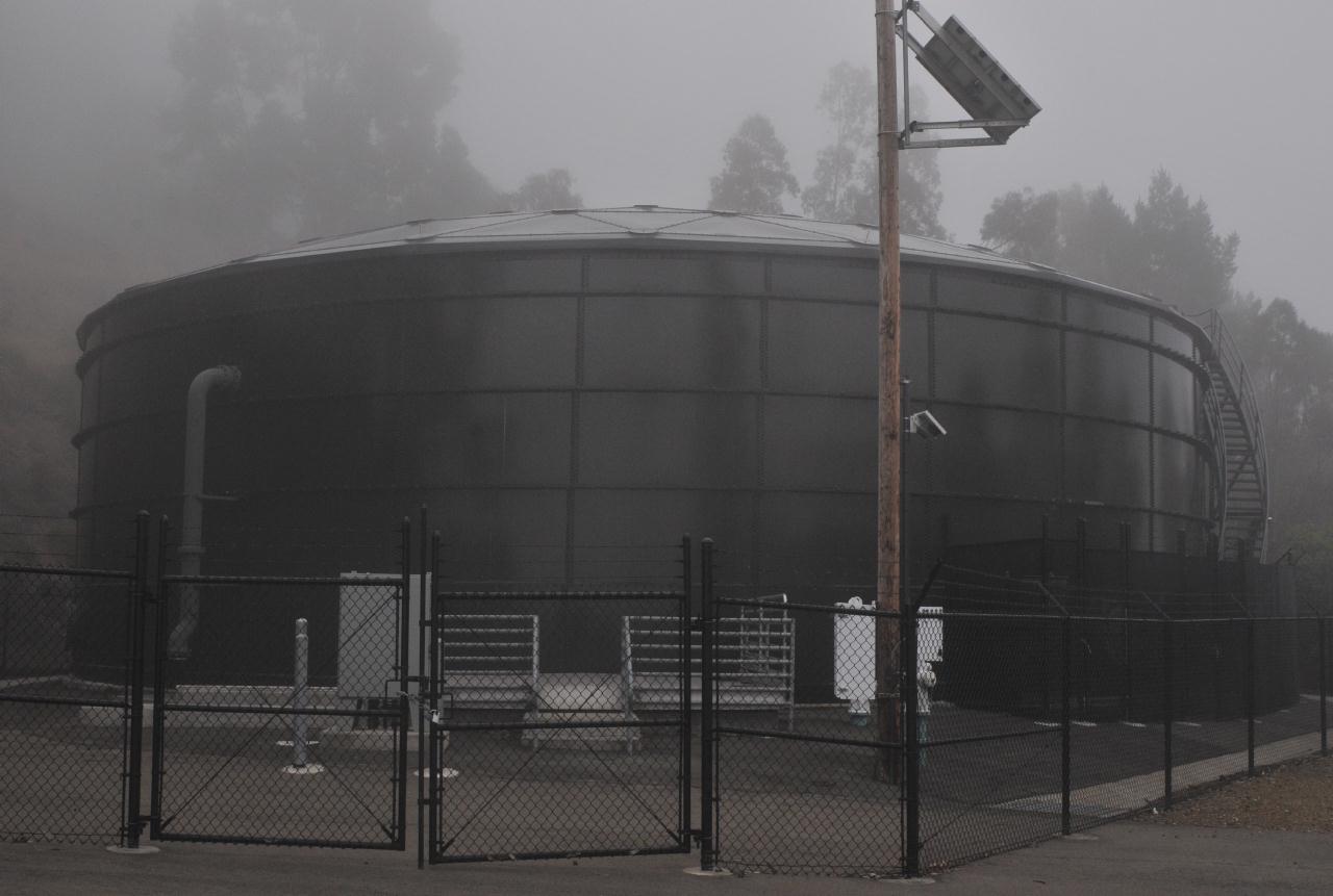
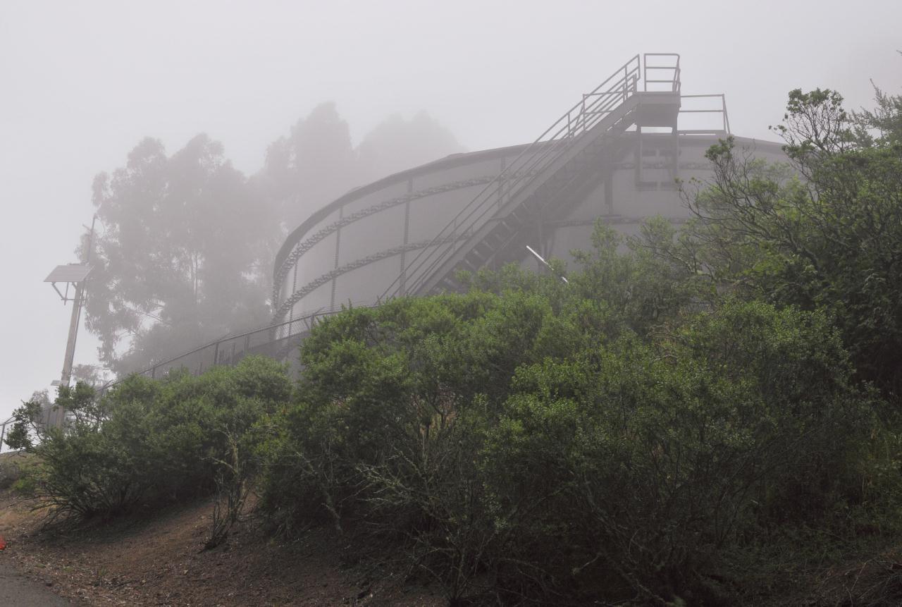 The water storage tank was found at the top of the hill. It was unexpectedly black and more industrial looking than anticipated.
Robert Sibley Volcanic Regional Preserve • East Bay Regional Park District • Access via Oakland, but above Berkeley • (Photo posted 31 July 2010) • (Photo taken 12:37:42 Wednesday 9 June 2010) • © 2010 Bryan Costales
Add a comment or report a mistake
|
|
 Once to the top of the hill, it was clear why a paved road was needed. Maintenance of such a large facility could not be handled by foot along a narrow path. No trails led off the road from its top. The nearest trail was found part way back down the road where Loop Trail crossed it.
Robert Sibley Volcanic Regional Preserve • East Bay Regional Park District • Access via Oakland, but above Berkeley • (Photo posted 31 July 2010) • (Photo taken 12:38:50 Wednesday 9 June 2010) • © 2010 Bryan Costales
Add a comment or report a mistake
|
|
 Loop Trail as it appeared leading away from the paved road. It was on the left when traveling back down the road, but on the right when originally going up. Notice how it appeared to be more of a traditional forest trail. The loop circled around the hill and later rejoined the paved road.
Robert Sibley Volcanic Regional Preserve • East Bay Regional Park District • Access via Oakland, but above Berkeley • (Photo posted 31 July 2010) • (Photo taken 12:43:48 Wednesday 9 June 2010) • © 2010 Bryan Costales
Add a comment or report a mistake
|
|
 Alongside the Loop Trail while still inside a foggy forest, a moss covered boulder looked slimy but felt dry. So perhaps the moss was actually lichen.
Robert Sibley Volcanic Regional Preserve • East Bay Regional Park District • Access via Oakland, but above Berkeley • (Photo posted 31 July 2010) • (Photo taken 12:45:02 Wednesday 9 June 2010) • © 2010 Bryan Costales
Add a comment or report a mistake
|
|
The official mascot of University of California at Santa Cruz
Robert Sibley Volcanic Regional Preserve • East Bay Regional Park District • Access via Oakland, but above Berkeley • (Photo posted 31 July 2010) • (Photo taken 12:49:44 Wednesday 9 June 2010) • © 2010 Bryan Costales
Add a comment or report a mistake
|
|
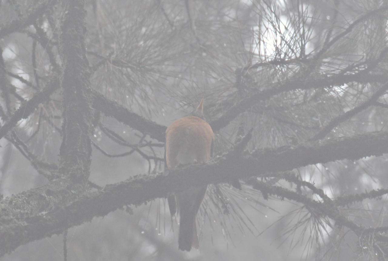 A Robin was barely visible up inside a fog encircled tree.
Robert Sibley Volcanic Regional Preserve • East Bay Regional Park District • Access via Oakland, but above Berkeley • (Photo posted 31 July 2010) • (Photo taken 12:49:58 Wednesday 9 June 2010) • © 2010 Terry Costales
Add a comment or report a mistake
|
|
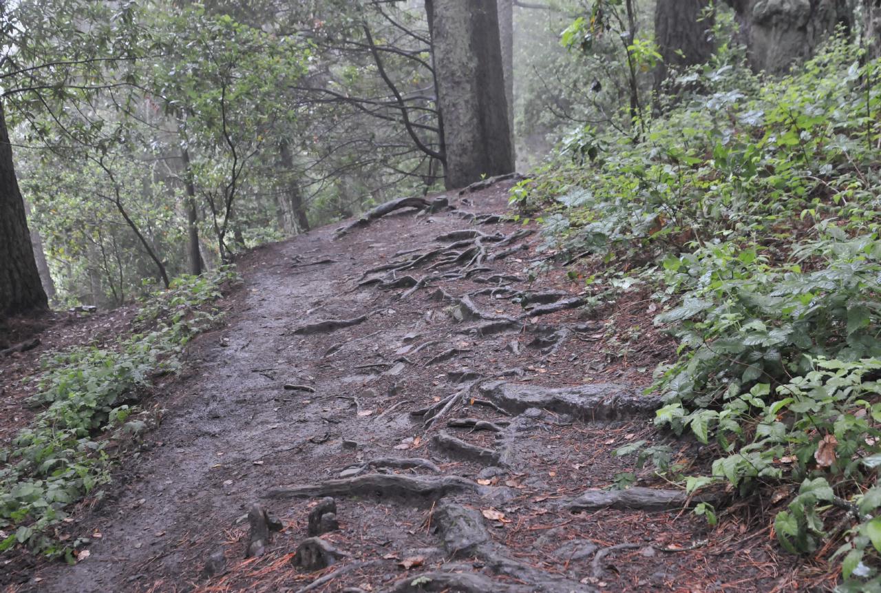 Cresting a hill, the downward side revealed a tangle of roots. Added to the nasty surface was mud left behind by departing fog.
Robert Sibley Volcanic Regional Preserve • East Bay Regional Park District • Access via Oakland, but above Berkeley • (Photo posted 31 July 2010) • (Photo taken 12:51:04 Wednesday 9 June 2010) • © 2010 Bryan Costales
Add a comment or report a mistake
|
|
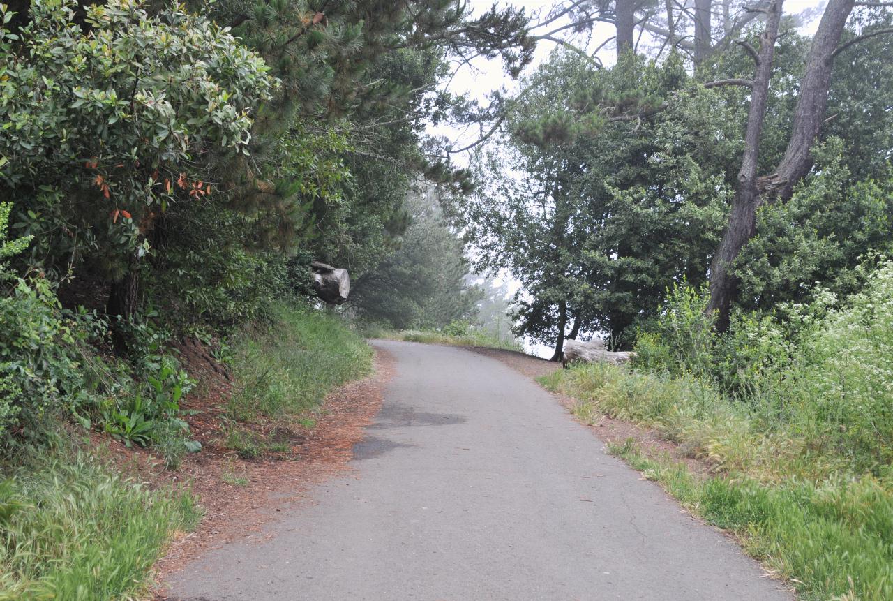
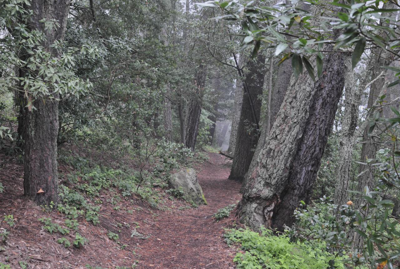
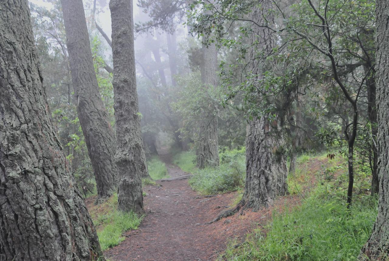 After a while, the forest path became level and easy to traverse. Birds could be heard calling to each other in the distance and the air smelled fresh and moist.
Robert Sibley Volcanic Regional Preserve • East Bay Regional Park District • Access via Oakland, but above Berkeley • (Photo posted 31 July 2010) • (Photo taken 12:55:10 Wednesday 9 June 2010) • © 2010 Bryan Costales
Add a comment or report a mistake
|
|
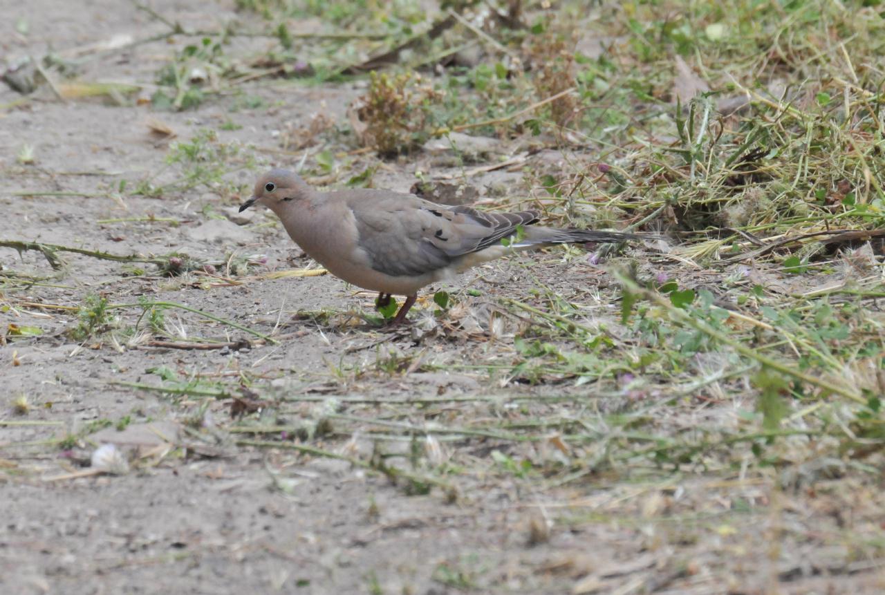 One interloper on the trail was a Mourning Dove. This shot was taken through a long lens. The dove flew off as we approached.
Robert Sibley Volcanic Regional Preserve • East Bay Regional Park District • Access via Oakland, but above Berkeley • (Photo posted 31 July 2010) • (Photo taken 13:03:36 Wednesday 9 June 2010) • © 2010 Terry Costales
Add a comment or report a mistake
|
|
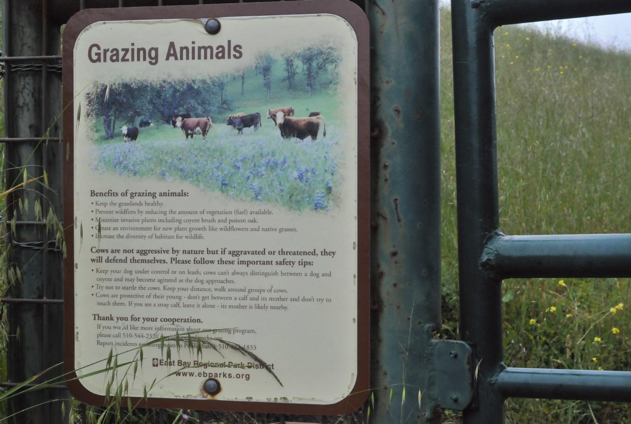 The Loop Trail exited the forest and entered grassland. A short way up the trail was a latched gate with a sign warning about Grazing Animals. The sign described the "Benefits of grazing animals," and how "Cows are not aggressive by nature but if aggravated or threatened, they will defend themselves."
Robert Sibley Volcanic Regional Preserve • East Bay Regional Park District • Access via Oakland, but above Berkeley • (Photo posted 31 July 2010) • (Photo taken 13:21:34 Wednesday 9 June 2010) • © 2010 Bryan Costales
Add a comment or report a mistake
|
|
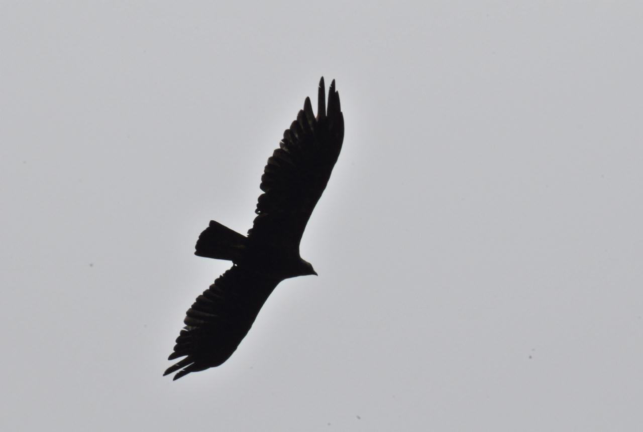 An unidentified raptor soared overhead searching the grasslands for small prey.
Robert Sibley Volcanic Regional Preserve • East Bay Regional Park District • Access via Oakland, but above Berkeley • (Photo posted 31 July 2010) • (Photo taken 13:22:32 Wednesday 9 June 2010) • © 2010 Terry Costales
Add a comment or report a mistake
|
|
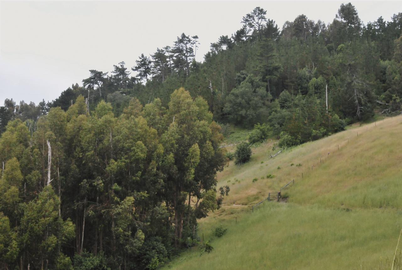 In the distance (the lower right) was the gate with the warning about cows. Notice how on one side was dense forest and on the other side was rolling grassland.
Robert Sibley Volcanic Regional Preserve • East Bay Regional Park District • Access via Oakland, but above Berkeley • (Photo posted 31 July 2010) • (Photo taken 13:29:20 Wednesday 9 June 2010) • © 2010 Bryan Costales
Add a comment or report a mistake
|
|
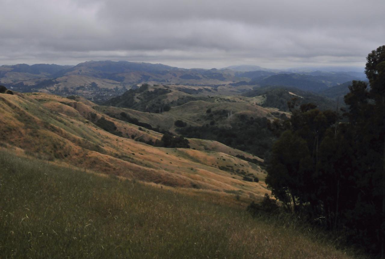 The view from the grassy rolling hill portion of Loop Trail. Here looking back east toward the preserve entrance and in the far distance at Mount Diablo.
Robert Sibley Volcanic Regional Preserve • East Bay Regional Park District • Access via Oakland, but above Berkeley • (Photo posted 31 July 2010) • (Photo taken 13:29:28 Wednesday 9 June 2010) • © 2010 Bryan Costales
Add a comment or report a mistake
|
|
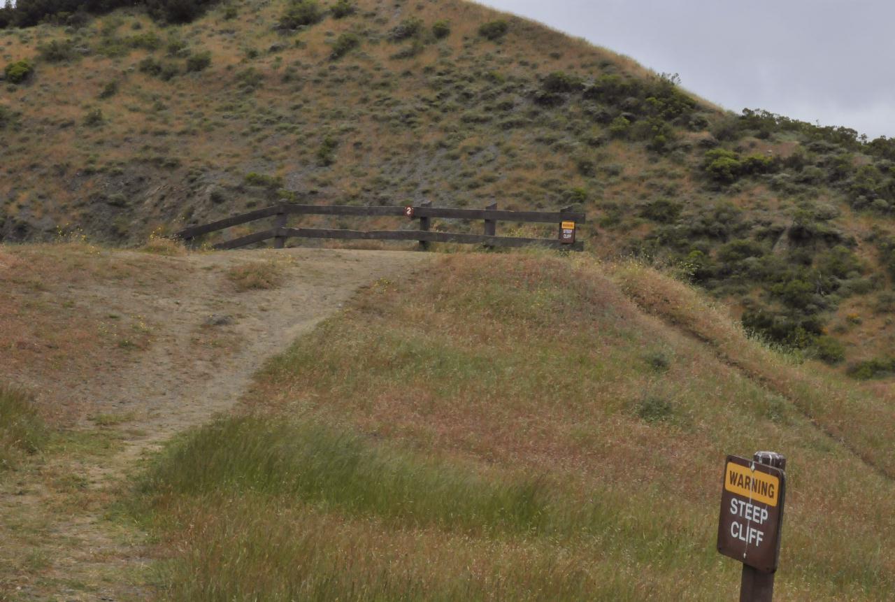 A fence and: Warning: Steep Cliff marked the southern edge of an old quarry. Basalt lava was removed to form this pit. As a boon, a cross section of the old volcano was exposed for geologists. The number 2 on the fence corresponded to the numbers on the printed guide available at the preserve's entrance.
Robert Sibley Volcanic Regional Preserve • East Bay Regional Park District • Access via Oakland, but above Berkeley • (Photo posted 31 July 2010) • (Photo taken 13:40:12 Wednesday 9 June 2010) • © 2010 Bryan Costales
Add a comment or report a mistake
|
|
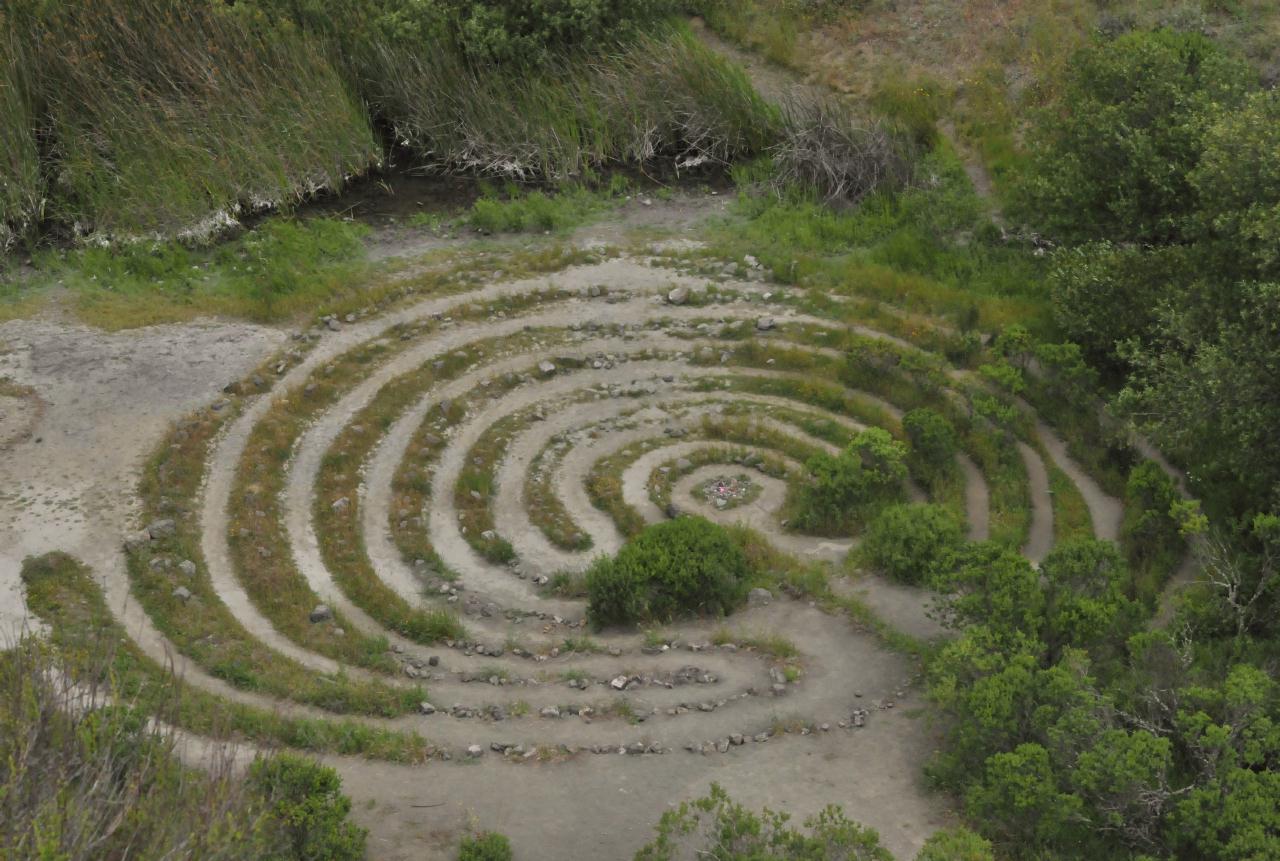
At the bottom of the quarry was a prayer labyrinth
Robert Sibley Volcanic Regional Preserve • East Bay Regional Park District • Access via Oakland, but above Berkeley • (Photo posted 31 July 2010) • (Photo taken 13:40:00 Wednesday 9 June 2010) • © 2010 Bryan Costales
Add a comment or report a mistake
|
|
 Loop Trail ended at the quarry. The view from the quarry showed Quarry Trail continuing down and away from it.
Robert Sibley Volcanic Regional Preserve • East Bay Regional Park District • Access via Oakland, but above Berkeley • (Photo posted 31 July 2010) • (Photo taken 13:53:00 Wednesday 9 June 2010) • © 2010 Bryan Costales
Add a comment or report a mistake
|
|
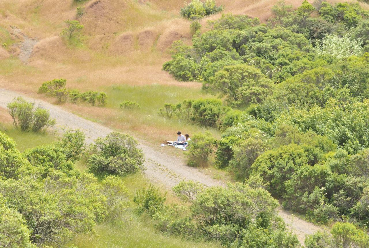 A picnic took place on the back side (western edge) of the preserve. Loop Trail turned out to be the adventure. Most people took Round Top Trail for easier access to the rolling hills behind the forest. On the back side we found off-leash dogs and dozens of people strolling and enjoying themselves.
Robert Sibley Volcanic Regional Preserve • East Bay Regional Park District • Access via Oakland, but above Berkeley • (Photo posted 31 July 2010) • (Photo taken 13:54:24 Wednesday 9 June 2010) • © 2010 Bryan Costales
Add a comment or report a mistake
|
|
 Looking west toward San Francisco, the fog was still blowing in, but sunlight had become strong enough to begin to burn it off. Above the fog could be seen clouds from an approaching storm.
Robert Sibley Volcanic Regional Preserve • East Bay Regional Park District • Access via Oakland, but above Berkeley • (Photo posted 31 July 2010) • (Photo taken 13:58:50 Wednesday 9 June 2010) • © 2010 Bryan Costales
Add a comment or report a mistake
|
|
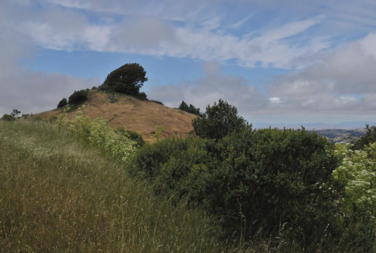
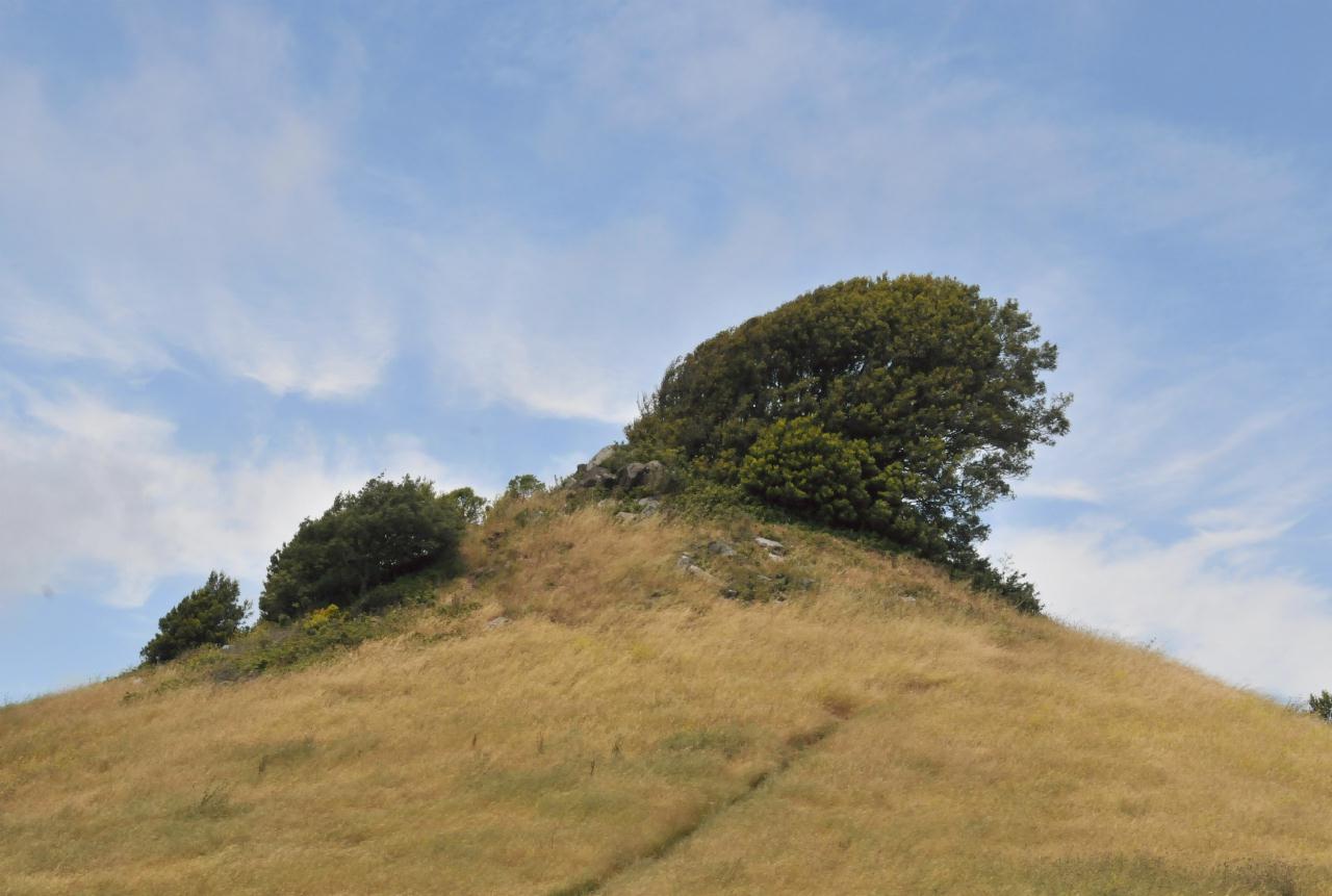 One hill had a dramatically bent bush growing from the rocks atop it. The look of that hill dramatically resembled a hill from the Lord Of The Rings trilogy.
Robert Sibley Volcanic Regional Preserve • East Bay Regional Park District • Access via Oakland, but above Berkeley • (Photo posted 31 July 2010) • (Photo taken 14:00:50 Wednesday 9 June 2010) • © 2010 Bryan Costales
Add a comment or report a mistake
|
|
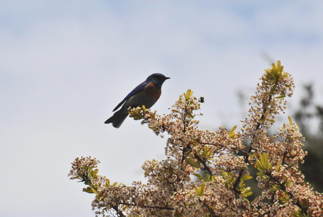 A western bluebird was perched on the blooming branches of a bush alongside Quarry Trail.
Robert Sibley Volcanic Regional Preserve • East Bay Regional Park District • Access via Oakland, but above Berkeley • (Photo posted 31 July 2010) • (Photo taken 14:10:08 Wednesday 9 June 2010) • © 2010 Terry Costales
Add a comment or report a mistake
|
|
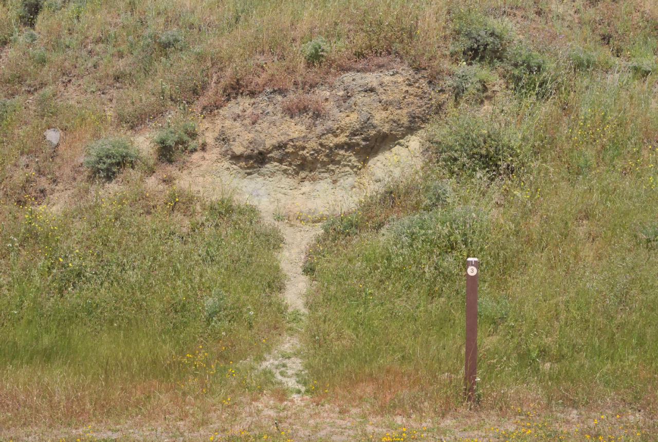 From the pamphlet available at the preserve's entrance, "This road cut exposes Orinda Formation river gravels, sands, and mudstones ... explored worldwide for the fossils and plants and animals they contain."
Robert Sibley Volcanic Regional Preserve • East Bay Regional Park District • Access via Oakland, but above Berkeley • (Photo posted 31 July 2010) • (Photo taken 14:11:44 Wednesday 9 June 2010) • © 2010 Bryan Costales
Add a comment or report a mistake
|
|
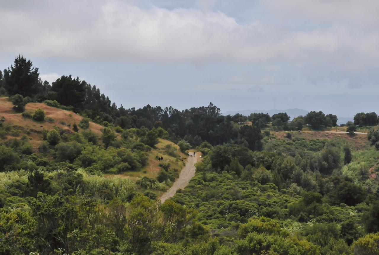
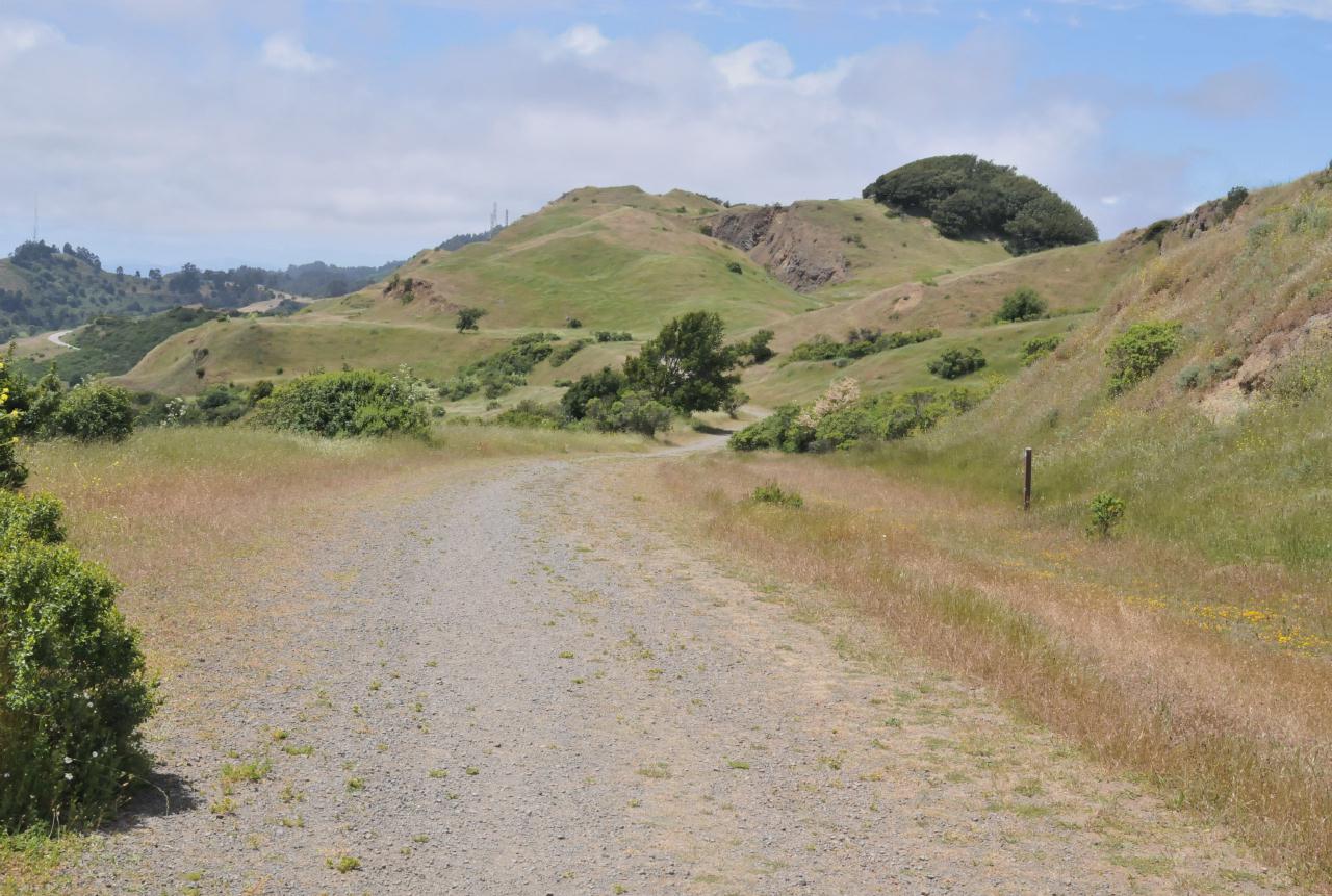 Quarry Trail continues for a mile or so further until it reaches Quarry Road and a southern entry to the preserve.
Robert Sibley Volcanic Regional Preserve • East Bay Regional Park District • Access via Oakland, but above Berkeley • (Photo posted 31 July 2010) • (Photo taken 14:12:28 Wednesday 9 June 2010) • © 2010 Bryan Costales
Add a comment or report a mistake
|
|
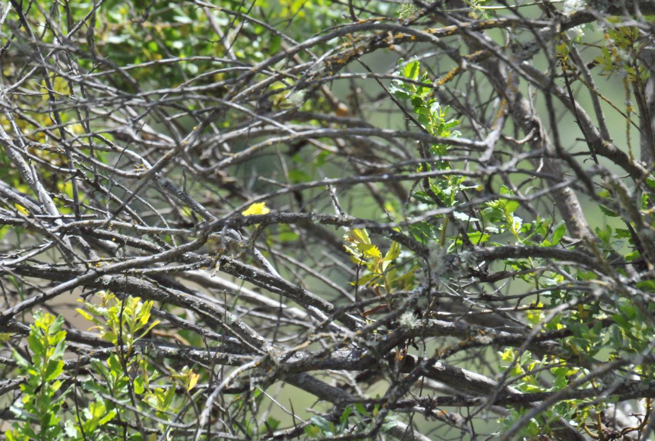 The easiest way back out of the preserve is along Round Top Trail. This trail became forested almost at once, and was bordered by dense foliage. Somewhere in this mass of tangled branches was a bird not captured on film.
Robert Sibley Volcanic Regional Preserve • East Bay Regional Park District • Access via Oakland, but above Berkeley • (Photo posted 31 July 2010) • (Photo taken 14:14:00 Wednesday 9 June 2010) • © 2010 Terry Costales
Add a comment or report a mistake
|
|
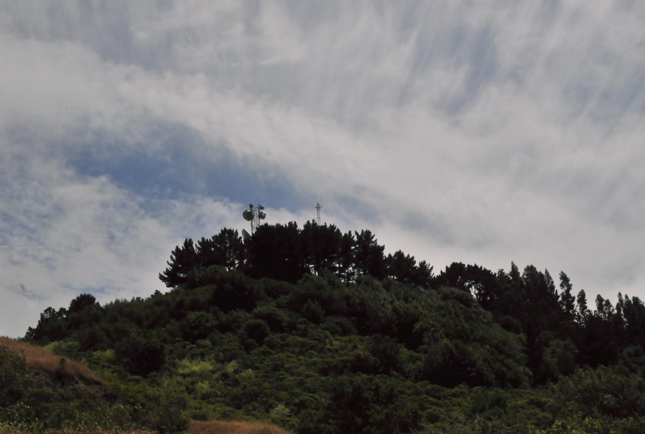 A Pacific storm was approaching that day and its approach created dramatic clouds behind Round Top Mountain as seen from Round Top Trail.
Robert Sibley Volcanic Regional Preserve • East Bay Regional Park District • Access via Oakland, but above Berkeley • (Photo posted 31 July 2010) • (Photo taken 14:16:08 Wednesday 9 June 2010) • © 2010 Bryan Costales
Add a comment or report a mistake
|
|
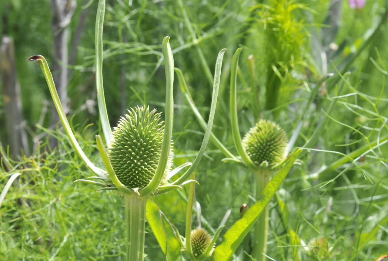 Fresh growth was evident alongside Round Top Trail.
Robert Sibley Volcanic Regional Preserve • East Bay Regional Park District • Access via Oakland, but above Berkeley • (Photo posted 31 July 2010) • (Photo taken 14:18:44 Wednesday 9 June 2010) • © 2010 Bryan Costales
Add a comment or report a mistake
|
|
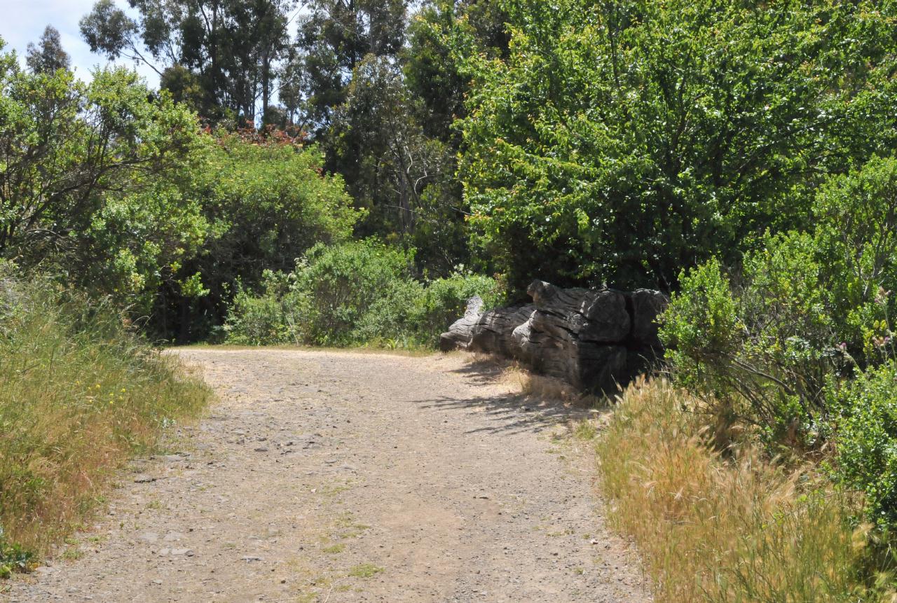 Round Top Trail was the wide easy trail into and out of the preserve lands behind the hill. It was also the easy way back out to the parking lot. If you want to visit the numbered exhibits in order, pick up a guide at the entrance and plan your walk accordingly. Note that it may be easier to backtrack from Round Top Trail up Quarry Trail, than to go all the way around Loop Trail.
Robert Sibley Volcanic Regional Preserve • East Bay Regional Park District • Access via Oakland, but above Berkeley • (Photo posted 31 July 2010) • (Photo taken 14:26:46 Wednesday 9 June 2010) • © 2010 Bryan Costales
Add a comment or report a mistake
|
|
 The only warning about rattlesnakes was posted on the gate leading into and out of Round Top Trail. The sign read: Rattlesnakes may be found in this area. They are important members of the natural community. They are not aggressive, but if threatened or cornered, they will defend themselves. Give them distance and respect.
Robert Sibley Volcanic Regional Preserve • East Bay Regional Park District • Access via Oakland, but above Berkeley • (Photo posted 31 July 2010) • (Photo taken 14:28:00 Wednesday 9 June 2010) • © 2010 Bryan Costales
Add a comment or report a mistake
|
 |
| home • contact • topic guide • top 25 • photos • video • writing • blogs • upload • terms • privacy |