
|
|
|
|
|
Anacapa Island
|
|
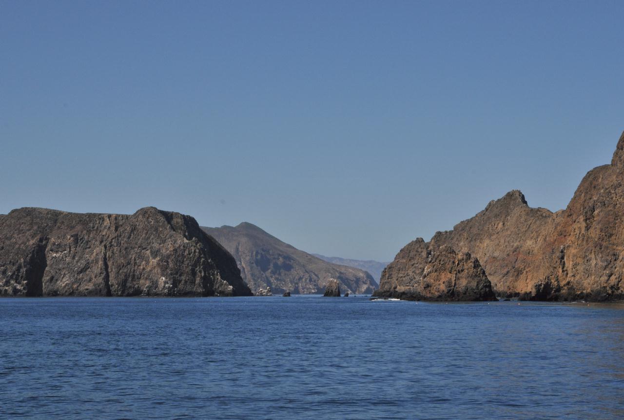
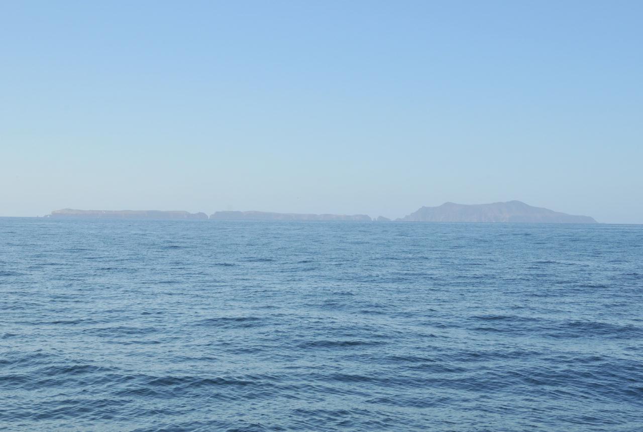 Anacapa Island appeared ahead. From the distance its three islands can be discerned. East Anacapa Island to the left, Middle Anacapa Island in the center, and West Anacapa Island to the right. All told a mere 699 acres (283 hectares).
Anacapa Island • Channel Islands National Park • Island Packers Tour • From Channel Islands Harbor, Oxnard, California • (Photo posted Tuesday 23 November 2010) • (Photo taken 10:17:08 Friday 8 October 2010) • © 2010 Bryan Costales 
Add a comment or report a mistake
|
|
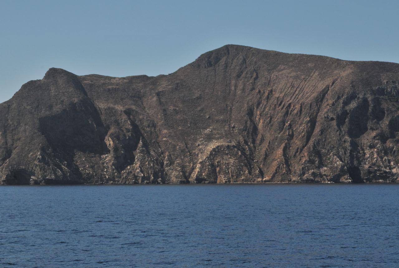 West Anacapa Island rose from the water like a massive hill. It was formed by a volcano so has no natural source of fresh water.
Anacapa Island • Channel Islands National Park • Island Packers Tour • From Channel Islands Harbor, Oxnard, California • (Photo posted Tuesday 23 November 2010) • (Photo taken 10:50:07 Friday 8 October 2010) • © 2010 Bryan Costales
Add a comment or report a mistake
|
|
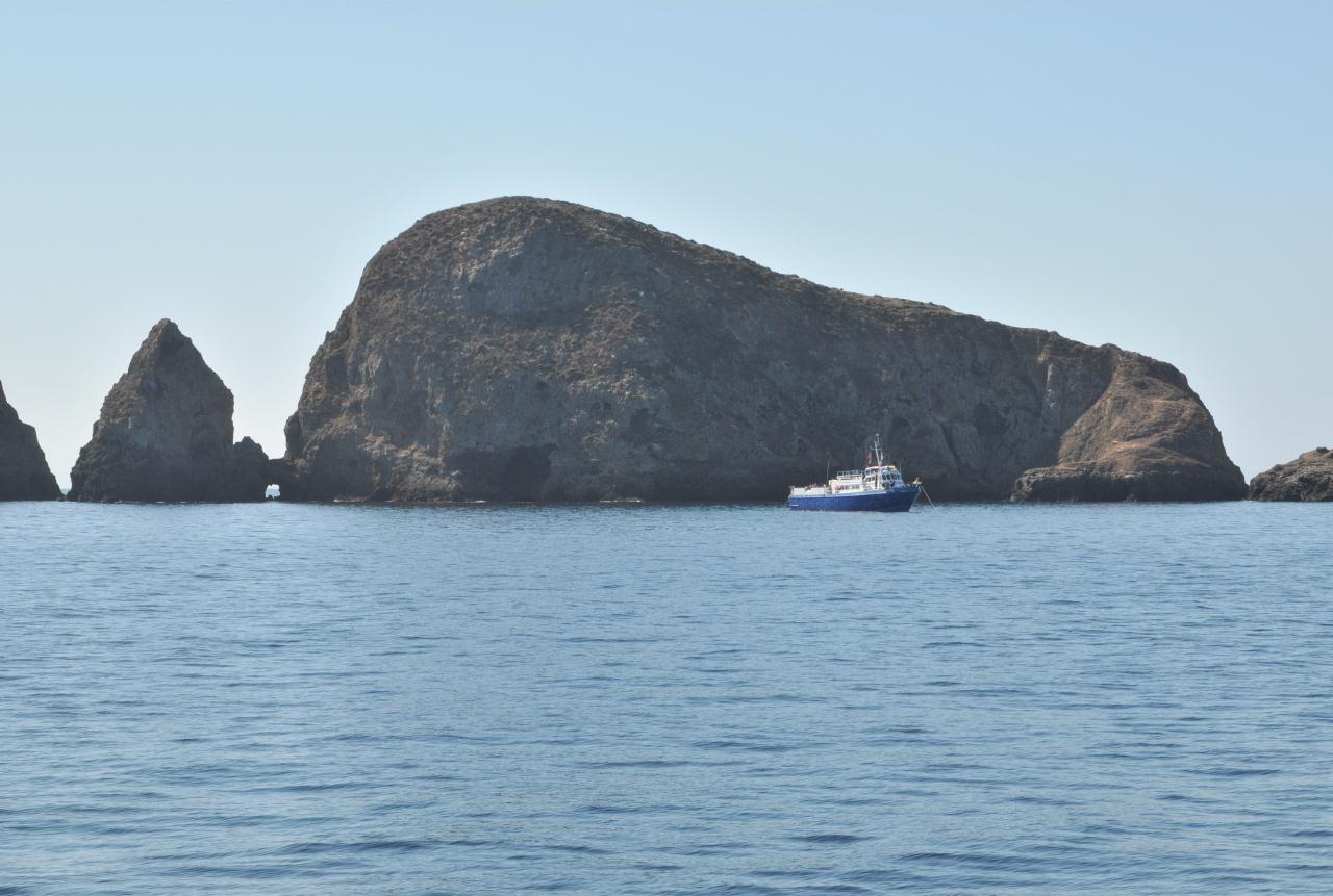 Boulders separated West Anacapa Island from Middle Anacapa Island.
Anacapa Island • Channel Islands National Park • Island Packers Tour • From Channel Islands Harbor, Oxnard, California • (Photo posted Tuesday 23 November 2010) • (Photo taken 10:53:08 Friday 8 October 2010) • © 2010 Bryan Costales
Add a comment or report a mistake
|
|
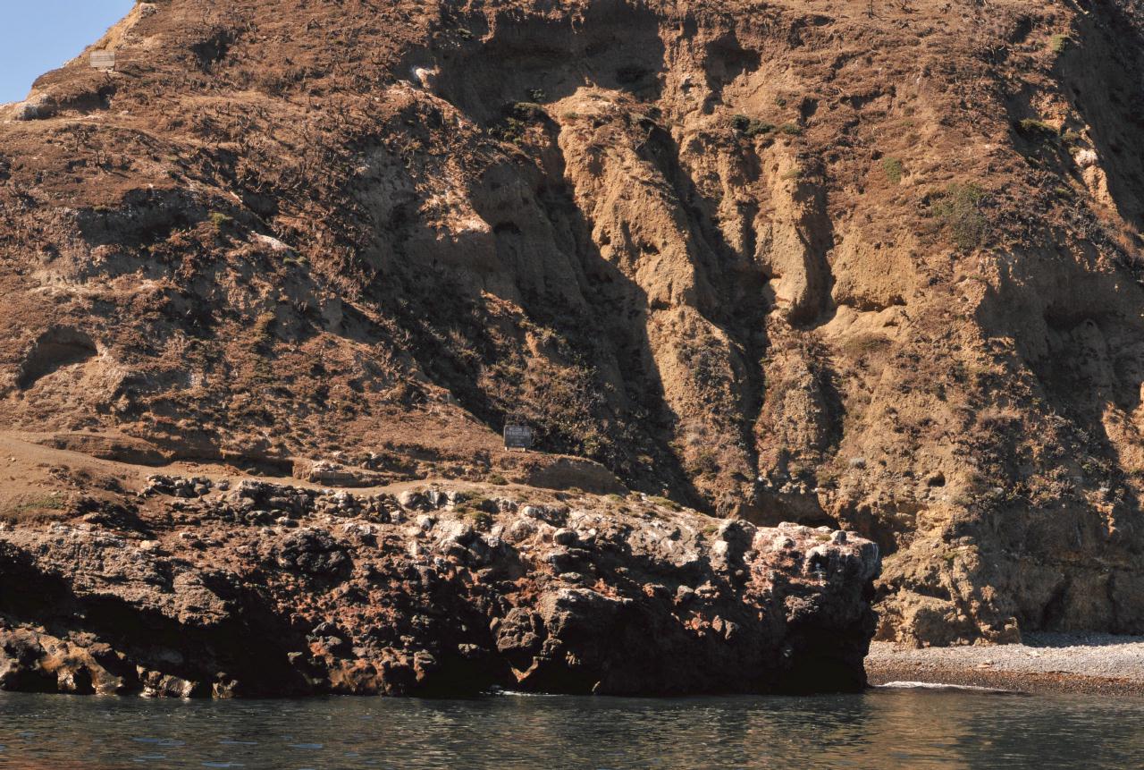
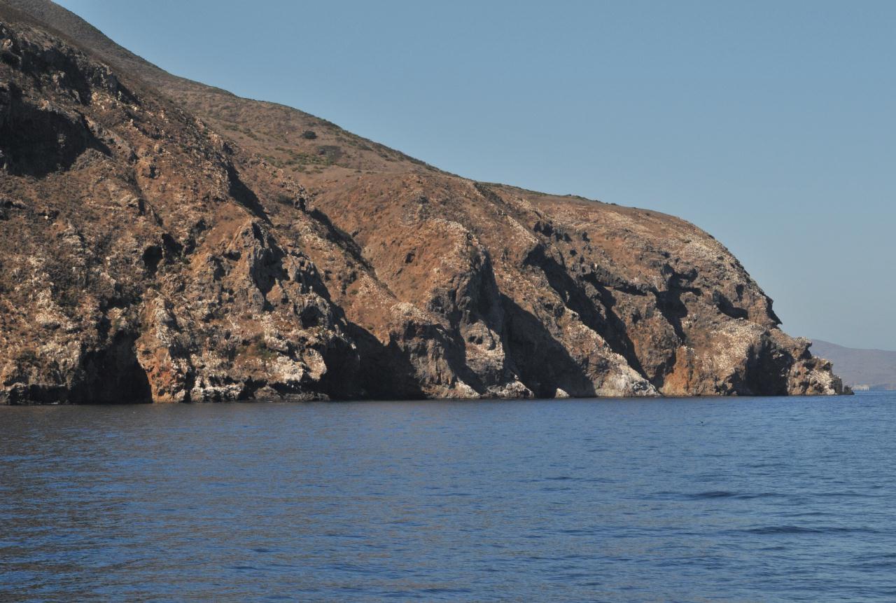 The western-most end of West Anacapa Island was composed of heavily eroded stone.
Anacapa Island • Channel Islands National Park • Island Packers Tour • From Channel Islands Harbor, Oxnard, California • (Photo posted Tuesday 23 November 2010) • (Photo taken 10:53:22 Friday 8 October 2010) • © 2010 Bryan Costales
Add a comment or report a mistake
|
|
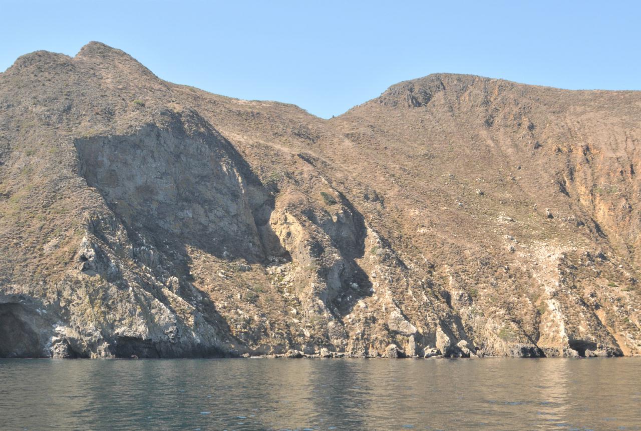 A hilly ridge ran over the top of West Anacapa Island. Although it appeared narrow, it was said to be wide enough to easily walk.
Anacapa Island • Channel Islands National Park • Island Packers Tour • From Channel Islands Harbor, Oxnard, California • (Photo posted Tuesday 23 November 2010) • (Photo taken 10:54:13 Friday 8 October 2010) • © 2010 Bryan Costales
Add a comment or report a mistake
|
|
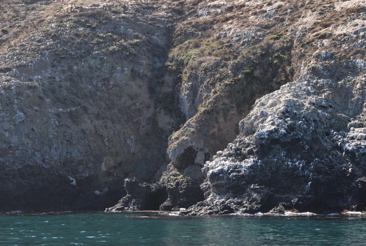
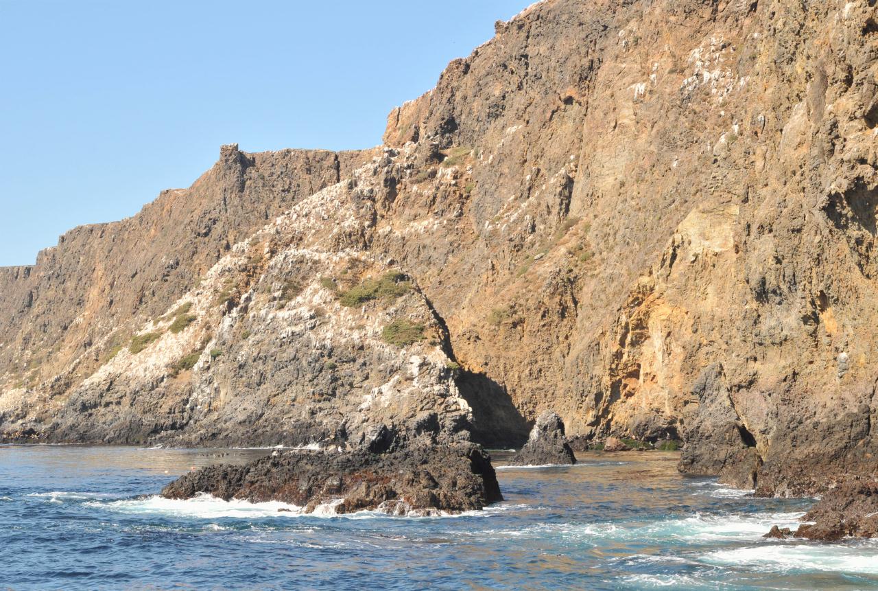
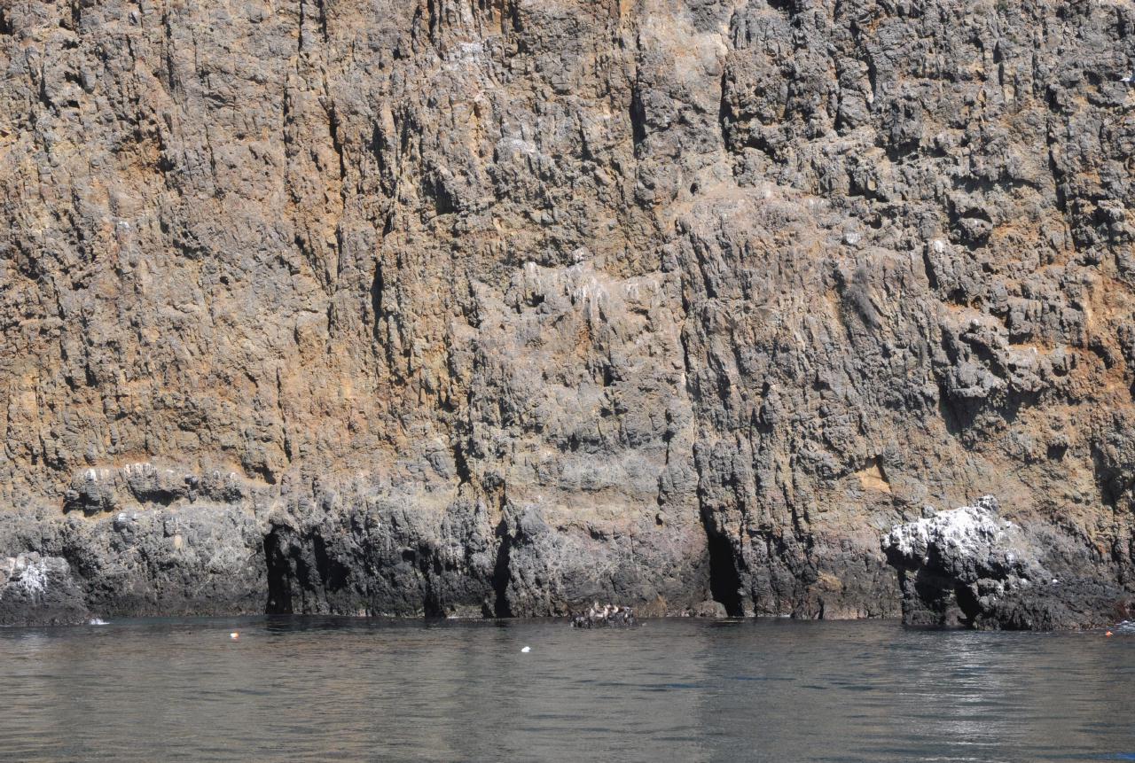
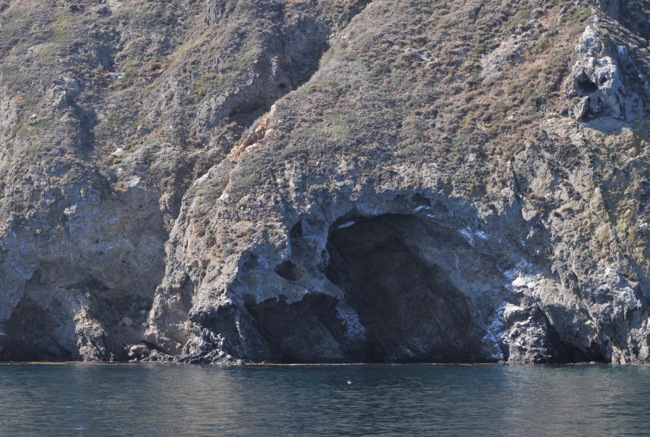 Surf eroded caves lined areas of the shore. Note the presence of grasses and other ground covering plants that gradually convert the volcanic surface into soil.
Anacapa Island • Channel Islands National Park • Island Packers Tour • From Channel Islands Harbor, Oxnard, California • (Photo posted Tuesday 23 November 2010) • (Photo taken 10:54:28 Friday 8 October 2010) • © 2010 Bryan Costales
Add a comment or report a mistake
|
|
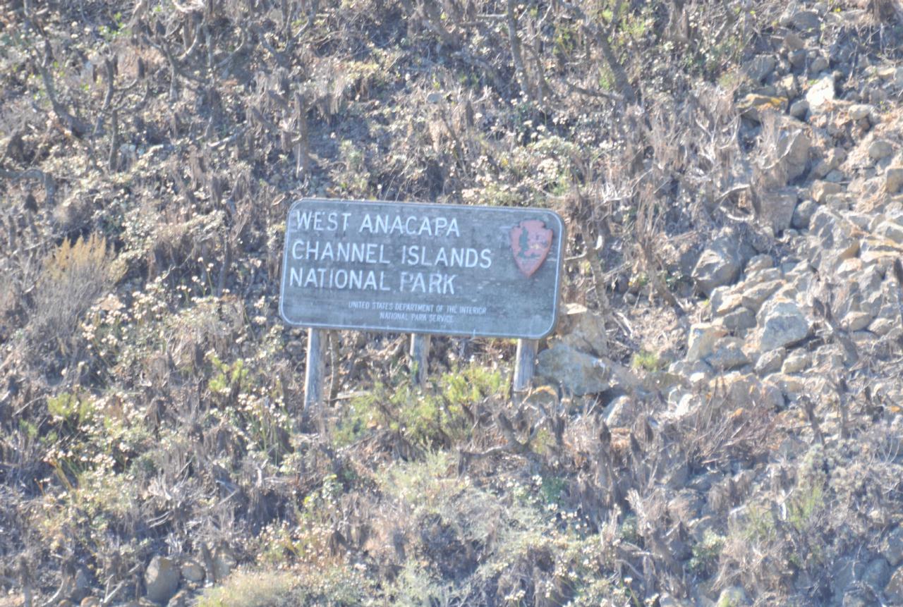 On the shore of West Anacapa Island was a sign for those in doubt. Notice, in this closeup, the presence of ground covering plants.
Anacapa Island • Channel Islands National Park • Island Packers Tour • From Channel Islands Harbor, Oxnard, California • (Photo posted Tuesday 23 November 2010) • (Photo taken 10:56:00 Friday 8 October 2010) • © 2010 Terry Costales
Add a comment or report a mistake
|
|
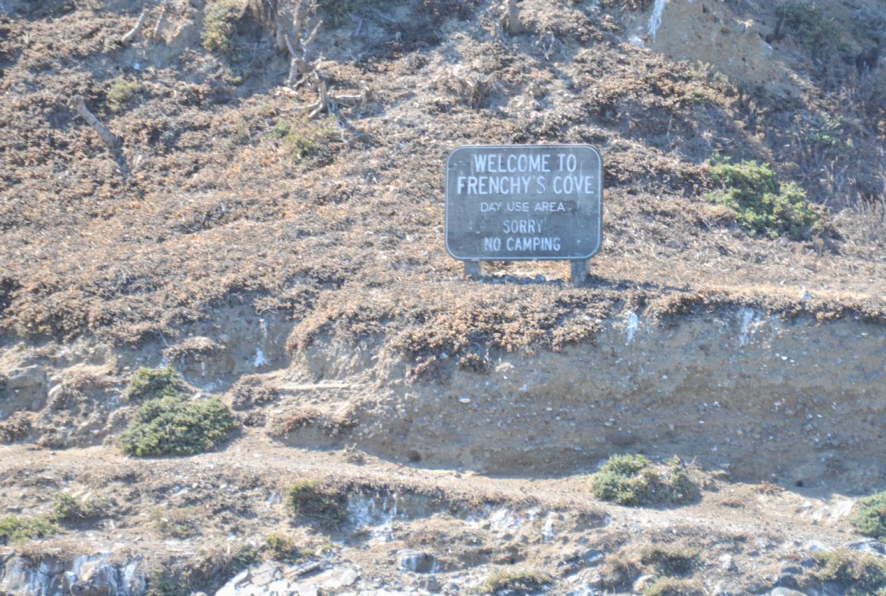
 The "Welcome to Frency's Cove" sign described the area as "Day Use Area. Sorry No Camping."
Anacapa Island • Channel Islands National Park • Island Packers Tour • From Channel Islands Harbor, Oxnard, California • (Photo posted Tuesday 23 November 2010) • (Photo taken 10:57:11 Friday 8 October 2010) • © 2010 Terry Costales
Add a comment or report a mistake
|
|
 The "Welcome to Frenchy's Cove" sign described the area as for "Day Use Only," and added, "Sorry No Camping."
Anacapa Island • Channel Islands National Park • Island Packers Tour • From Channel Islands Harbor, Oxnard, California • (Photo posted Tuesday 23 November 2010) • (Photo taken 10:57:38 Friday 8 October 2010) • © 2010 Terry Costales
Add a comment or report a mistake
|
|
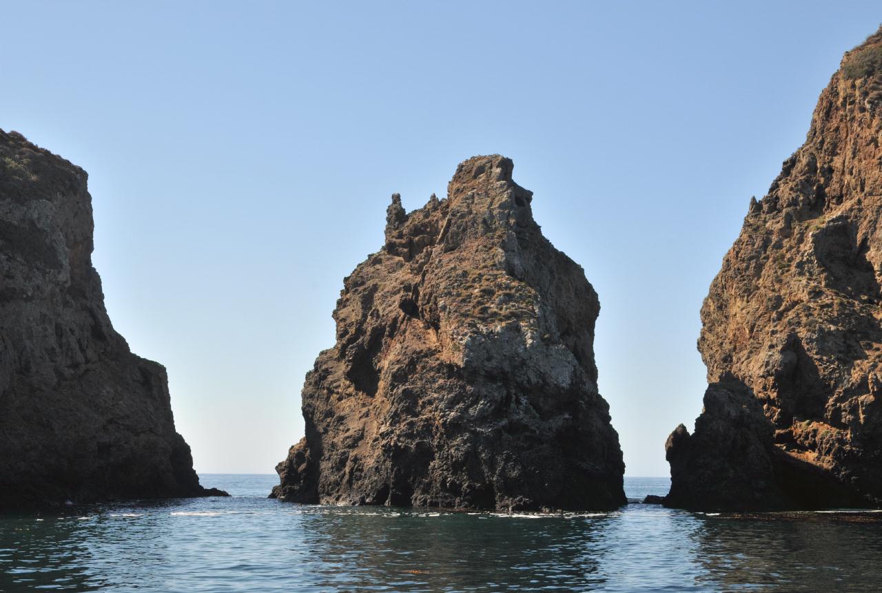
 Boulders separated West Anacapa Island from Middle Anacapa Island. Up close those boulders could be mistaken for islands themselves. Here was a small natural arch in one.
Anacapa Island • Channel Islands National Park • Island Packers Tour • From Channel Islands Harbor, Oxnard, California • (Photo posted Tuesday 23 November 2010) • (Photo taken 10:58:02 Friday 8 October 2010) • © 2010 Bryan Costales
Add a comment or report a mistake
|
|
 One of the small boulders separating Middle Anacapa Island from West Anacapa Island.
Anacapa Island • Channel Islands National Park • Island Packers Tour • From Channel Islands Harbor, Oxnard, California • (Photo posted Tuesday 23 November 2010) • (Photo taken 10:58:19 Friday 8 October 2010) • © 2010 Bryan Costales
Add a comment or report a mistake
|
|
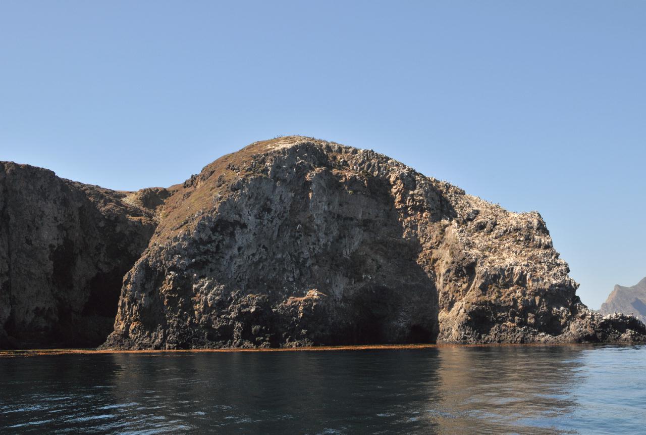
 Layered outcroppings on Middle Anacapa Island extended into green shallow water.
Anacapa Island • Channel Islands National Park • Island Packers Tour • From Channel Islands Harbor, Oxnard, California • (Photo posted Tuesday 23 November 2010) • (Photo taken 10:59:14 Friday 8 October 2010) • © 2010 Bryan Costales
Add a comment or report a mistake
|
|
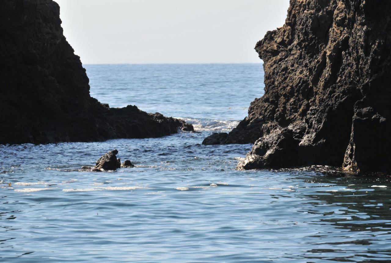 Closeup shot of the surf between two separating rocks. Imagine trying to cross this on foot at low tide.
Anacapa Island • Channel Islands National Park • Island Packers Tour • From Channel Islands Harbor, Oxnard, California • (Photo posted Tuesday 23 November 2010) • (Photo taken 10:59:20 Friday 8 October 2010) • © 2010 Terry Costales
Add a comment or report a mistake
|
|
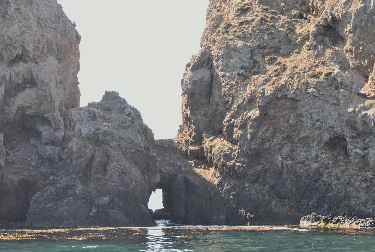
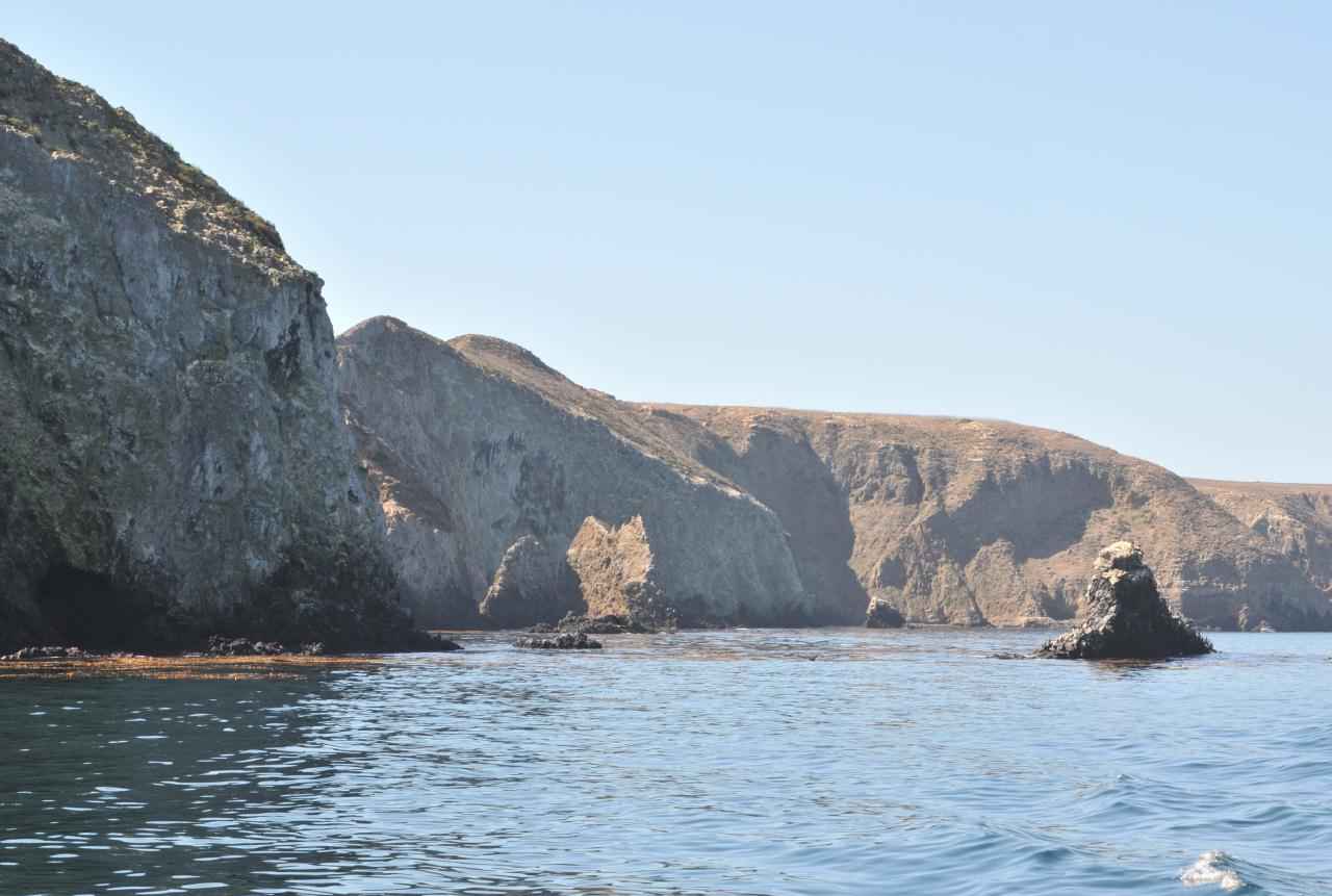
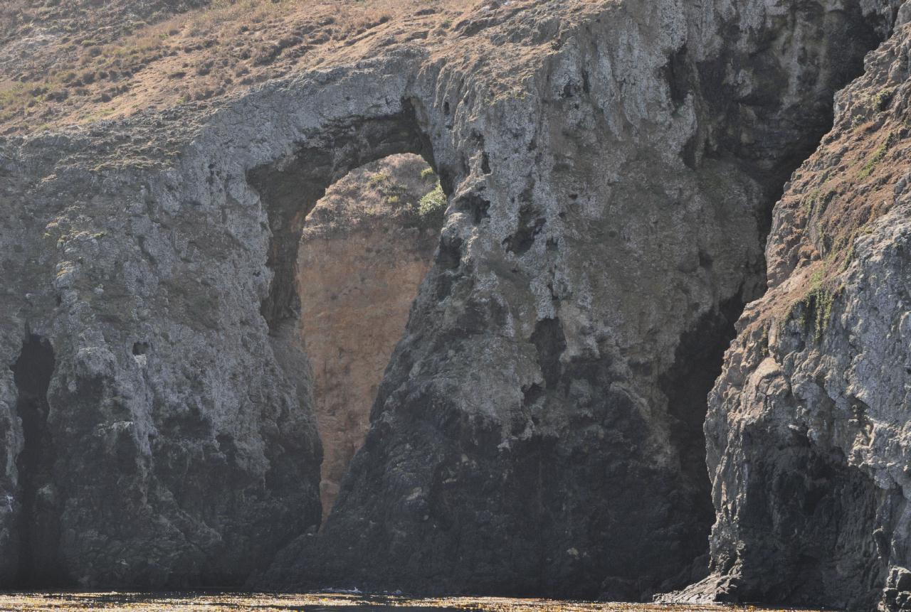 A large natural arch in one of the outcroppings jutting out from Middle Anacapa Island resembled a keyhole.
Anacapa Island • Channel Islands National Park • Island Packers Tour • From Channel Islands Harbor, Oxnard, California • (Photo posted Tuesday 23 November 2010) • (Photo taken 11:00:24 Friday 8 October 2010) • © 2010 Bryan Costales
Add a comment or report a mistake
|
|
 Closeup of Keyhole Rock a the bottom of the keyhole.
Anacapa Island • Channel Islands National Park • Island Packers Tour • From Channel Islands Harbor, Oxnard, California • (Photo posted Tuesday 23 November 2010) • (Photo taken 11:01:38 Friday 8 October 2010) • © 2010 Terry Costales
Add a comment or report a mistake
|
|
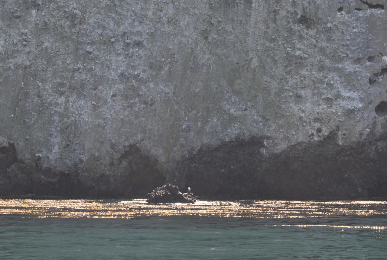 The face of Middle Anacapa Island was a sheer cliff all the way down to the water. Just off the cliff face was a rock with birds.
Anacapa Island • Channel Islands National Park • Island Packers Tour • From Channel Islands Harbor, Oxnard, California • (Photo posted Tuesday 23 November 2010) • (Photo taken 11:07:59 Friday 8 October 2010) • © 2010 Bryan Costales
Add a comment or report a mistake
|
|
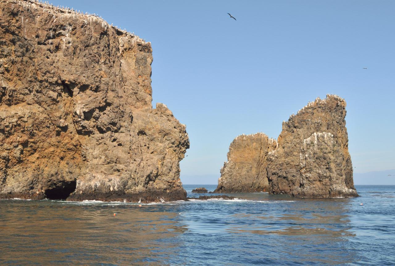
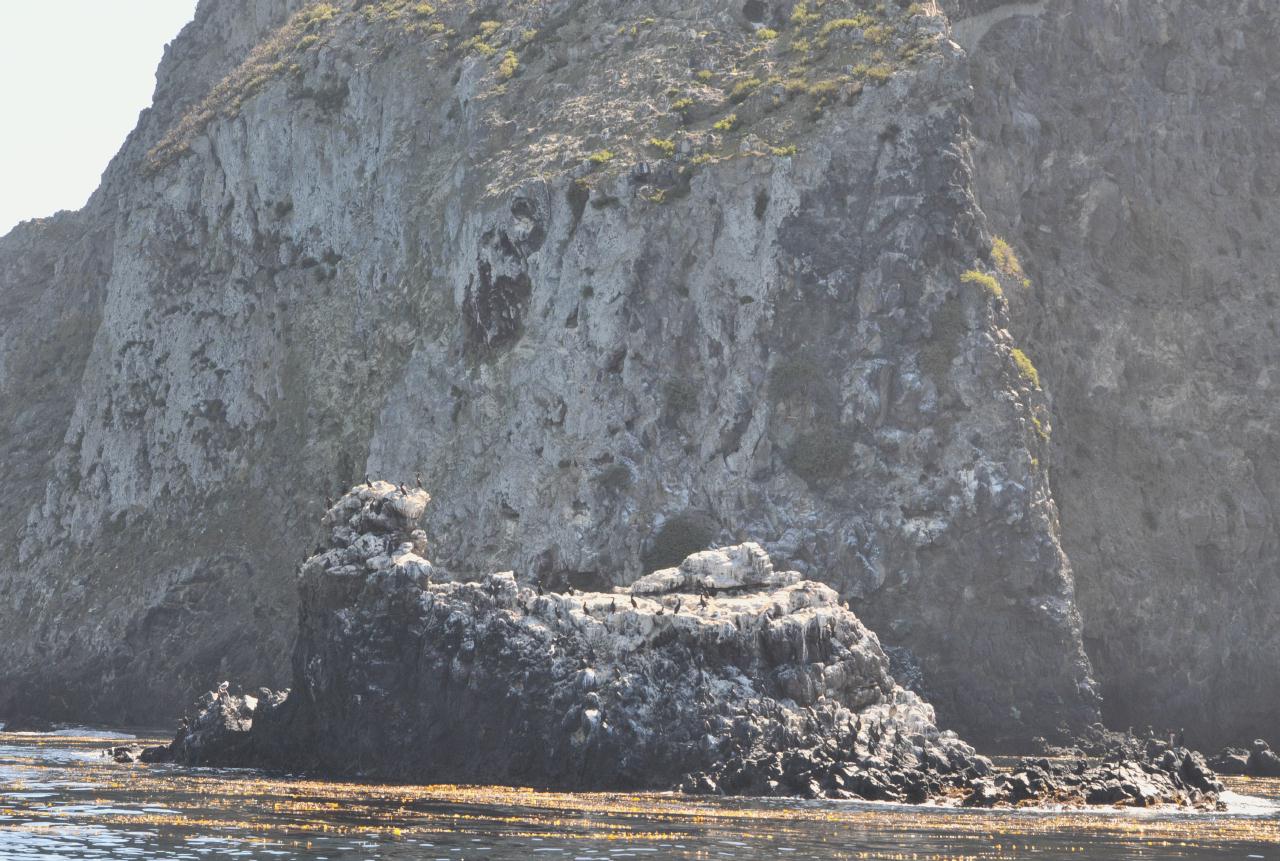 One of the outcroppings jutting into the sea had been eroded away over time to become this boulder tooth, its top white-edged because of birds.
Anacapa Island • Channel Islands National Park • Island Packers Tour • From Channel Islands Harbor, Oxnard, California • (Photo posted Tuesday 23 November 2010) • (Photo taken 11:10:29 Friday 8 October 2010) • © 2010 Bryan Costales
Add a comment or report a mistake
|
|
 Here Middle Anacapa Island ranged away, as seen from just offshore of East Anacapa Island (screen left).
Anacapa Island • Channel Islands National Park • Island Packers Tour • From Channel Islands Harbor, Oxnard, California • (Photo posted Tuesday 23 November 2010) • (Photo taken 11:11:51 Friday 8 October 2010) • © 2010 Bryan Costales
Add a comment or report a mistake
|
|
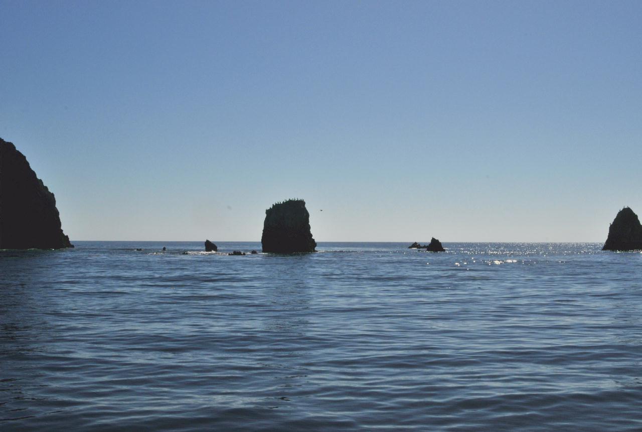 The gap between East Anacapa Island (to the left) and Middle Anacapa Island (to the right) was wide with just a few low bird-crowned rocks.
Anacapa Island • Channel Islands National Park • Island Packers Tour • From Channel Islands Harbor, Oxnard, California • (Photo posted Tuesday 23 November 2010) • (Photo taken 11:11:56 Friday 8 October 2010) • © 2010 Bryan Costales
Add a comment or report a mistake
|
|
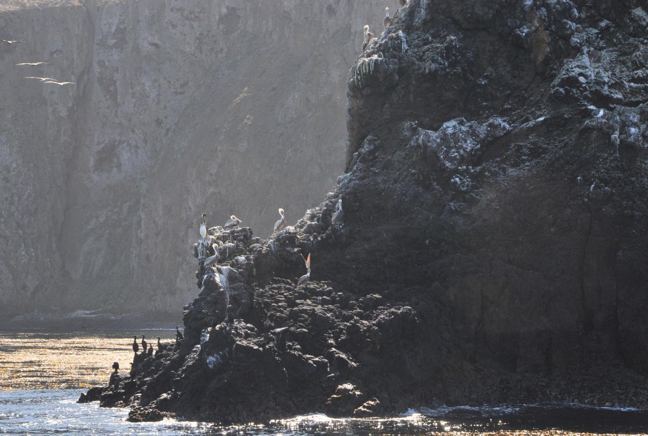 The rocks surrounding these islands provided perching and nesting for many sorts of birds. Here were cormorants and brown pelicans.
Anacapa Island • Channel Islands National Park • Island Packers Tour • From Channel Islands Harbor, Oxnard, California • (Photo posted Tuesday 23 November 2010) • (Photo taken 11:15:08 Friday 8 October 2010) • © 2010 Bryan Costales
Add a comment or report a mistake
|
|
 East Anacapa Island was edged at its waterline with golden kelp.
Anacapa Island • Channel Islands National Park • Island Packers Tour • From Channel Islands Harbor, Oxnard, California • (Photo posted Tuesday 23 November 2010) • (Photo taken 11:15:57 Friday 8 October 2010) • © 2010 Bryan Costales
Add a comment or report a mistake
|
|
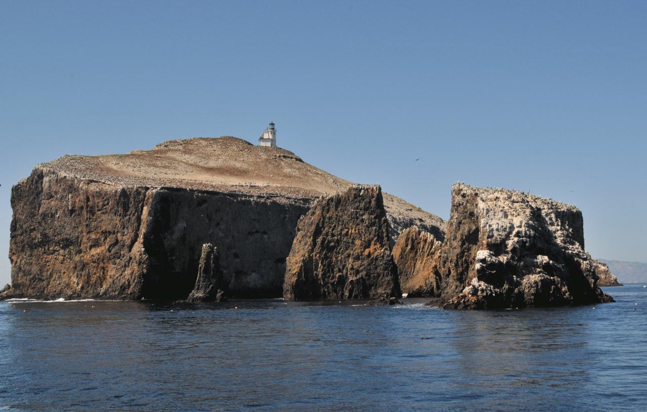
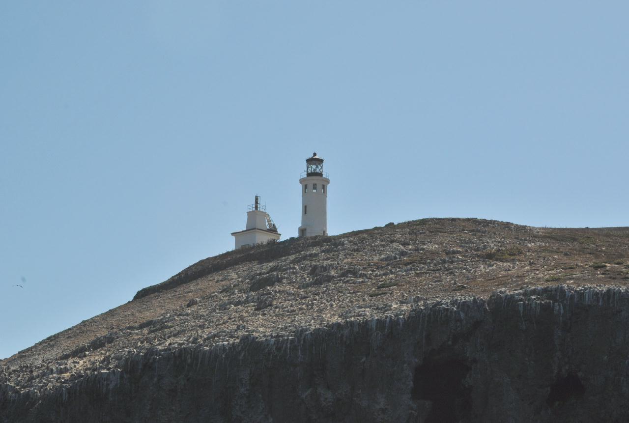 The lighthouse on East Anacapa Island was built in 1912 by the United States Lighthouse Service.
Anacapa Island • Channel Islands National Park • Island Packers Tour • From Channel Islands Harbor, Oxnard, California • (Photo posted Tuesday 23 November 2010) • (Photo taken 11:18:14 Friday 8 October 2010) • © 2010 Bryan Costales
Add a comment or report a mistake
|
|
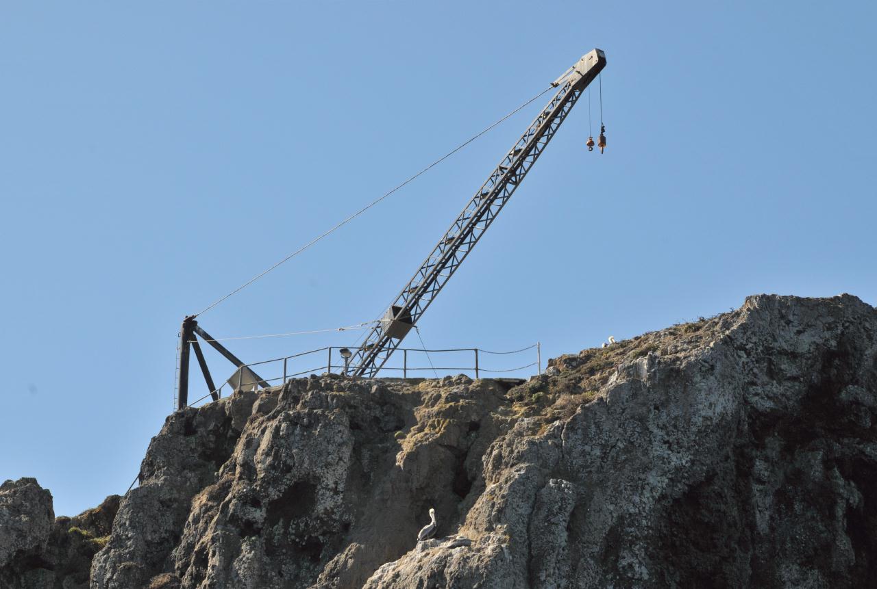 A crane on the cliff of East Anacapa Island was used to haul supplies up from boats to the lighthouse.
Anacapa Island • Channel Islands National Park • Island Packers Tour • From Channel Islands Harbor, Oxnard, California • (Photo posted Tuesday 23 November 2010) • (Photo taken 11:18:48 Friday 8 October 2010) • © 2010 Bryan Costales
Add a comment or report a mistake
|
|
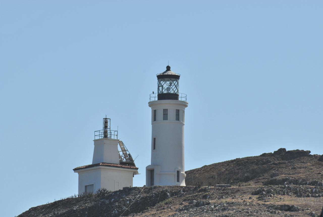 The classic shot of the East Anacapa Island lighthouse as seen from offshore.
Anacapa Island • Channel Islands National Park • Island Packers Tour • From Channel Islands Harbor, Oxnard, California • (Photo posted Tuesday 23 November 2010) • (Photo taken 11:18:57 Friday 8 October 2010) • © 2010 Terry Costales
Add a comment or report a mistake
|
|
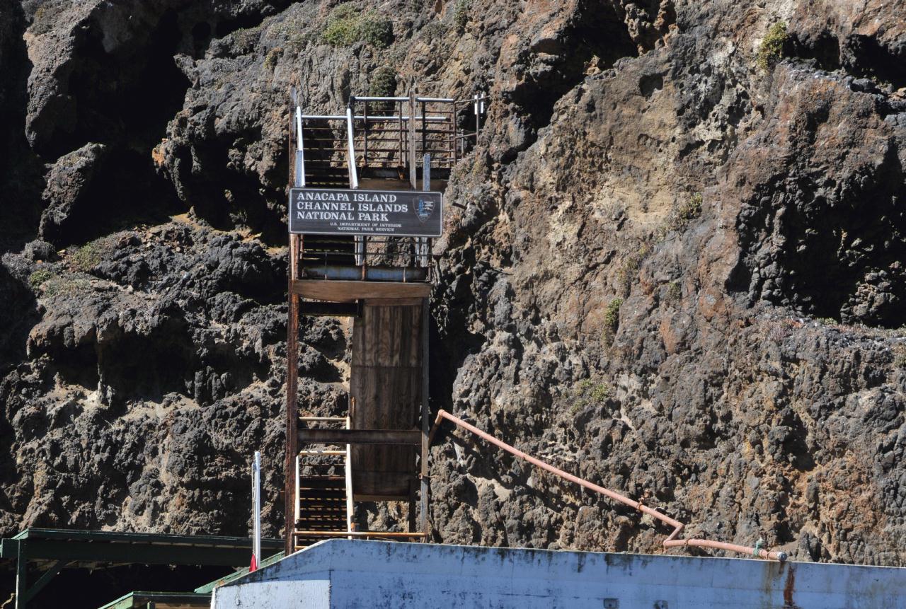 Stairs led up from the boat dock to the top of East Anacapa Island. The stairs were closed at this time for repair. The sign read:
Anacapa Island
Anacapa Island • Channel Islands National Park • Island Packers Tour • From Channel Islands Harbor, Oxnard, California • (Photo posted Tuesday 23 November 2010) • (Photo taken 11:19:16 Friday 8 October 2010) • © 2010 Bryan Costales
Add a comment or report a mistake
|
|
 The boat dock at East Anacapa Island. Here is where day tours and overnight campers would be dropped off, had the stairs been open.
Anacapa Island • Channel Islands National Park • Island Packers Tour • From Channel Islands Harbor, Oxnard, California • (Photo posted Tuesday 23 November 2010) • (Photo taken 11:20:10 Friday 8 October 2010) • © 2010 Bryan Costales
Add a comment or report a mistake
|
|
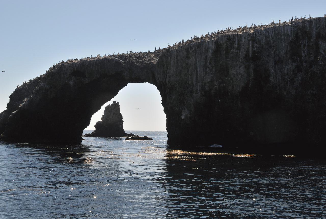 Arch Rock was a natural arch located in the water just off the end of East Anacapa Island.
Anacapa Island • Channel Islands National Park • Island Packers Tour • From Channel Islands Harbor, Oxnard, California • (Photo posted Tuesday 23 November 2010) • (Photo taken 11:23:07 Friday 8 October 2010) • © 2010 Bryan Costales
Add a comment or report a mistake
|
|
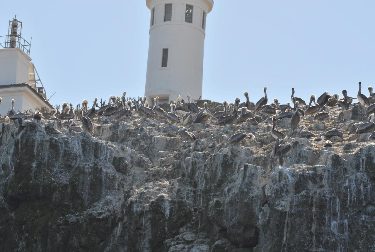 Brown Pelicans lined the cliff top of East Anacapa Island.
Anacapa Island • Channel Islands National Park • Island Packers Tour • From Channel Islands Harbor, Oxnard, California • (Photo posted Tuesday 23 November 2010) • (Photo taken 11:23:09 Friday 8 October 2010) • © 2010 Terry Costales
Add a comment or report a mistake
|
|
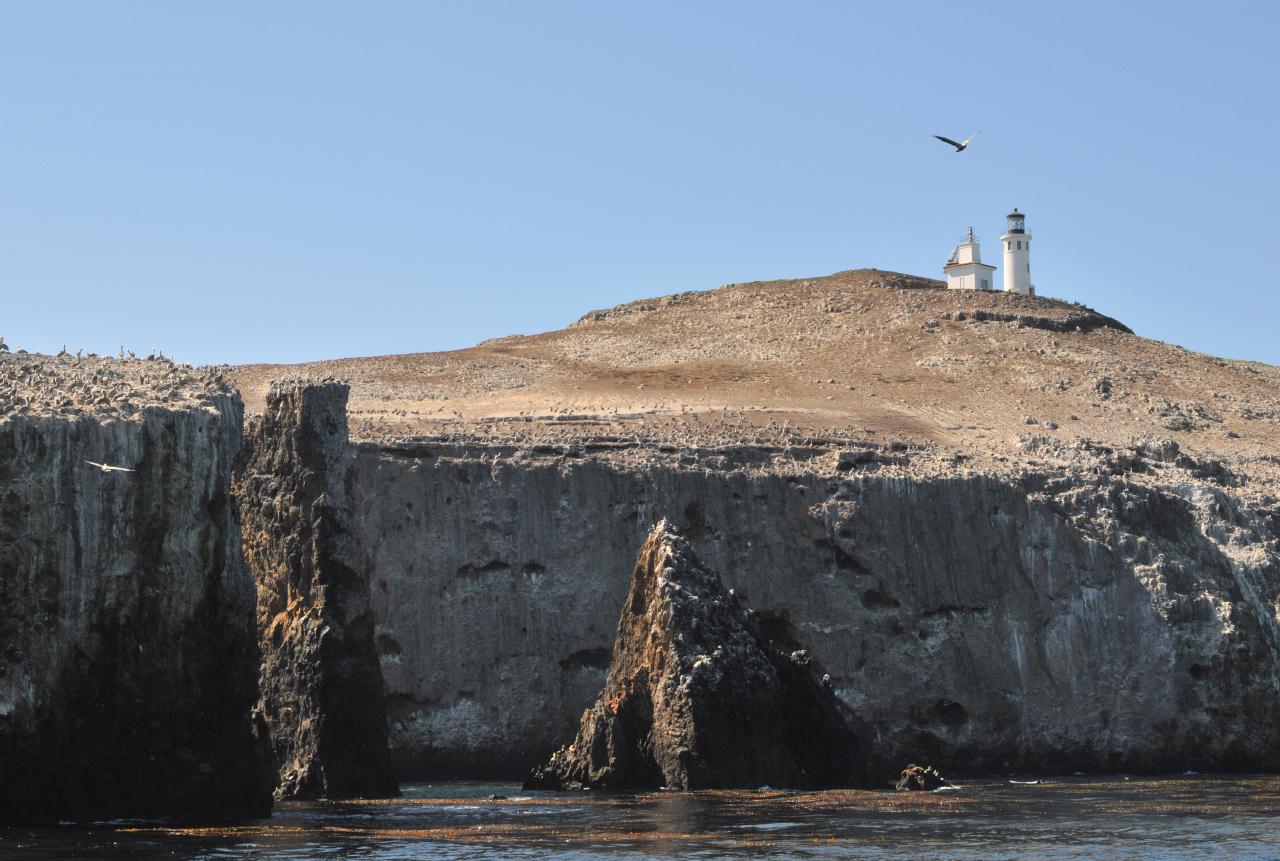 The End of East Anacapa Island had lower cliffs and pinnacle-like rocks just offshore with the lighthouse up a gentle slope behind.
Anacapa Island • Channel Islands National Park • Island Packers Tour • From Channel Islands Harbor, Oxnard, California • (Photo posted Tuesday 23 November 2010) • (Photo taken 11:23:49 Friday 8 October 2010) • © 2010 Bryan Costales
Add a comment or report a mistake
|
|
 East Anacapa Island as viewed from the sea off its very end.
Anacapa Island • Channel Islands National Park • Island Packers Tour • From Channel Islands Harbor, Oxnard, California • (Photo posted Tuesday 23 November 2010) • (Photo taken 11:25:05 Friday 8 October 2010) • © 2010 Bryan Costales
Add a comment or report a mistake
|
|
 The bird-crowned end of East Anacapa Island as viewed from around behind it.
Anacapa Island • Channel Islands National Park • Island Packers Tour • From Channel Islands Harbor, Oxnard, California • (Photo posted Tuesday 23 November 2010) • (Photo taken 11:26:27 Friday 8 October 2010) • © 2010 Bryan Costales
Add a comment or report a mistake
|
|
 Low rocks in the sea on the back side of East Anacapa Island provided a sunny resting place for sea lions.
Anacapa Island • Channel Islands National Park • Island Packers Tour • From Channel Islands Harbor, Oxnard, California • (Photo posted Tuesday 23 November 2010) • (Photo taken 11:28:27 Friday 8 October 2010) • © 2010 Bryan Costales
Add a comment or report a mistake
|
|
 Sea Lions bordered the entry to a sea cave on the back side of East Anacapa Island.
Anacapa Island • Channel Islands National Park • Island Packers Tour • From Channel Islands Harbor, Oxnard, California • (Photo posted Tuesday 23 November 2010) • (Photo taken 11:29:11 Friday 8 October 2010) • © 2010 Terry Costales
Add a comment or report a mistake
|
|
 The cliff face located on the backside of East Anacapa Island.
Anacapa Island • Channel Islands National Park • Island Packers Tour • From Channel Islands Harbor, Oxnard, California • (Photo posted Tuesday 23 November 2010) • (Photo taken 11:30:43 Friday 8 October 2010) • © 2010 Bryan Costales
Add a comment or report a mistake
|
|
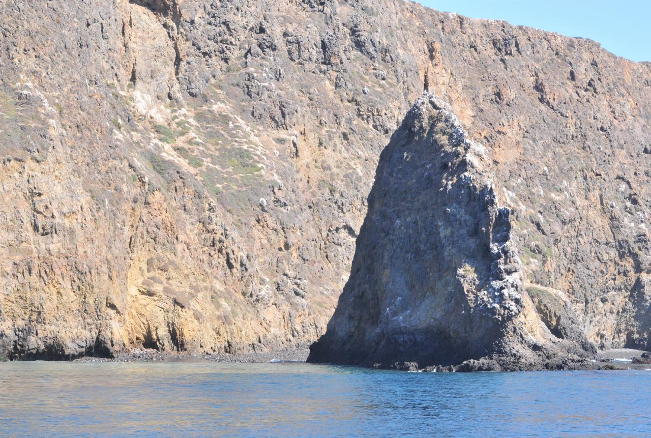 A giant tooth rose out of the water just behind East Anacapa Island.
Anacapa Island • Channel Islands National Park • Island Packers Tour • From Channel Islands Harbor, Oxnard, California • (Photo posted Tuesday 23 November 2010) • (Photo taken 11:34:54 Friday 8 October 2010) • © 2010 Bryan Costales
Add a comment or report a mistake
|
|
 East Anacapa Island to the right with Middle Anacapa Island to the left, and West Anacapa Island far behind.
Anacapa Island • Channel Islands National Park • Island Packers Tour • From Channel Islands Harbor, Oxnard, California • (Photo posted Tuesday 23 November 2010) • (Photo taken 11:35:18 Friday 8 October 2010) • © 2010 Bryan Costales
Add a comment or report a mistake
|
 |
| home • contact • topic guide • top 25 • photos • video • writing • blogs • upload • terms • privacy |